Heartland America Map
This is a full reference map highlighting America’s Heartland in yellow. Our map distinguishes the region from the remaining states in gray.
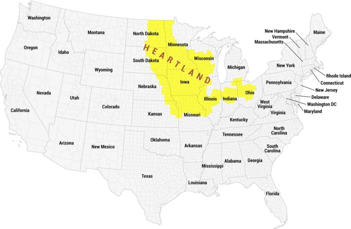
This is a full reference map highlighting America’s Heartland in yellow. Our map distinguishes the region from the remaining states in gray.
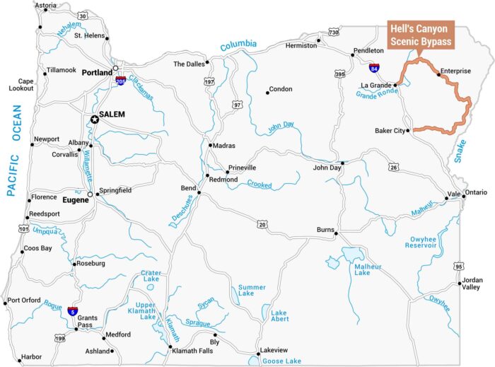
Our map of Oregon highlights the Hell’s Canyon Scenic Bypass in orange along the state’s northeastern border.
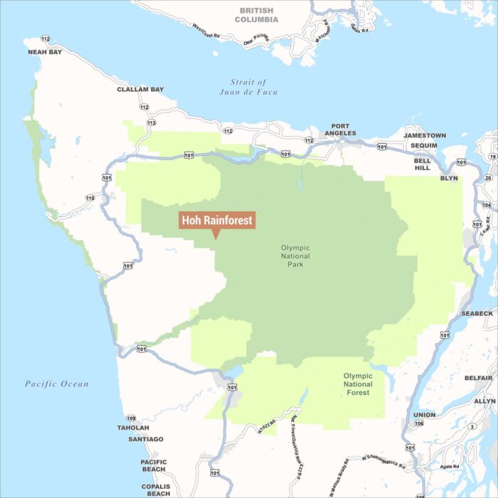
Our map highlights the location of the Hoh Rainforest within Olympic National Park. The rainforest sits inland from the Pacific Ocean.
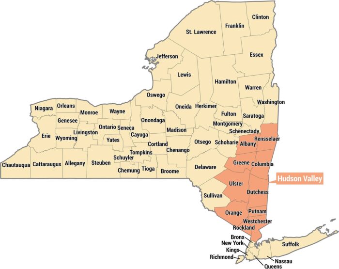
Get to know the Hudson Valley with our New York State map. It displays this region in salmon across the southeastern portion of the state.
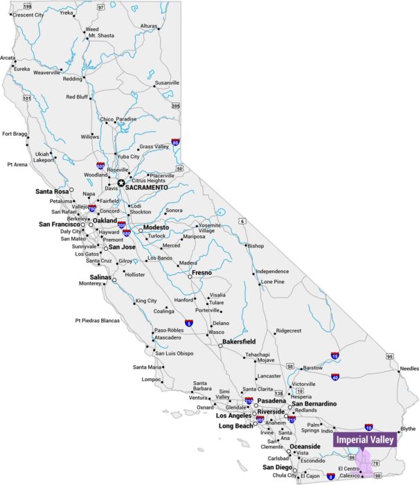
Explore the Imperial Valley with our reference map of California. We’ve highlighted this region in light purple, situated along the Mexico.
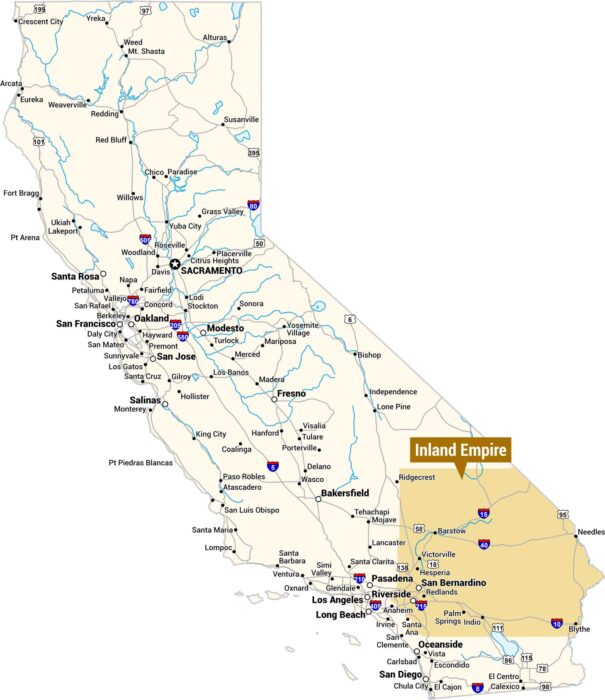
This is a map of California highlighting the Inland Empire in orange, located in the southwestern corner of the state east of Los Angeles.
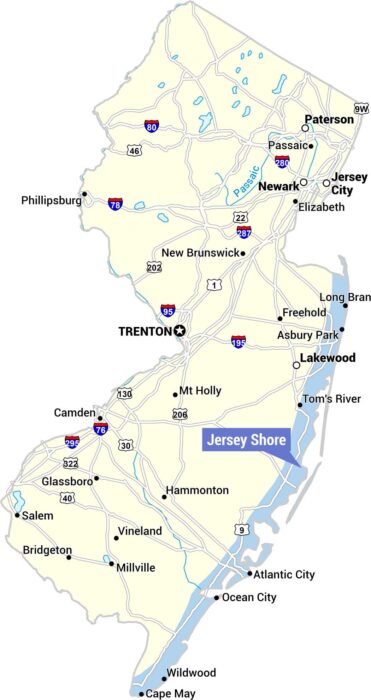
Our map highlights the Jersey Shore along the eastern coastline, marked with a blue label. The map covers the full state with major cities.
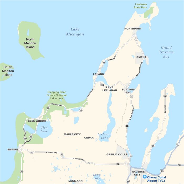
This is a detailed map of the Leelanau Peninsula in northwestern Michigan, showing towns, lakes, parks, islands, and roads.
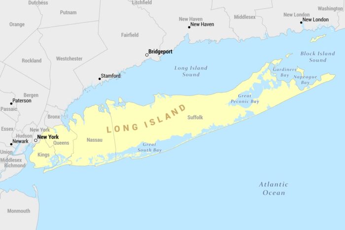
Here’s our reference map of Long Island, New York, shown in yellow. It extends eastward from New York City into the Atlantic Ocean.
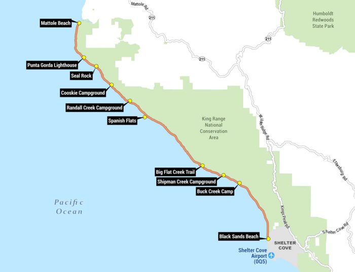
Our Lost Coast map shows the famous coastal backpacking route running along the Pacific Ocean, from Mattole Beach to Black Sands Beach.
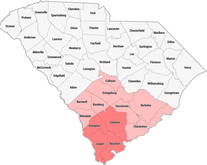
This county map of South Carolina highlights the Lowcountry region in pink and red across the southern and coastal portions of the state.
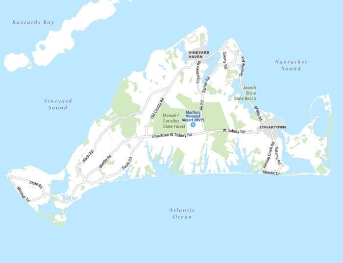
Here’s our detailed map of Martha’s Vineyard, the island off the coast of Massachusetts. It shows towns, roads, natural areas, and waterways.
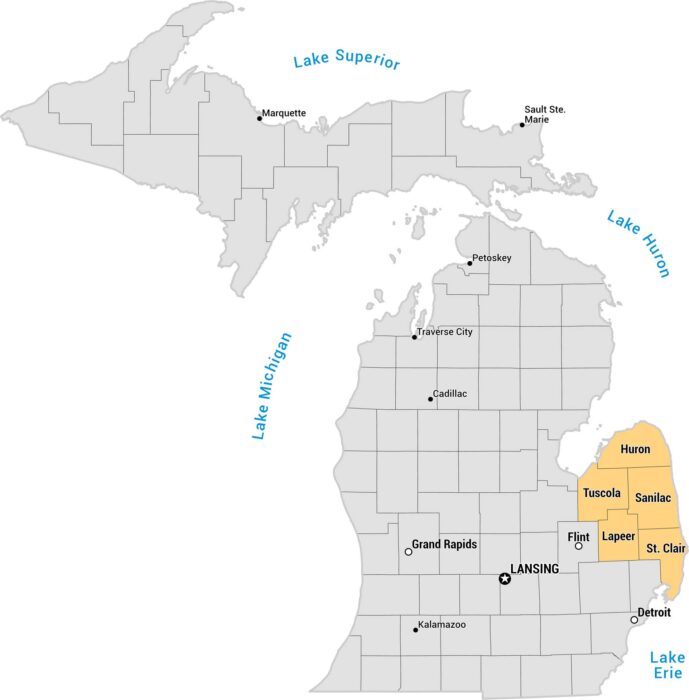
This is a county map of Michigan highlighting the Thumb region. The remaining counties are shown in gray, with major cities labeled.
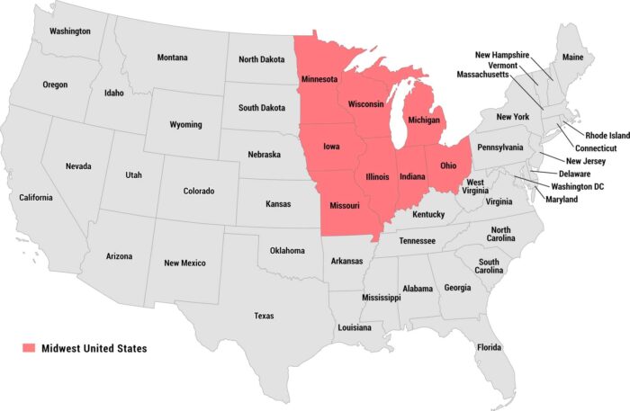
Our map highlights the Midwest United States in red/pink, clearly distinguishing the region from the remaining states shown in gray.
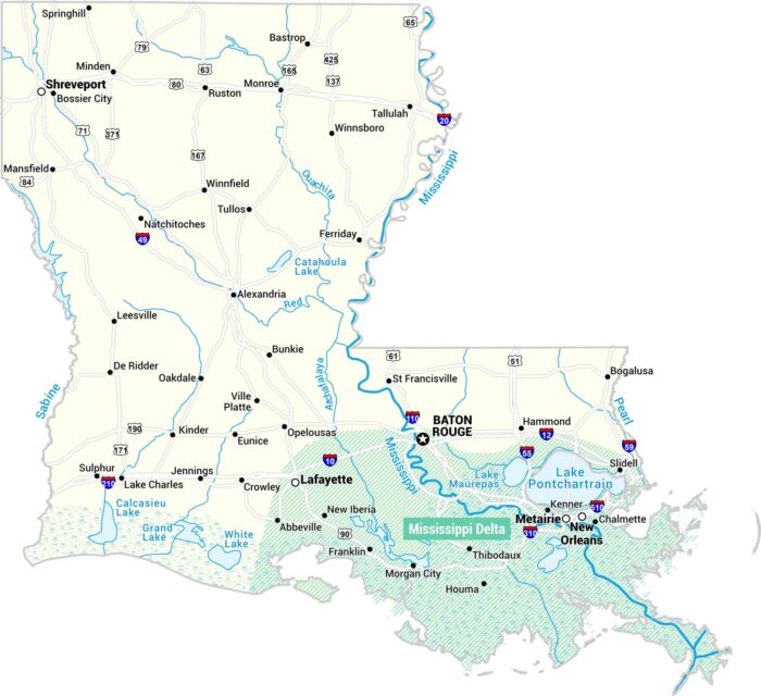
Here’s our map map of Louisiana’s Mississippi Delta region in teal. This regions stretches along the southeastern portion of the state.