Missouri Bootheel Map
We created this county map of Missouri to highlight the Bootheel region in pink. This distinctive geographic appendage sits juts southward.
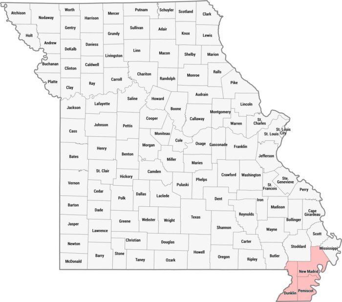
We created this county map of Missouri to highlight the Bootheel region in pink. This distinctive geographic appendage sits juts southward.
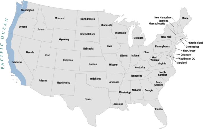
Our map highlights the Pacific Coast states shaded in blue along the western edge with the Pacific Ocean labeled to the left.
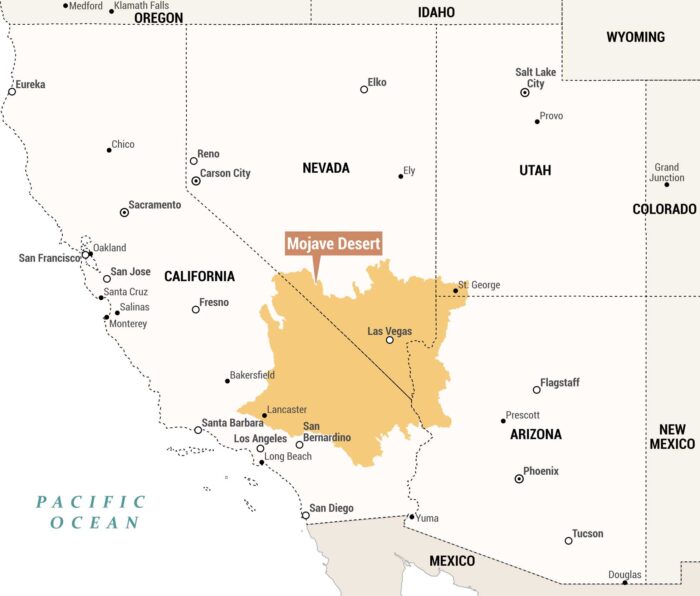
We created this regional map to highlight the Mojave Desert in orange. Our spans parts of southeastern California and southern Nevada.
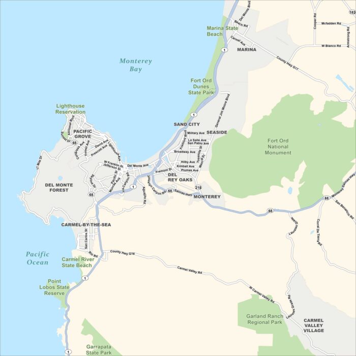
Our map of the Monterey Peninsula in California shows cities, parks, highways, roads, Monterey Bay and the Pacific Ocean to the west.
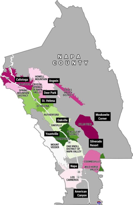
This is a map of Napa County, California, showing all of its American Viticultural Areas (AVAs). These are the official wine-growing regions.
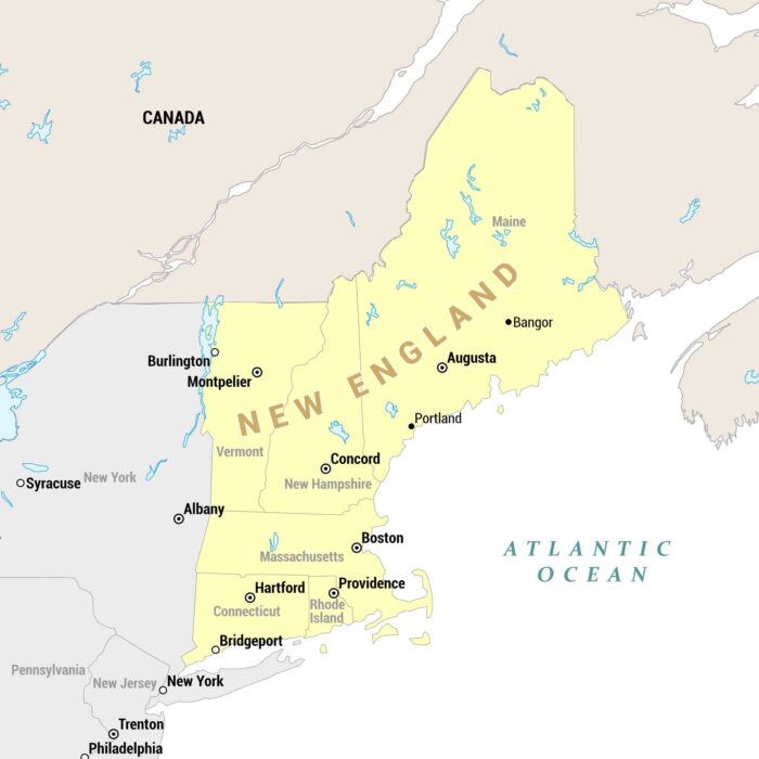
Our regional map highlights New England states in yellow, set against surrounding states and Canada in tan/gray and the Atlantic Ocean.
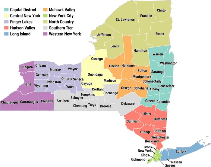
This is a color-coded county map of New York State divided into its 10 official regions. Each region has a distinct color with a legend.
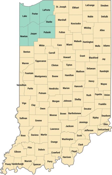
This is a county map with the Northwest Indiana region highlighted in teal in the upper-left corner. The remaining counties are shown in tan.
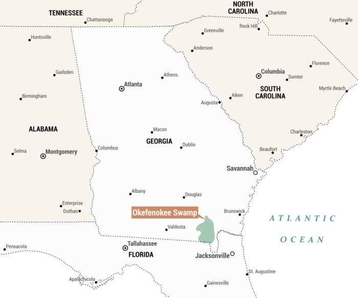
This is a regional reference map highlighting the Okefenokee Swamp. The swamp is shaded in green and sits near Jacksonville, Florida.
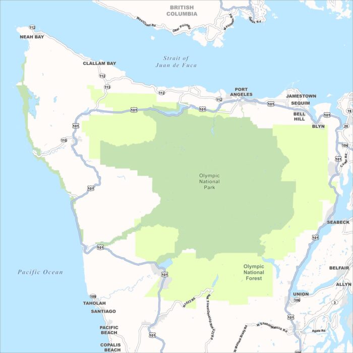
This map shows Washington State’s Olympic Peninsula. It’s dominated by two large protected land areas shaded in green.
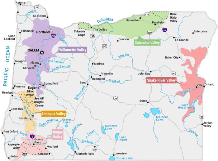
This map displays Oregon’s major wine regions (AVAs – American Viticultural Areas). Each one is shaded in a distinct color across the state.
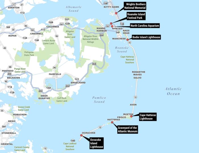
Our Outer Banks map highlights key landmarks, waterways, highways, and natural areas, with points of interest marked in black callout boxes.
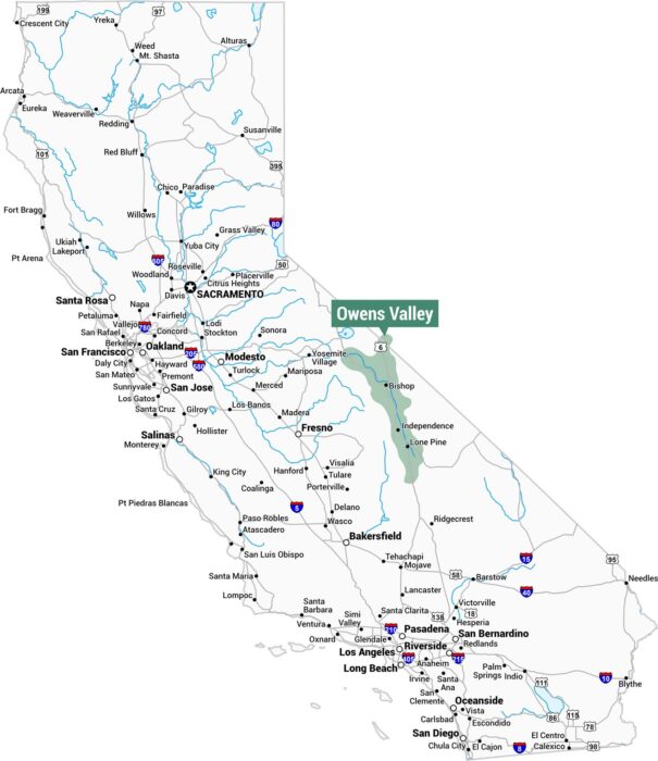
This map of California highlights the Owens Valley in green. This narrow valley runs along the eastern side of the state near Nevada.
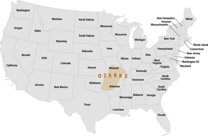
This map highlights the Ozarks, centered in the heart of the country. The Ozarks span southern Missouri and northern Arkansas.
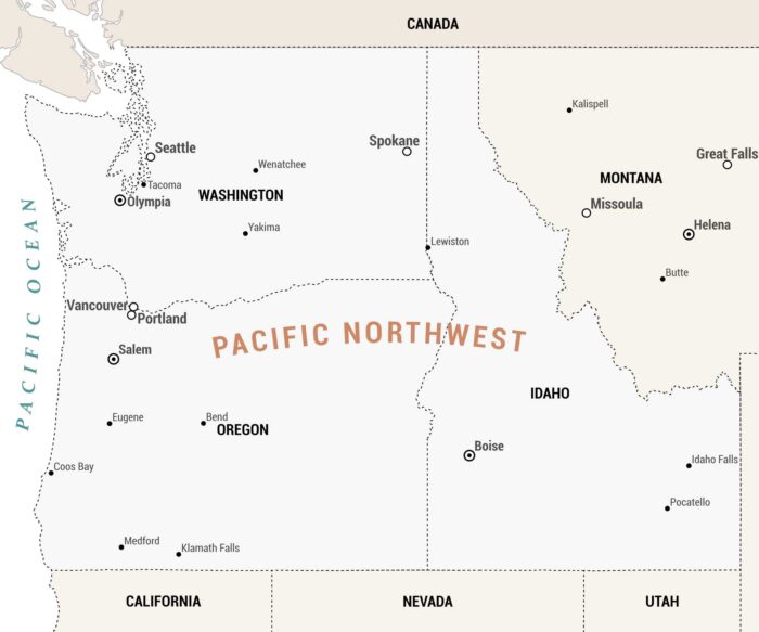
Our Pacific Northwest map covers the northwestern corner of the United States, encompassing Washington, Oregon, Idaho, and Montana.