Home » State Maps » Iowa Population Map

Iowa Population Map

Iowa Population Density Map

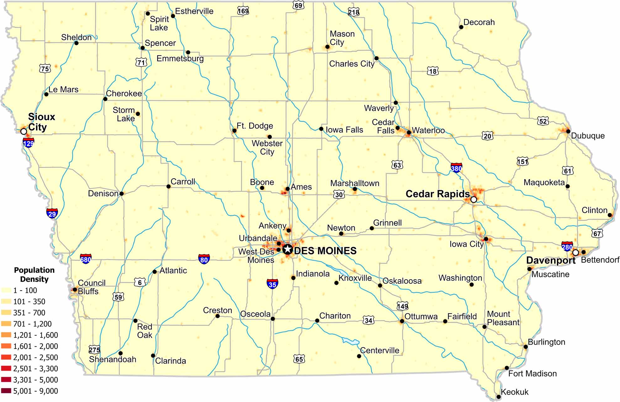
Population density remains moderate across much of Iowa. Cities like Des Moines, Davenport and Cedar Rapids align closely with spikes in population density. But it’s mostly agricultural land that keeps density even on our population density map.

Map Information

  • Population Density Map of Iowa
  • Data provided by NASA SEDAC Gridded Population of the World
  • Free for personal and commercial purpose. Attribution is required. How to attribute?

On the Map

Iowa Location Map
State Capital: Des Moines Major Cities: Cedar Rapids, Davenport, Sioux City, Waterloo Cities and Towns: Ames, Ankeny, Atlantic, Bettendorf, Boone, Burlington, Carroll, Centerville, Chariton, Charles City, Cherokee, Clarinda, Clinton, Council Bluffs, Creston, Dubuque, Emmetsburg, Estherville, Fairfield, Fort Dodge, Fort Madison, Grinnell, Indianola, Iowa City, Iowa Falls, Keokuk, Knoxville, Le Mars, Marshalltown, Mason City, Mount Pleasant, Muscatine, Osceola, Oskaloosa, Ottumwa, Red Oak, Sheldon, Shenandoah, Spencer, Spirit Lake, Storm Lake, Urbandale, Washington, Waverly, Webster City Interstate Highways: I-29, I-35, I-80, I-129, I-280, I-380, I-680 US Routes: US-6, US-18, US-20, US-30, US-34, US-52, US-59, US-61, US-63, US-65, US-67, US-69, US-71, US-75, US-149, US-151, US-169, US-218, US-275

Leave a Reply

Your email address will not be published. Required fields are marked *