South Philadelphia Map
Our map of South Philadelphia lays out the stretch between the Delaware and Schuylkill Rivers. You’ll spot its roads and Citizens Bank Park.
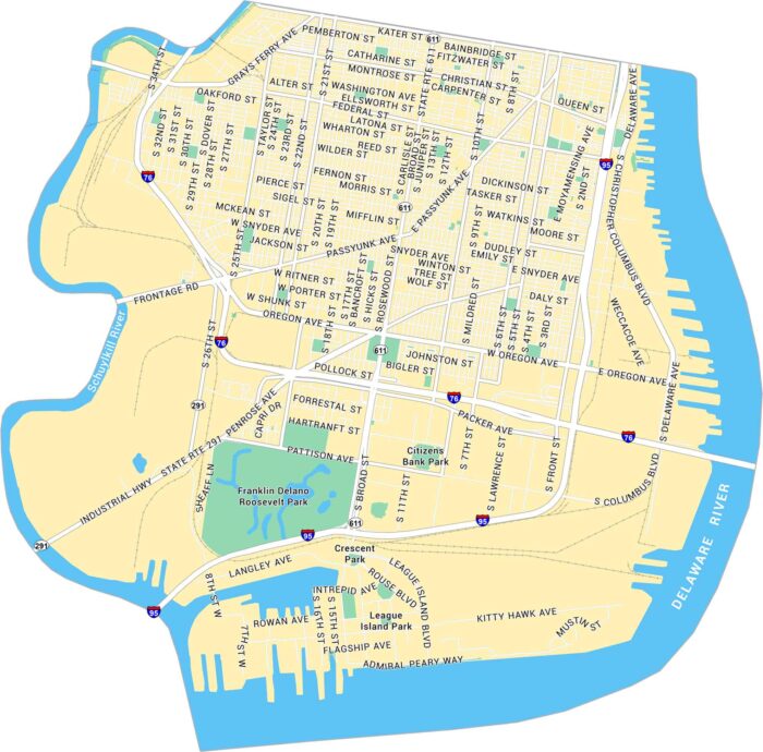
Our map of South Philadelphia lays out the stretch between the Delaware and Schuylkill Rivers. You’ll spot its roads and Citizens Bank Park.
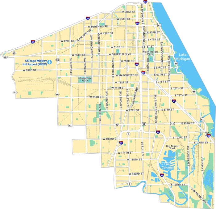
Our map of Chicago’s South Side displays a vast stretch of neighborhoods rich in history. You’ll spot parks, lakefront paths, and streets.
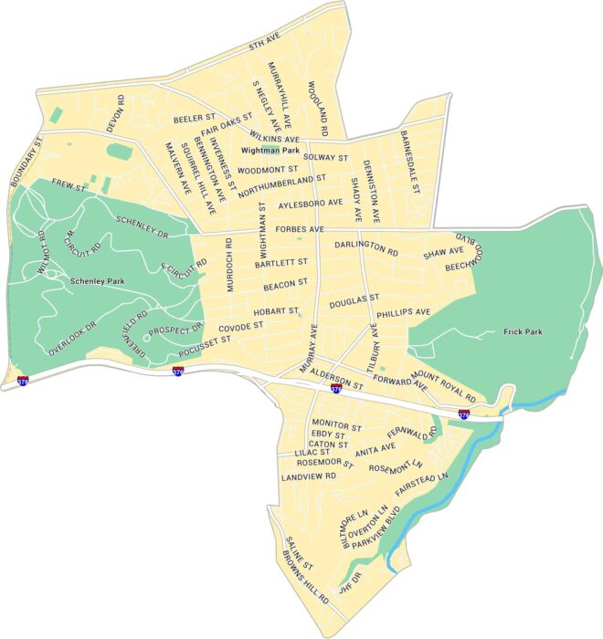
Our map of Squirrel Hill highlights this Pittsburgh neighborhood. You’ll see Frick Park to the east and Schenley Park to the west.
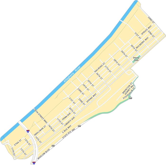
The Strip District stretches along the Allegheny River just northeast of downtown Pittsburgh. Our map highlights its highways and roads.
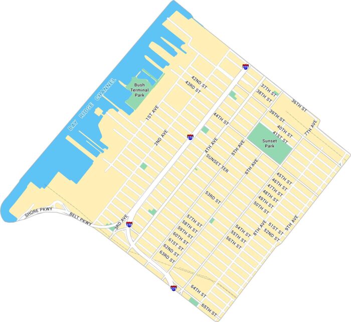
Sunset Park sits on Brooklyn’s western edge, overlooking New York Harbor. Our map shows its streets, green parkland, and waterfront.
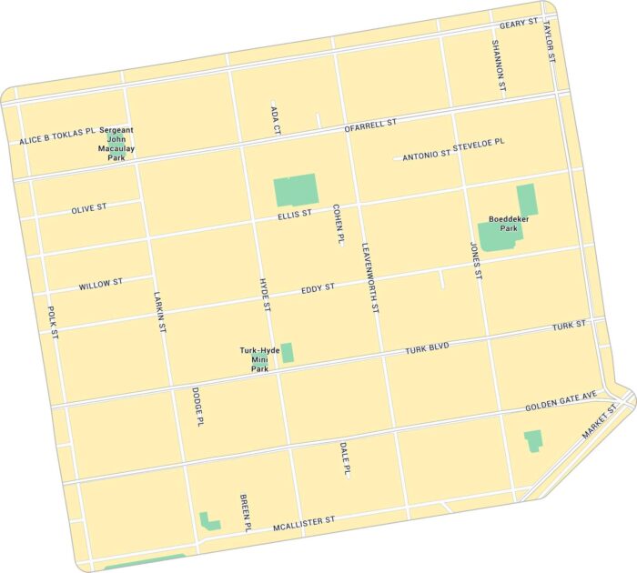
The Tenderloin is a gritty neighborhood near downtown San Francisco. Our map of Tenderloin highlights its streets and parks.
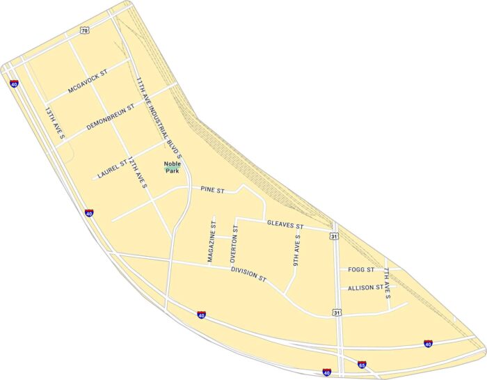
The Gulch is where old rail lines meet big-city energy. Our map of the Gulch shows its streets, highways and rail lines.
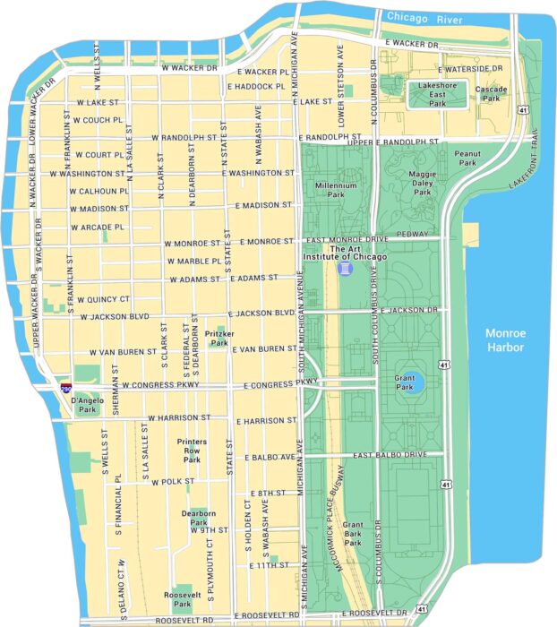
The Loop is Chicago’s core. Our map highlights its streets, parks, and landmarks that define downtown. It’s the city’s business hub by day.
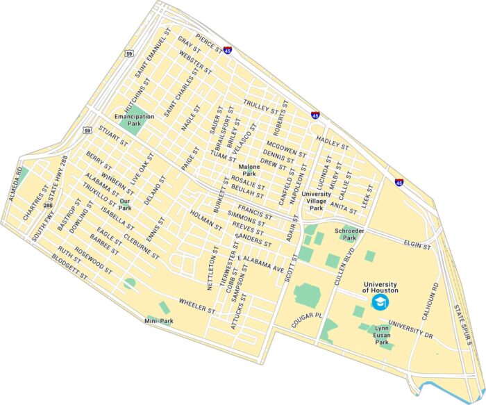
Houston’s Third Ward is rich with history and heart. Our map shows its main roads, parks, and the University of Houston.
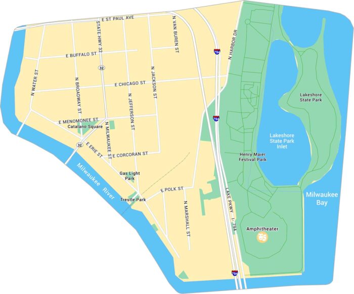
Our map of Milwaukee’s Historic Third Ward highlights its riverwalks, lakeshore park, and proximity to Lake Michigan.
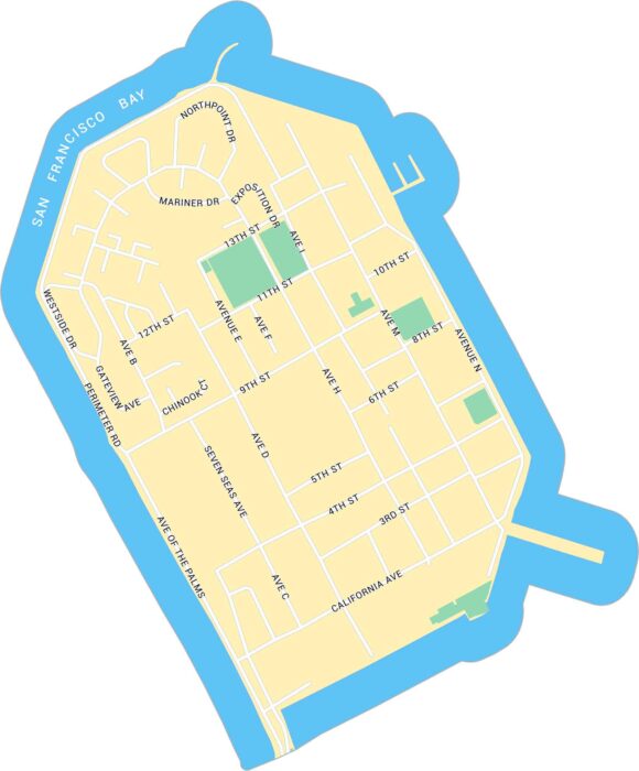
Treasure Island sits in the middle of San Francisco Bay. Our map shows this man-made island including its streets and surrounding parks.
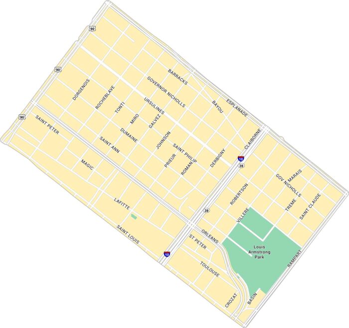
Our Treme map displays its narrow streets, from Louis Armstrong Park to Claiborne Avenue. It’s historic, proud, and beats to its own rhythm.
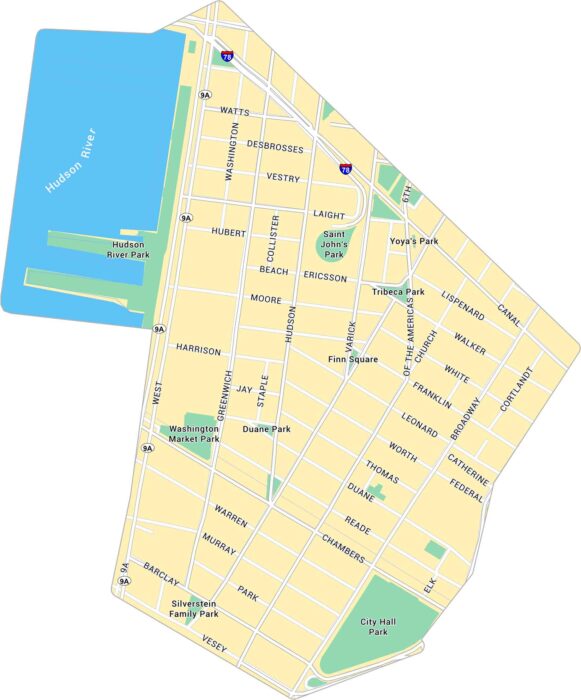
Tribeca is one of New York’s most distinct neighborhoods. Our map of Tribeca highlights its major roads, nearby piers, and parks.
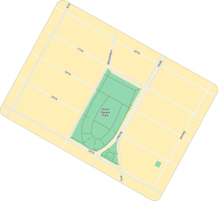
Union Square in New York is a spot of downtown energy. Our map shows the busy park, pathways and streets that surround the green space.

Union Station in Denver is the heart of the city’s transit and history. Our map highlights the station itself, surrounded by its roads.