Squirrel Hill Map, Pittsburgh
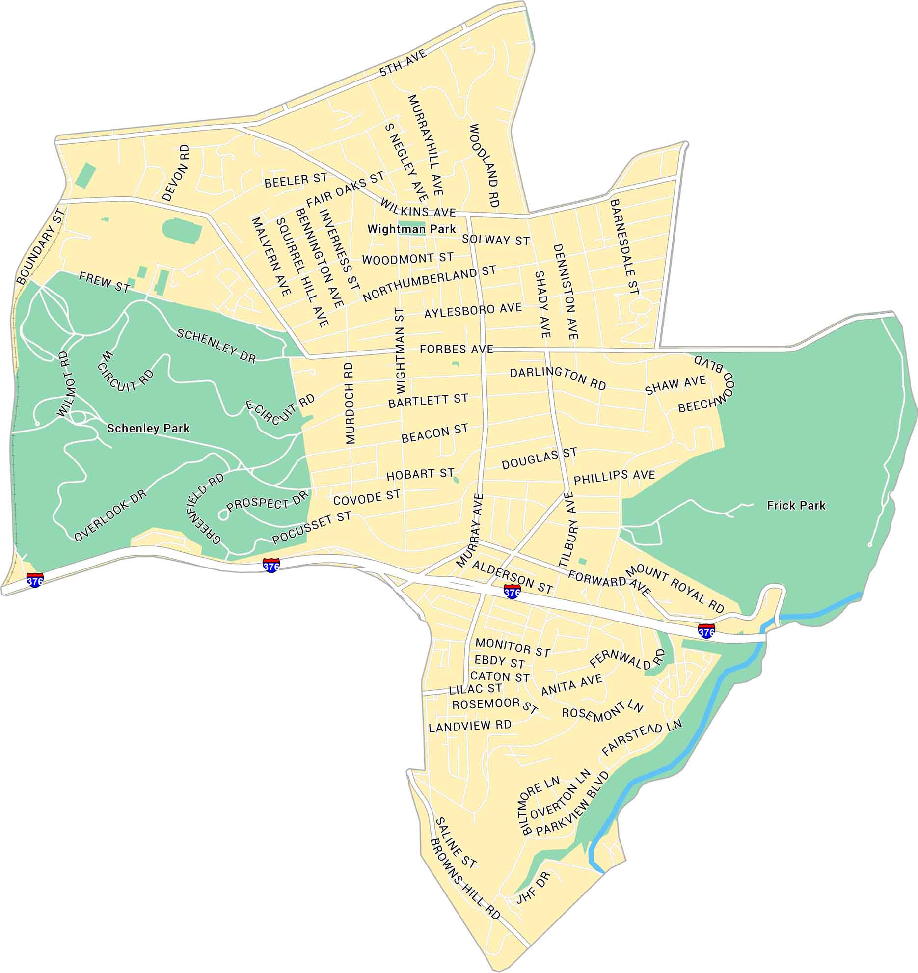
Our map of Squirrel Hill highlights this Pittsburgh neighborhood. You’ll see Frick Park to the east and Schenley Park to the west. Forbes and Murray avenues are lined with shops and cafes.
Map Information
Pittsburgh Neighborhood Maps
See our neighborhood maps for a closer look of the city.
On the Map
Interstates/Highways: I-376 Major Roads: Forbes Ave, Murray Ave, Shady Ave, 5th Ave, Wilkins Ave, Beechwood Blvd, Forward Ave, Browns Hill Rd, Hazel St, Phillips Ave, Hobart St, Beacon St, Bartlett St, Darlington Rd, Northumberland St, Wightman St, Negley Ave, Murrayhill Ave, Woodland Rd, Beeler St Parks: Schenley Park, Frick Park, Wightman ParkCity Maps of Pennsylvania
Here is our city map collection for all of Pennsylvania.


