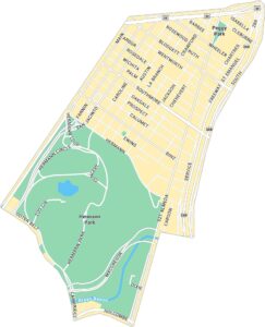
Third Ward Map, Houston
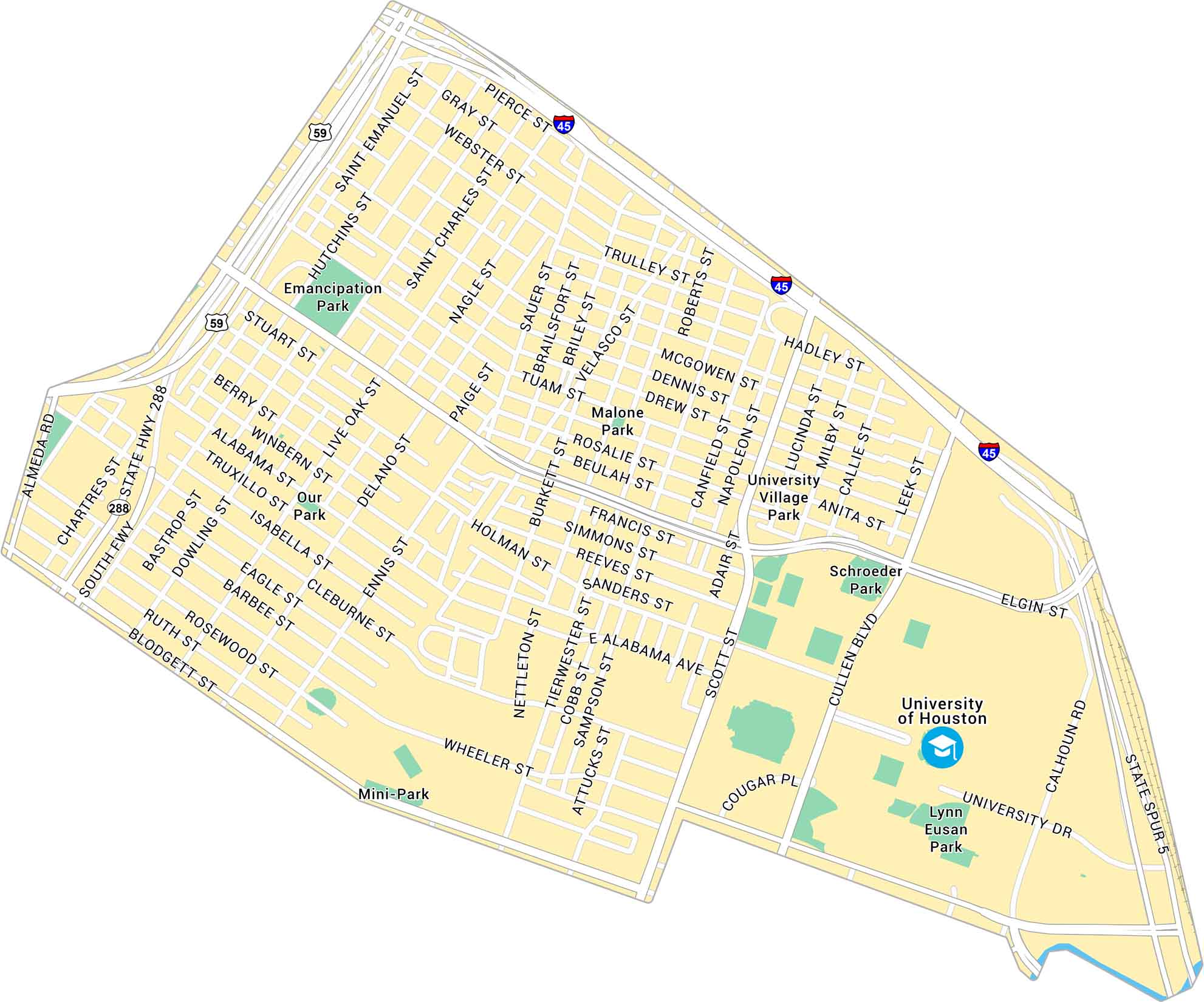
Houston’s Third Ward is rich with history and heart. Our map shows its main roads, parks, and nearby universities. It’s a place rooted in culture and creativity.
Map Information
Houston Neighborhood Maps
See our neighborhood maps for a closer look of the city.
On the Map
Interstates/Highways: US Hwy 59, I-45, State Rte 288, State Spur 5 Major Roads: Alabama Ave, Scott St, Elgin St, Wheeler St, Cleburne St, Blodgett St, Rosewood St, Barbee St, Dowling St, Bastrop St, Hutchins St, St Emanuel St, Chartres St, Almeda Rd, Cullen Blvd, Calhoun Rd, University Dr, Tuam St, McGowen St, Gray St Parks: Emancipation Park, Our Park, Mini-Park, Malone Park, University Village Park, Schroeder Park, Lynn Eusan Park Landmarks: University of HoustonCity Maps of Texas
Explore our map collection of Texas cities.


