Home » State Maps » Alabama Population Map

Alabama Population Map

Alabama Population Density Map

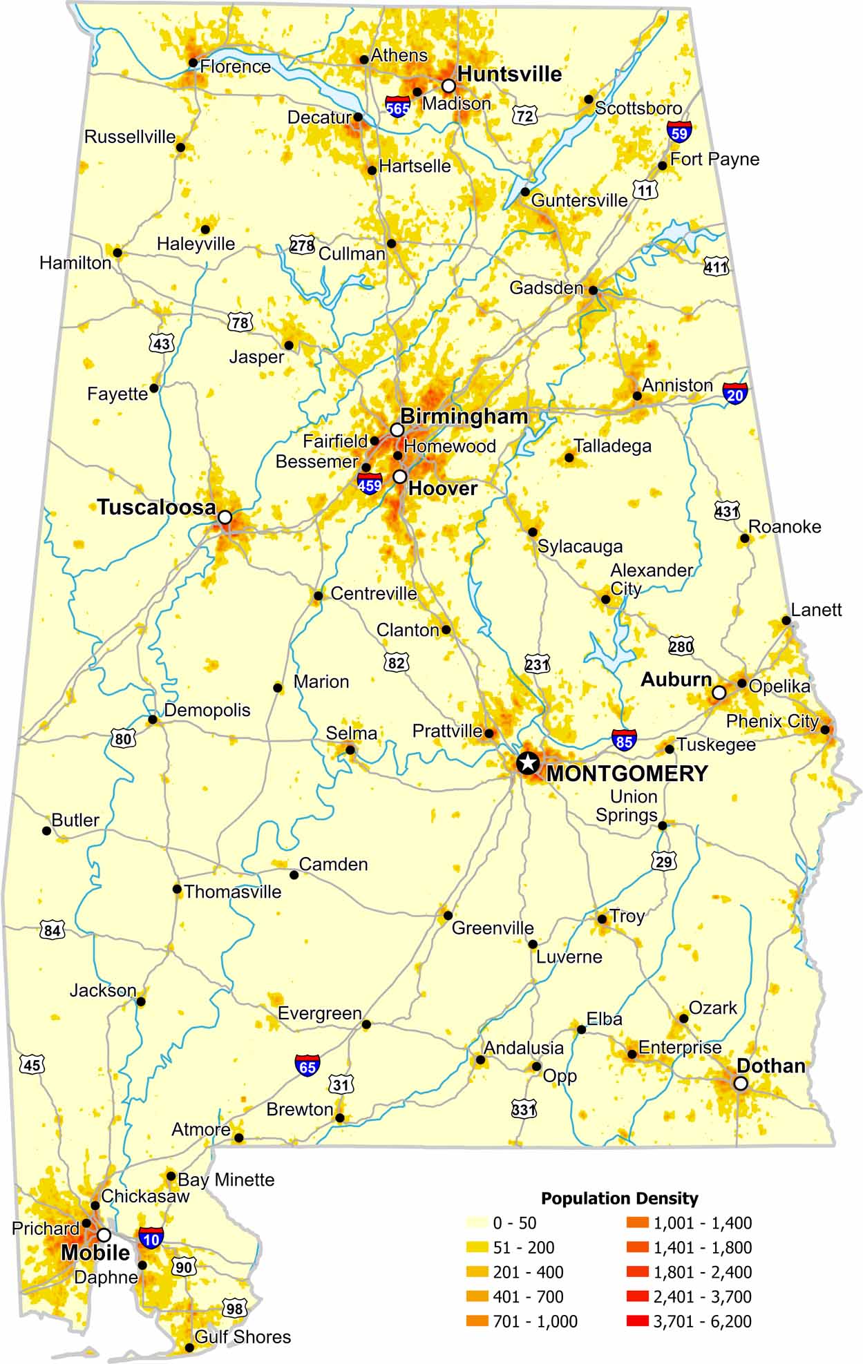
Population across Alabama is uneven, with clear clusters around major cities. Our map highlights higher density areas like Birmingham and the southern coast. Check out our population density map of Alabama to see city centers and rural areas.

Map Information

  • Population Density Map of Alabama
  • Data provided by NASA SEDAC Gridded Population of the World
  • Free for personal and commercial purpose. Attribution is required. How to attribute?

On the Map

Alabama Location Map
State Capital: Montgomery Major Cities: Auburn, Birmingham, Dothan, Hoover, Huntsville, Mobile, Tuscaloosa Cities and Towns: Andalusia, Anniston, Athens, Atmore, Bay Minette, Bessemer, Brewton, Butler, Camden, Centreville, Chickasaw, Clanton, Cullman, Daphne, Decatur, Demopolis, Elba, Enterprise, Evergreen, Fairfield, Fayette, Florence, Fort Payne, Gadsden, Greenville, Gulf Shores, Guntersville, Haleyville, Hamilton, Hartselle, Homewood, Jackson, Jasper, Lanett, Luverne, Madison, Marion, Opelika, Opp, Ozark, Phenix City, Prattville, Prichard, Roanoke, Russellville, Scottsboro, Selma, Sylacauga, Talladega, Thomasville, Troy, Tuskegee, Union Springs Interstate Highways: I-10, I-20, I-59, I-65, I-85, I-165, I-359, I-459, I-565, I-759 US Routes: U.S. 11, U.S. 29, U.S. 31, U.S. 43, U.S. 45, U.S. 72, U.S. 78, U.S. 80, U.S. 82, U.S. 84, U.S. 90, U.S. 98, U.S. 231, U.S. 278, U.S. 280, U.S. 331, U.S. 411, U.S. 431

Leave a Reply

Your email address will not be published. Required fields are marked *