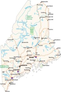
Home » State Maps » Maine Physical Map

Maine Physical Map

Maine Physical Map

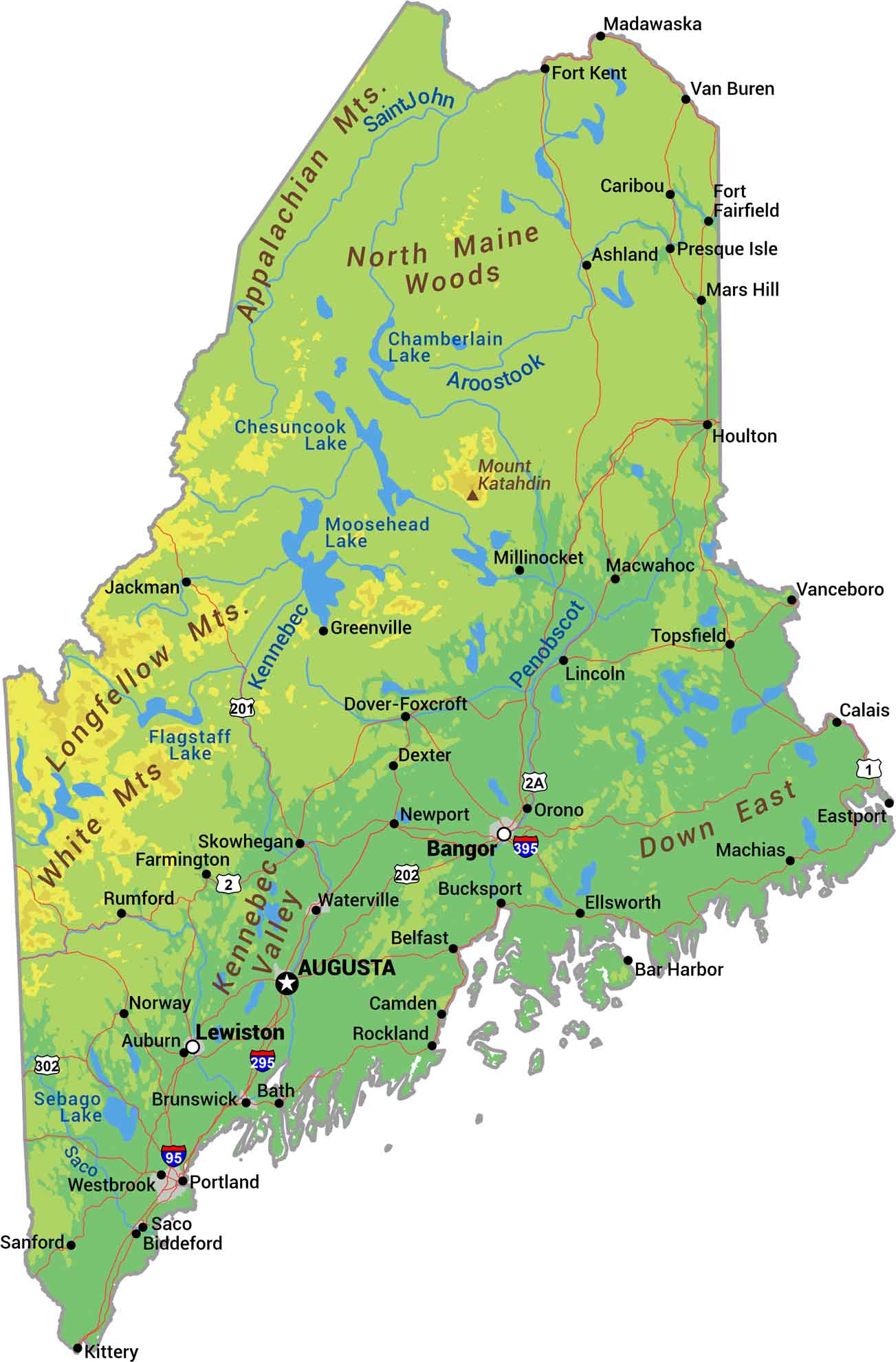
Our physical map of Maine shows where New England gets serious. The Appalachian Mountains roll through the interior with Mount Katahdin standing above the rest. The coastline is rocky and jagged. It has over 3,000 miles if you count every inlet and island.

Map Information

  • State of Maine
  • Physical Map of Maine
  • Free for personal and commercial purpose. Attribution is required. How to attribute?

On the Map

Maine Location Map
Physical Features: Appalachian Mts, Longfellow Mts, White Mts, North Maine Woods, Down East, Mount Katahdin State Capital: Augusta Major Cities: Bangor, Lewiston, Portland Cities and Towns: Ashland, Auburn, Bar Harbor, Bath, Belfast, Biddeford, Brunswick, Bucksport, Calais, Camden, Caribou, Dexter, Dover-Foxcroft, Eastport, Ellsworth, Farmington, Fort Fairfield, Fort Kent, Greenville, Houlton, Jackman, Kittery, Lincoln, Machias, Macwahoc, Madawaska, Mars Hill, Millinocket, Newport, Norway, Orono, Presque Isle, Rockland, Rumford, Saco, Sanford, Skowhegan, Topsfield, Van Buren, Vanceboro, Waterville, Westbrook Interstate Highways: I-95, I-295, I-395 US Routes: US-1, US-2, US-2A, US-201, US-202, US-302 Lakes and Reservoirs: Chamberlain Lake, Chesuncook Lake, Flagstaff Lake, Moosehead Lake, Richardson Lake, Sebago Lake Rivers and Streams: Aroostook River, Kennebec River, Penobscot River, Saco River, Saint John River

References

  1. Shuttle Radar Topography Mission Elevation
  2. National Map TopoBuilder Application

Leave a Reply

Your email address will not be published. Required fields are marked *