Utah County Map
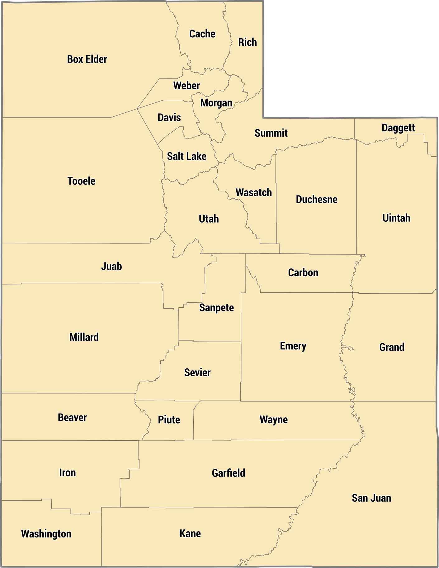
There are just 29 counties in Utah. But they cover everything from red rock desert to snowy mountains. Salt Lake County holds most of the population along the Wasatch Front. Southern counties like San Juan and Wayne are slickrock canyonlands where towns are hours apart.
Map Information
On the Map
Our table below provides you with population, area, and FIPS code for each county.
|
Name |
Population 2024 |
Total Area (sq mi) |
FIPS Code |
|
Beaver County |
7,424 |
2,584.90 |
49-001 |
|
Box Elder County |
64,120 |
6,729.20 |
49-003 |
|
Cache County |
145,487 |
1,172.90 |
49-005 |
|
Carbon County |
20,613 |
1,485.30 |
49-007 |
|
Daggett County |
956 |
720.6 |
49-009 |
|
Davis County |
378,470 |
635.2 |
49-011 |
|
Duchesne County |
20,803 |
3,250.30 |
49-013 |
|
Emery County |
10,161 |
4,471.80 |
49-015 |
|
Garfield County |
5,290 |
5,208.20 |
49-017 |
|
Grand County |
9,788 |
3,684.90 |
49-019 |
|
Iron County |
65,936 |
3,300.70 |
49-021 |
|
Juab County |
13,297 |
3,405.80 |
49-023 |
|
Kane County |
8,525 |
4,108.10 |
49-025 |
|
Millard County |
13,572 |
6,836.90 |
49-027 |
|
Morgan County |
13,093 |
610.9 |
49-029 |
|
Piute County |
1,534 |
766.3 |
49-031 |
|
Rich County |
2,752 |
1,086.40 |
49-033 |
|
Salt Lake County |
1,216,274 |
805.7 |
49-035 |
|
San Juan County |
14,601 |
7,933.20 |
49-037 |
|
Sanpete County |
30,732 |
1,602.30 |
49-039 |
|
Sevier County |
22,520 |
1,918.20 |
49-041 |
|
Summit County |
43,109 |
1,880.80 |
49-043 |
|
Tooele County |
84,488 |
7,286.00 |
49-045 |
|
Uintah County |
38,307 |
4,504.00 |
49-047 |
|
Utah County |
747,234 |
2,144.20 |
49-049 |
|
Wasatch County |
37,858 |
1,207.60 |
49-051 |
|
Washington County |
207,943 |
2,430.40 |
49-053 |
|
Wayne County |
2,608 |
2,466.80 |
49-055 |
|
Weber County |
276,118 |
659.8 |
49-057 |
Utah State Maps
Look through maps of deserts, parks, and cities.


State County Maps
Click on a map below to check out county maps of each state.


