Home » State Maps » Washington Lakes and Rivers Map

Washington Lakes and Rivers Map

Washington Lakes and Rivers Map

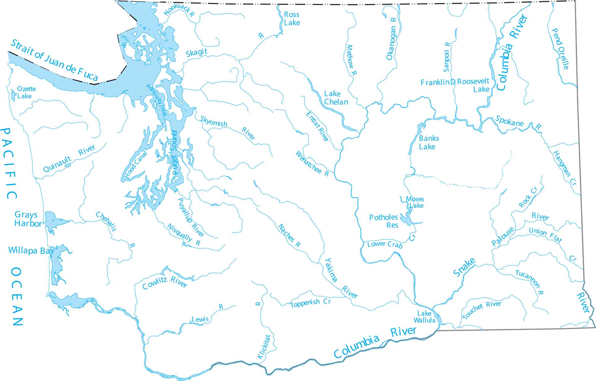
Washington is home to Puget Sound, a complex system of marine waterways and basins connected to the Pacific. Our lakes and rivers map of Washington follows the Yakima and Columbia rivers as they cut through the Cascade Range.

Map Information

  • Lakes and Rivers Map of Washington
  • Original map provided by National Map. Map updated by our team.
  • Free for personal and commercial purpose. Attribution is required. How to attribute?

On the Map

Washington Location Map
Lakes/Reservoirs: Banks Lake, Franklin D Roosevelt Lake, Lake Chelan, Lake Wallula, Moses Lake, Ozette Lake, Potholes Reservoir, Ross Lake Rivers and Creeks: Chehalis River, Columbia River, Cowlitz River, Entiat River, Hangman Creek, Klickitat River, Lewis River, Lower Crab Creek, Methow River, Naches River, Nisqually River, Nooksack River, Okanogan River, Palouse River, Pend Oreille River, Puyallup River, Quinault River, Rock Creek, Sanpoil River, Skagit River, Skykomish River, Snake River, Spokane River, Toppenish Creek, Touchet River, Tucannon River, Union Flat Creek, Wenatchee River, Yakima River Bays, Straits and Sounds: Admiralty Inlet, Grays Harbor, Hood Canal, Pacific Ocean, Puget Sound, Strait of Georgia, Strait of Juan de Fuca, Willapa Bay

Leave a Reply

Your email address will not be published. Required fields are marked *