Virginia Population Map
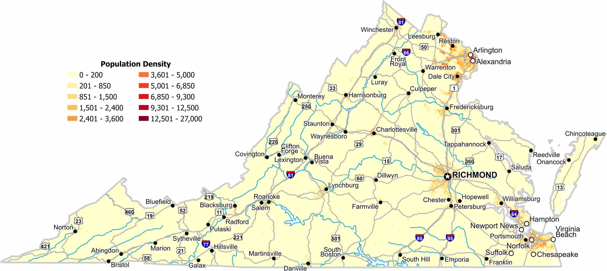
In our population density map of Virginia, the northern and eastern regions appear far denser than the rest of the state. Our map shows settlement thinning toward the west as mountains limit expansion. Coastal plains remain more developed.
Map Information
On the Map
Virginia State Maps
Spanning coasts and mountains, here are our maps of Virginia.


State Population Maps
Select any state map below to view its population density map.


