Tennessee Precipitation Map
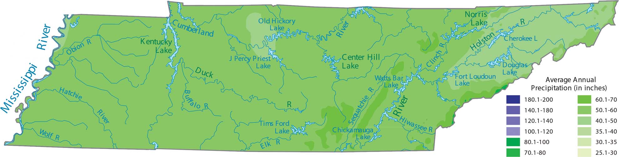
Tennessee gets a high amount of rain because it sits in a path where moist air from the Gulf often passes through. Our precipitation map of Tennessee shows that the Great Smoky Mountains in the east are the wettest areas.
Map Information
State Precipitation Maps
Select any state map below to view its precipitation map.


Tennessee State Maps
Here are our state maps of Tennessee.


