Tennessee Lakes and Rivers Map
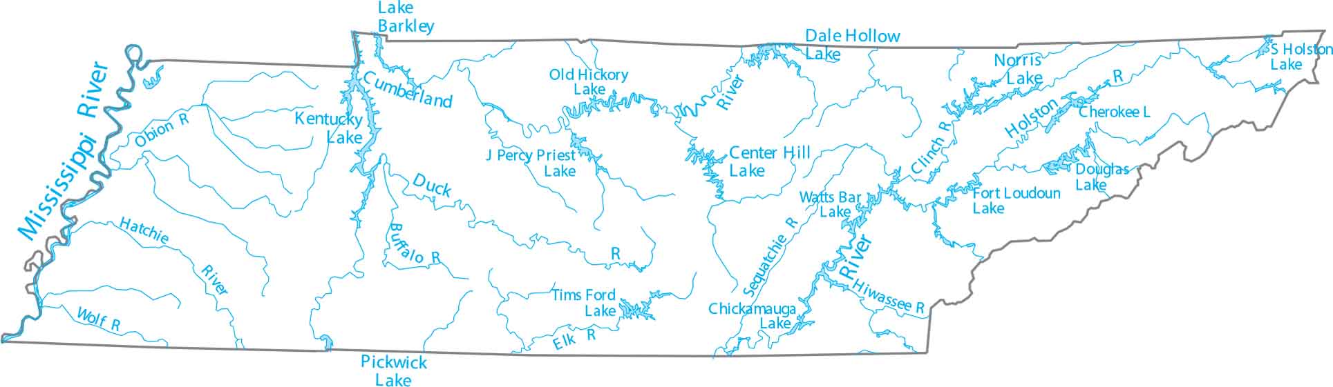
Tennessee is in the Southeast, shaped by one of the most winding major rivers. Our map includes the Tennessee River, Cumberland River, and Mississippi River border.
Map Information
On the Map
Lakes and Rivers State Maps
Select any state map below to view its lakes and rivers map.


Tennessee State Maps
Here are our state maps of Tennessee.


