Pennsylvania Outline Map
Pennsylvania has a nearly rectangular outline. The state stretches from the mountains to the Delaware River along the eastern edge.
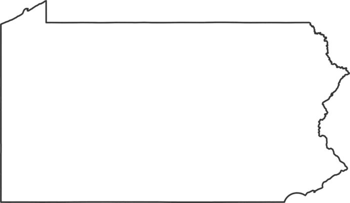
Pennsylvania has a nearly rectangular outline. The state stretches from the mountains to the Delaware River along the eastern edge.
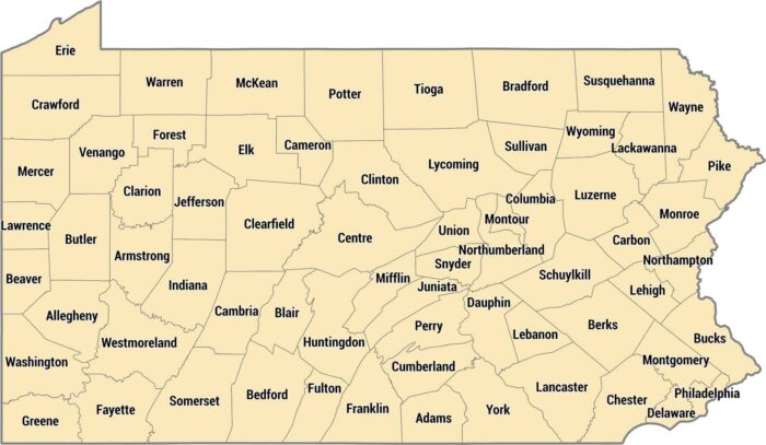
Pennsylvania has 67 counties with Philadelphia as its own county. Allegheny County holds Pittsburgh in the west, including rural counties.
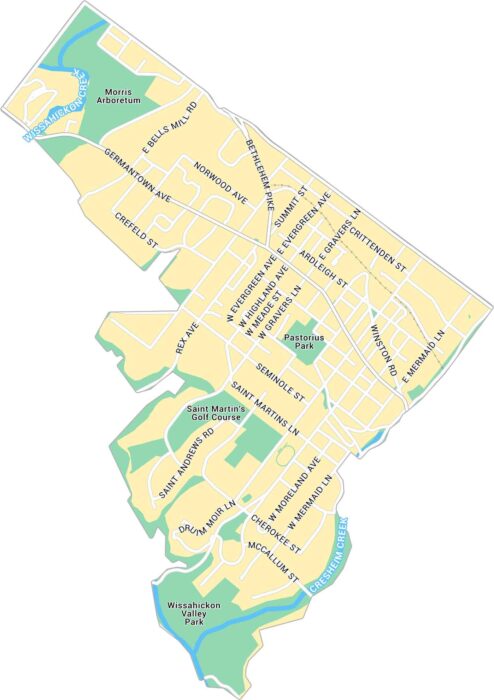
Our map of Chestnut Hill highlights the business district in northwest Philadelphia. You’ll also find local parks and city streets.
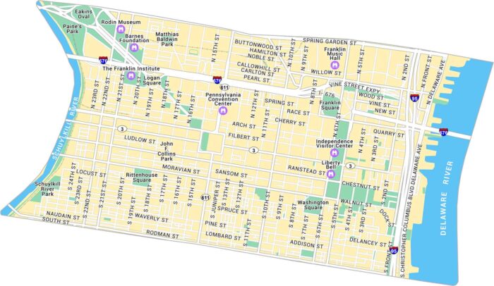
Explore Downtown Philadelphia with our map, covering between the Schuylkill and Delaware Rivers. It shows streets, city squares and landmarks.
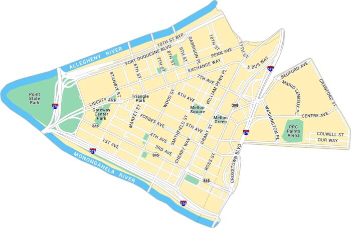
Explore Downtown Pittsburgh with our map, showing where the Allegheny and Monongahela Rivers meet. It’s a triangular core with skyline views.
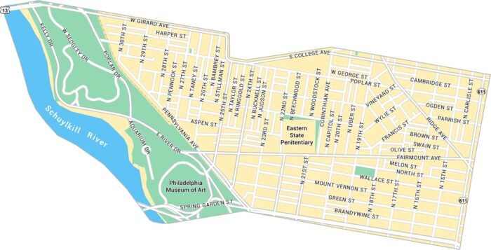
Our map of Fairmount shows this neighborhood in Philadelphia. It includes the Museum of Art, Kelly Drive, and nearby green spaces.
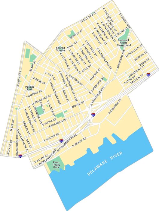
Our map of Fishtown shows the riverside neighborhood northeast of downtown Philadelphia. It lays out the streets, parks, and main routes.
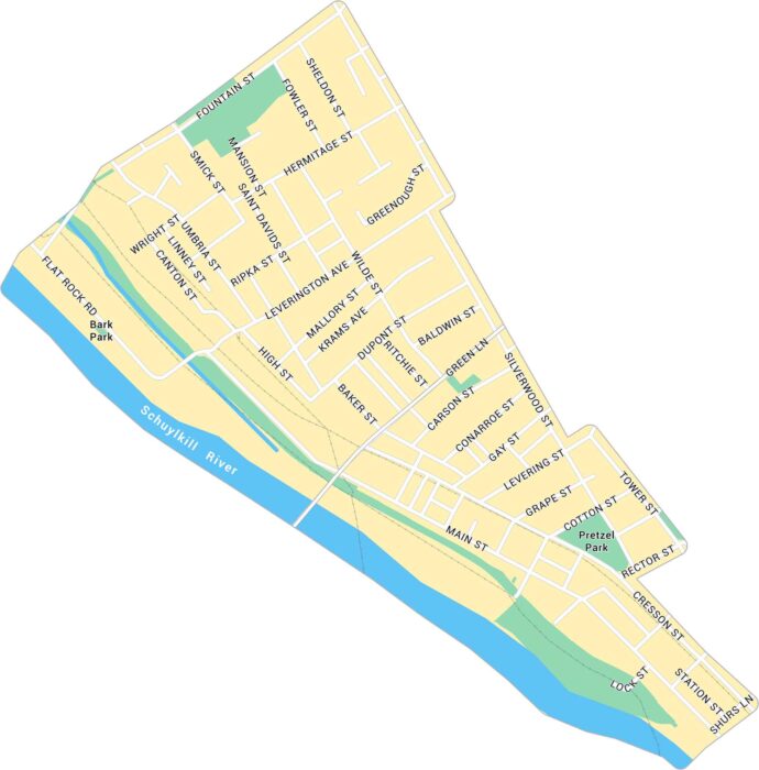
Our map of Manayunk shows the northwest Philadelphia neighborhood along the Schuylkill River. It shows Main Street, Pretzel Park, etc.
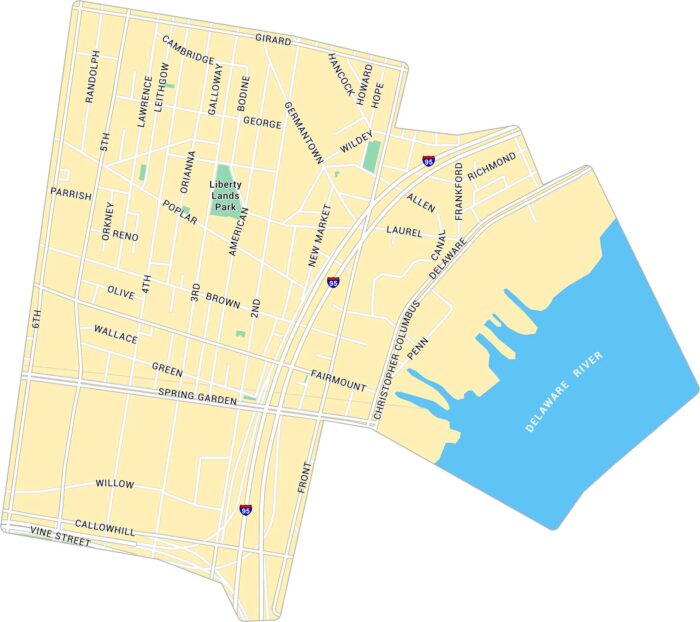
Our map of Northern Liberties highlights the neighborhood just north of Old City. It shows main streets, parks, and the Delaware River.
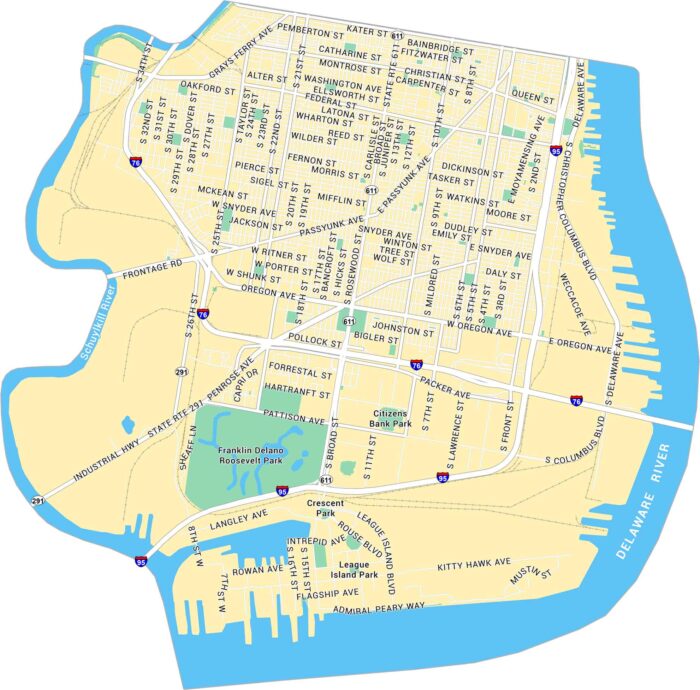
Our map of South Philadelphia lays out the stretch between the Delaware and Schuylkill Rivers. You’ll spot its roads and Citizens Bank Park.
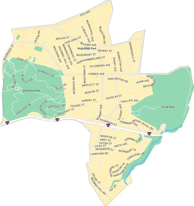
Our map of Squirrel Hill highlights this Pittsburgh neighborhood. You’ll see Frick Park to the east and Schenley Park to the west.
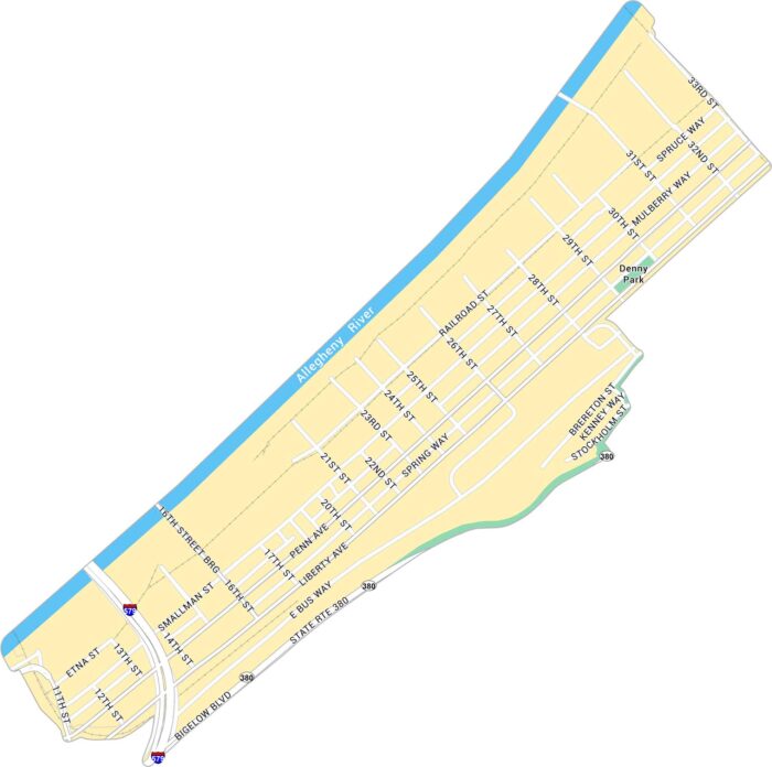
The Strip District stretches along the Allegheny River just northeast of downtown Pittsburgh. Our map highlights its highways and roads.
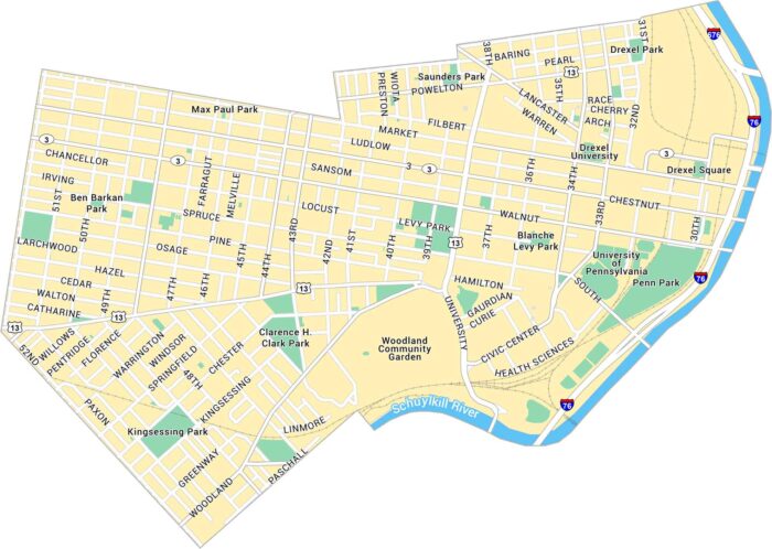
University City in Philadelphia is a hub of innovation. Our map shows the University of Pennsylvania, Drexel University, and its streets.
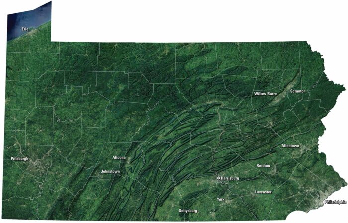
Our Pennsylvania satellite map shows its past and present. Farmland stretches through. But the Poconos and Appalachians brings mountain views.
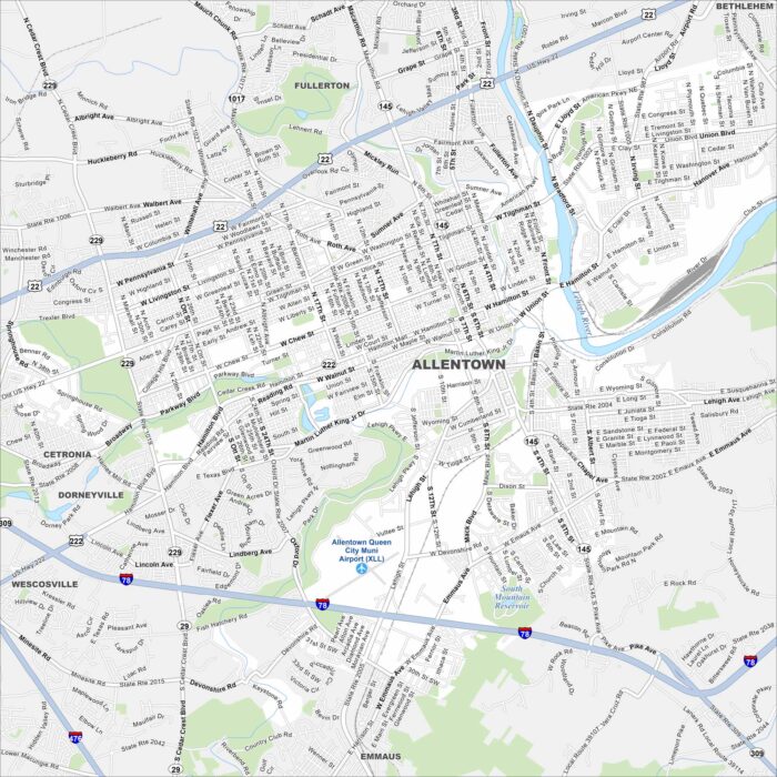
Our map of Allentown shows how the city stretches along the Lehigh River. Meanwhile, highways cut through old industrial corridors.