Northern Liberties Map, Philadelphia
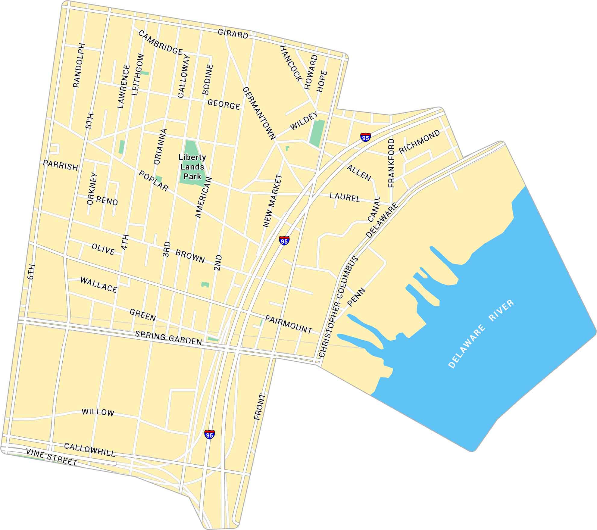
Our map of Northern Liberties highlights the neighborhood just north of Old City, Philadelphia. It shows main streets, parks, and the Delaware River.
Map Information
Philadelphia Neighborhood Maps
See our neighborhood maps for a closer look of the city.
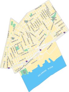
On the Map
Interstates/Highways: I-95 Major Roads: Girard Ave, Spring Garden St, Delaware Ave, Christopher Columbus Blvd, Front St, 2nd St, 5th St, 6th St, Germantown Ave, Fairmount Ave, Brown St, Poplar St, Green St, Callowhill St, Noble St, York St, Lawrence St, American St, New Market St, Richmond St Major Rivers: Delaware River Parks: Liberty Lands ParkCity Maps of Pennsylvania
Here is our city map collection for all of Pennsylvania.


