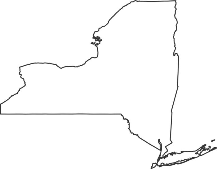
New York Outline Map
New York stretches from the Great Lakes all the way to the Atlantic. Our New York outline map highlights its borders showing the state shape.
New York stretches from the Great Lakes all the way to the Atlantic. Our New York outline map highlights its borders showing the state shape.
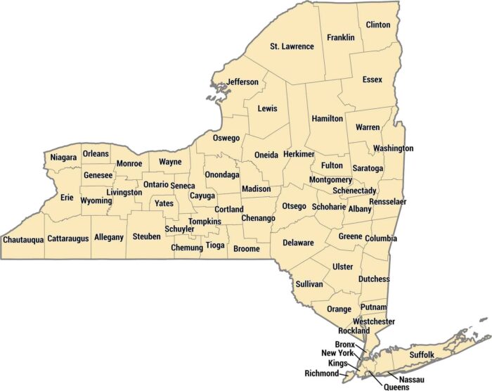
With 62 counties, New York stretches from Manhattan to Niagara Falls. The five boroughs of NYC are actually five separate counties.
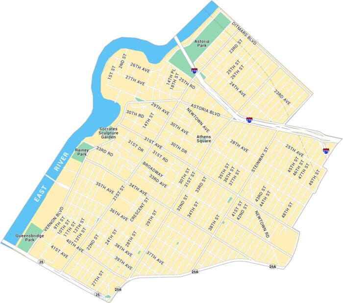
Our map of Astoria shows the road and highways near the East River. It’s one of Queens’ most diverse and lively neighborhoods.
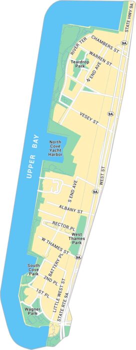
Here’s our map of Battery Park at Manhattan’s southern tip. It includes Teardrop Park, local roads, and green space that frame the skyline.
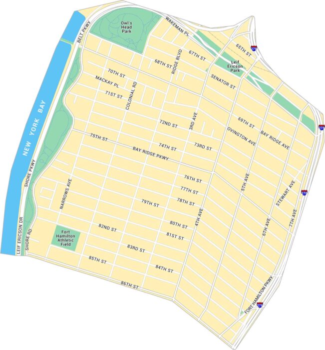
This map covers Bay Ridge along Brooklyn’s waterfront. It lays out Shore Road, local parks, and Interstate 278 at the edge of the map.
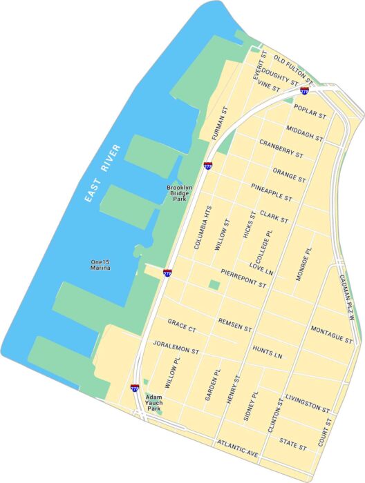
Here’s our map of Brooklyn Heights, situated along the East River. It includes Interstate 278, Brooklyn Bridge Park and local routes.
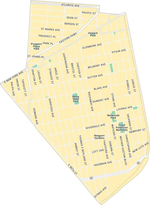
Our map of Brownsville lays out this historic Brooklyn neighborhood in clear detail. It shows major avenues and nearby parks.
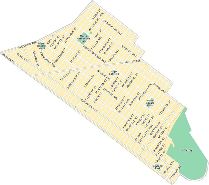
Our map of Bushwick shows its network of streets across this creative stretch of northern Brooklyn. It includes local parks, roads, etc.
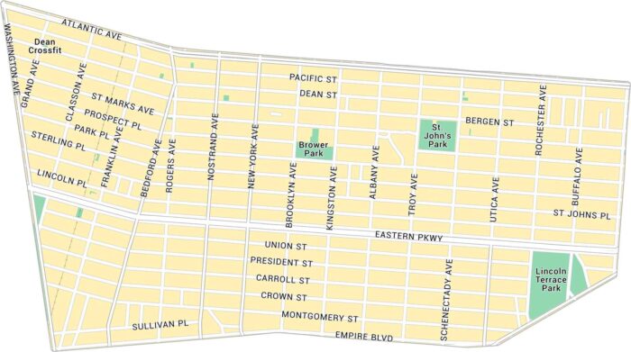
Here’s our map of Crown Heights covering this lively part of central Brooklyn. You’ll see main avenues and local parks.
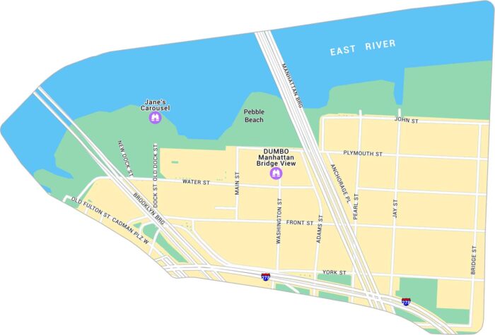
See DUMBO with our road map. It shows its streets, parks and the Manhattan Bridge view spot along Washington Street.
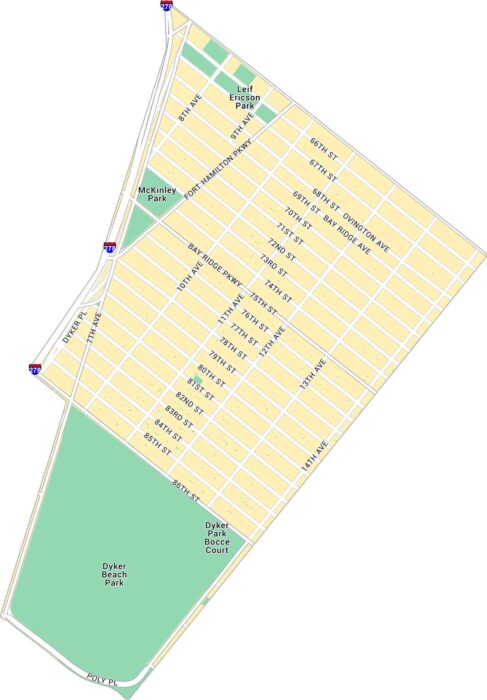
Get to know Dyker Heights with our road map. It shows the Brooklyn neighborhood along the southwestern edge of the borough.
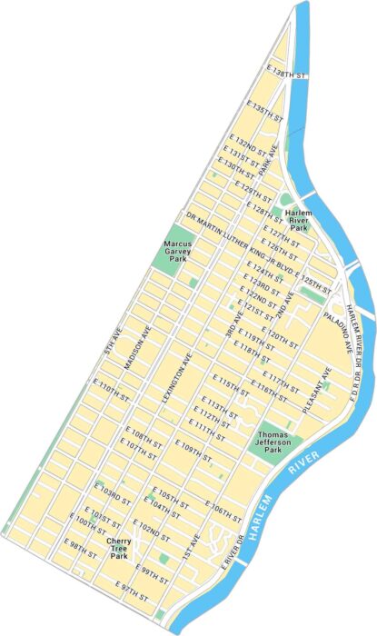
Get to know East Harlem with our map. It shows the uptown Manhattan neighborhood between the Harlem River and Central Park.
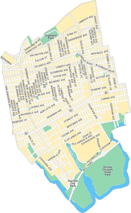
Our map of East New York shows the large Brooklyn neighborhood . It outlines major roads, parks, and waterways running through the area.
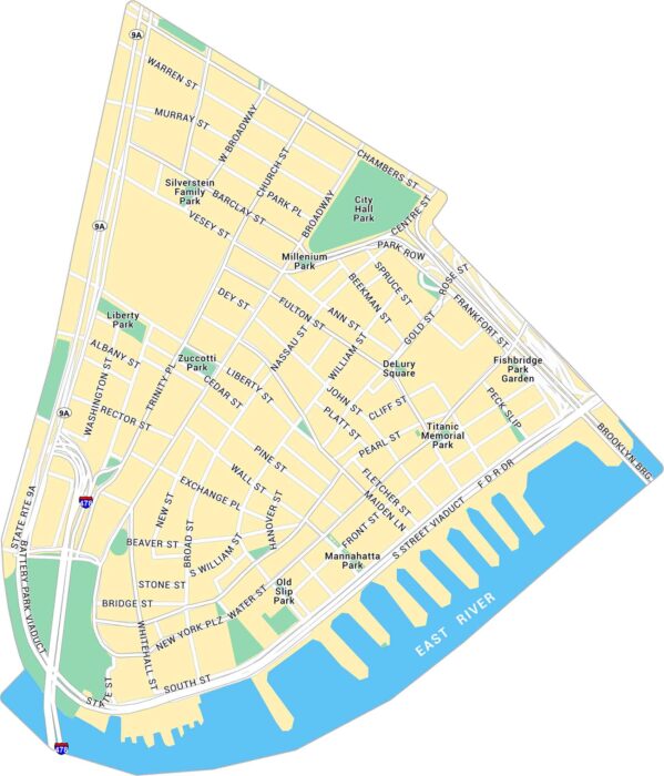
Our map of the Financial District shows the southern tip of Manhattan. It marks Wall Street, Battery Park, and its downtown streets.
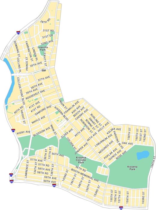
Our map of Flushing shows the busy Queens neighborhood centered around Main Street and Roosevelt Avenue. It outlines major roads and parks.