California Physical Map
No state packs more variety than California. The Sierra Nevada mountains wall off the east while the coastal ranges hug the Pacific Ocean.
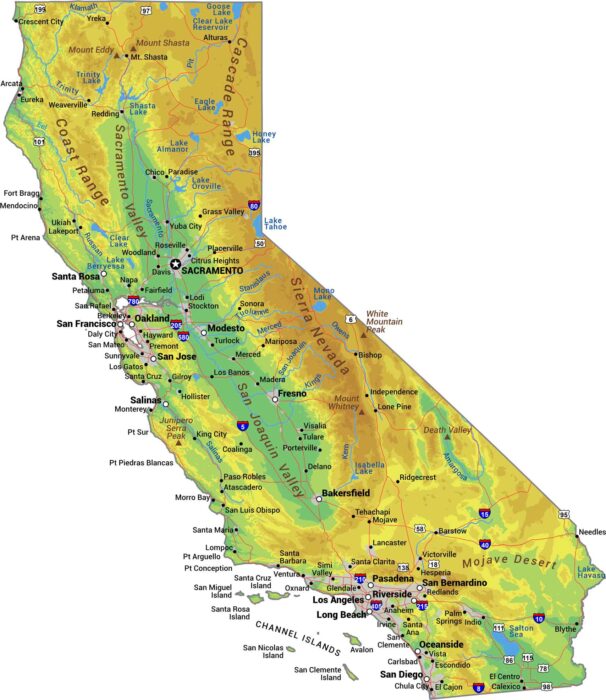
No state packs more variety than California. The Sierra Nevada mountains wall off the east while the coastal ranges hug the Pacific Ocean.
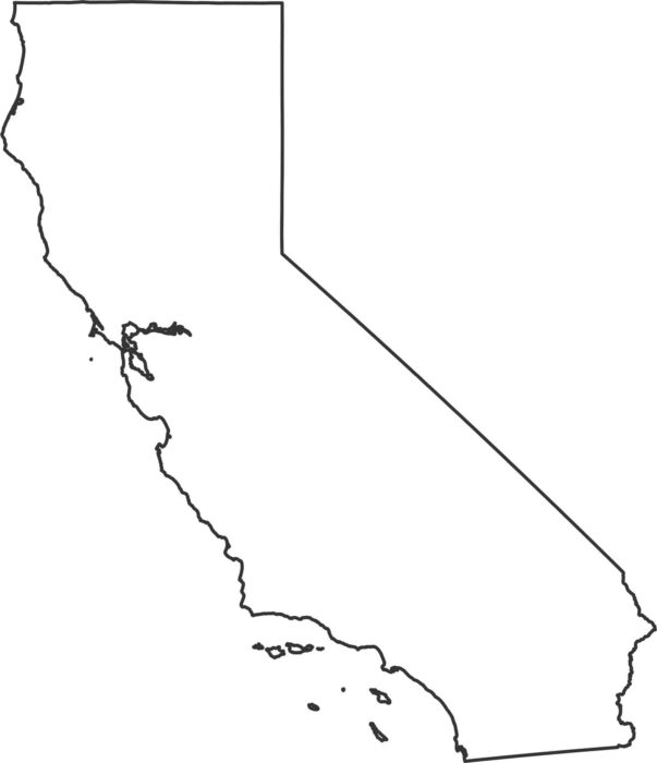
Our California outline map shows over 800 miles of Pacific coastline running down the entire western edge.
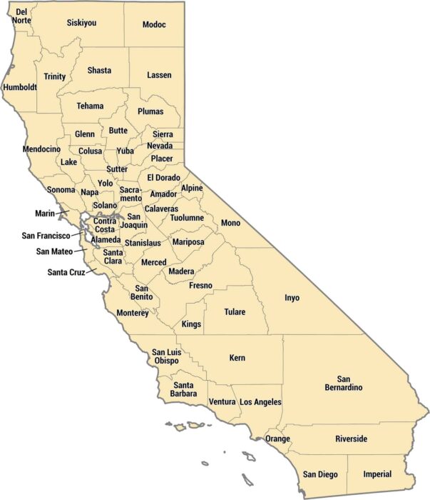
California has 58 counties ranging from tiny Alpine to massive San Bernardino. The coastal counties pack in millions of people.
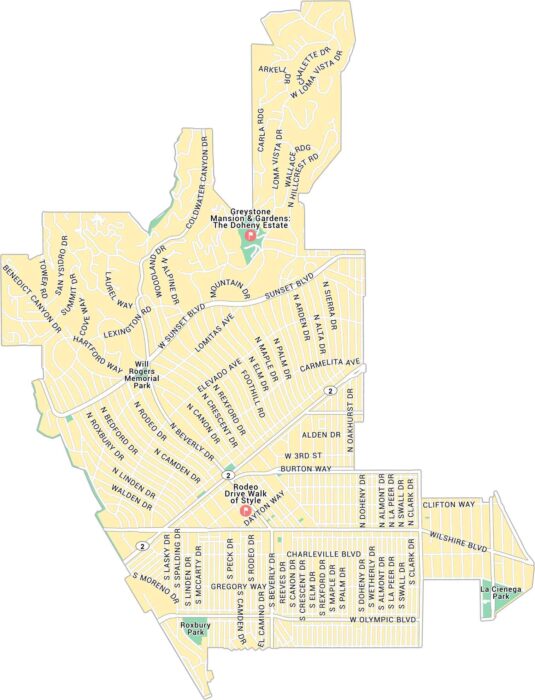
Here’s our map of Beverly Hills, the glamorous pocket west of Los Angeles. It lays out Rodeo Drive, Sunset Boulevard, and its roads.
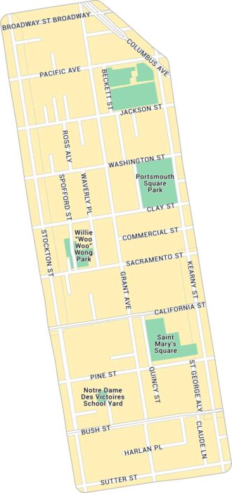
Our map of Chinatown in San Francisco highlights the narrow streets. It shows main routes and local parks.
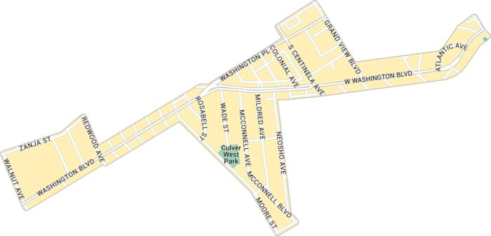
Our map of Culver West shows the streets and parks tucked into the west side of Culver City. It includes neighborhood roads and green spaces.
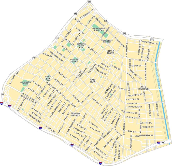
Our map of Downtown Los Angeles shows this big, loud center of LA. It includes the main roads, parks, and streets to the Arts District.
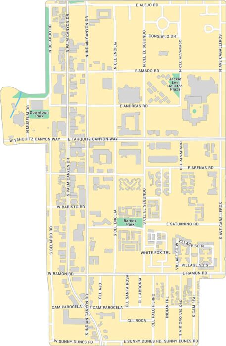
Explore Downtown Palm Springs with our map, showing the main strip along Palm Canyon Drive. It outlines streets, parks, and buildings.
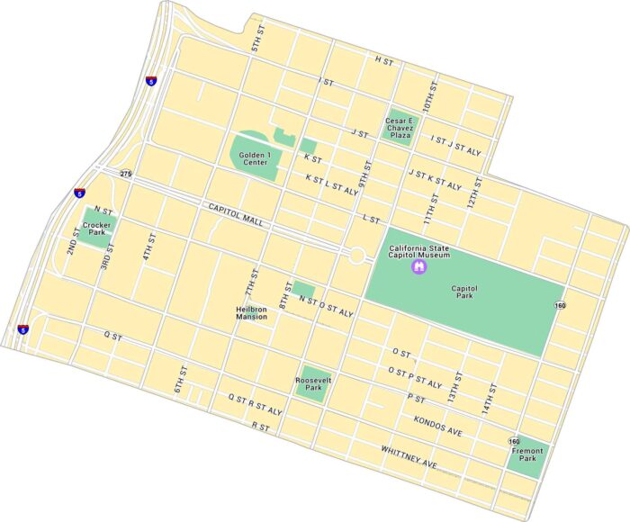
Explore Downtown Sacramento with our map, which shows the stretch between the river and Capitol Park. Follow its parks and routes.
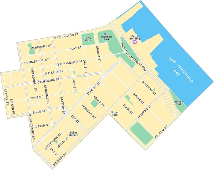
Our map of Downtown San Francisco shows the city’s core. It stretches from Market to Washington Street. We show its streets, parks, etc.
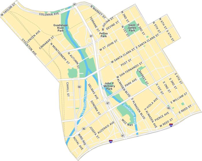
Our map of Downtown San Jose shows the city’s center with the Guadalupe River flowing through it. It lays out main roads, parks, and rail.
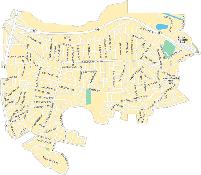
Discover Eagle Rock with our map, showing the Los Angeles neighborhood located between the Pasadena Hills and Glendale.
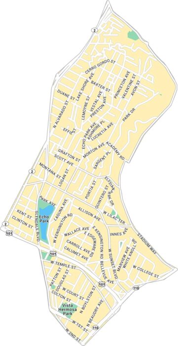
Get to know Echo Park with our map of Los Angeles neighborhood. It highlights Echo Park Lake, main streets, and residential roads.
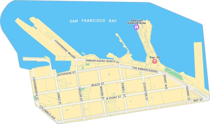
Our map of Fisherman’s Wharf shows the waterfront district on San Francisco’s northern edge with its roads, piers and sea lion viewing area.
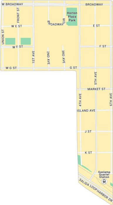
Our map of the Gaslamp Quarter shows the downtown San Diego district just north of the harbor. It’s a busy stretch packed with energy.