Home » State Maps » Oklahoma Lakes and Rivers Map

Oklahoma Lakes and Rivers Map

Oklahoma Lakes and Rivers Map

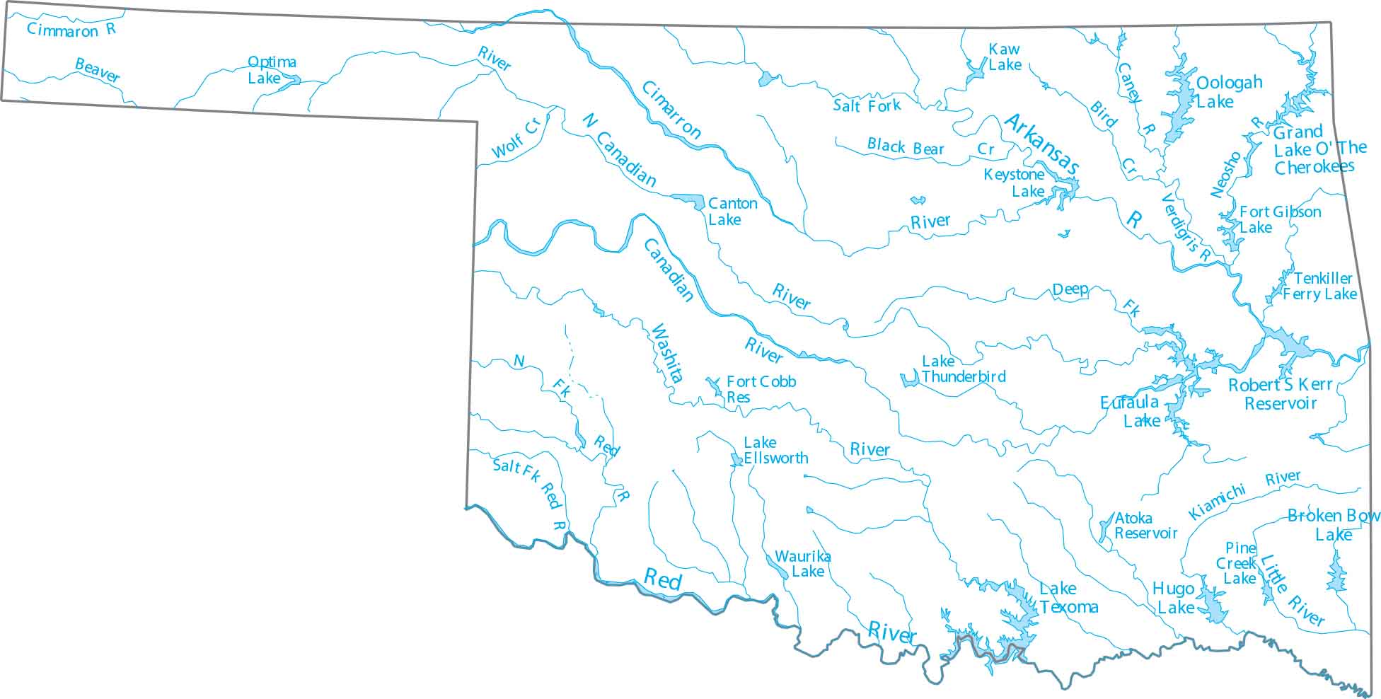
Our Oklahoma lakes and rivers map helps you get to know the Arkansas, Canadian, and Red River. You’ll find numerous large reservoirs created for flood control and water supply.

Map Information

  • Lakes and Rivers Map of Oklahoma
  • Original map provided by National Map. Map updated by our team.
  • Free for personal and commercial purpose. Attribution is required. How to attribute?

On the Map

Oklahoma Location Map
Lakes/Reservoirs: Atoka Reservoir, Broken Bow Lake, Canton Lake, Eufaula Lake, Fort Cobb Reservoir, Fort Gibson Lake, Hugo Lake, Kaw Lake, Keystone Lake, Lake Ellsworth, Lake O’ The Cherokees, Lake Texoma, Lake Thunderbird, Oologah Lake, Optima Lake, Robert S Kerr Reservoir, Tenkiller Ferry Lake, Waurika Lake Rivers and Creeks: Arkansas River, Beaver River, Bird Creek, Black Bear Creek, Canadian River, Caney River, Cimarron River, Kiamichi River, Little River, Neosho River, Pine Creek, Red River, Verdigris River, Washita River, Wolf Creek

Leave a Reply

Your email address will not be published. Required fields are marked *