Ohio Precipitation Map
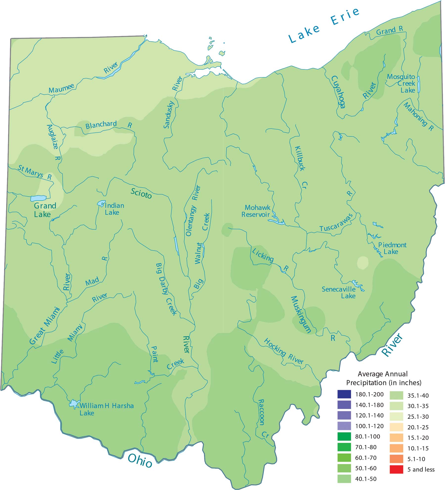
Our precipitation map of Ohio shows lake-effect precipitation. This especially dominates the northern areas near Lake Erie. The southern part of the state stays wetter year-round thanks to Gulf moisture pushing north.
Map Information
State Precipitation Maps
Select any state map below to view its precipitation map.


Ohio State Maps
Check out our maps covering farmland or any of Ohio’s major cities.


