Home » State Maps » North Carolina Population Map

North Carolina Population Map

North Carolina Population Density Map

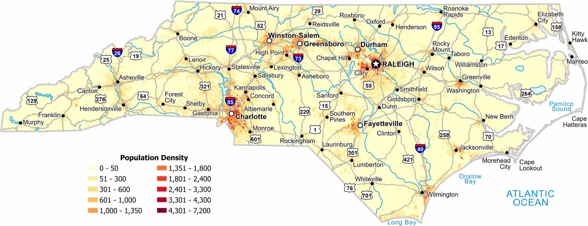
Check out our map to see the population density of North Carolina. Charlotte and Raleigh stick out the most, while mountains have a much lower density.

Map Information

  • Population Density Map of North Carolina
  • Data provided by NASA SEDAC Gridded Population of the World
  • Free for personal and commercial purpose. Attribution is required. How to attribute?

On the Map

North Carolina Location Map
State Capital: Raleigh Major Cities: Charlotte, Durham, Greensboro, Winston-Salem Cities and Towns: Albemarle, Asheboro, Asheville, Boone, Canton, Cary, Chapel Hill, Clinton, Concord, Dunn, Edenton, Elizabeth City, Fayetteville, Forest City, Franklin, Gastonia, Goldsboro, Greenville, Henderson, Hendersonville, Hickory, High Point, Jacksonville, Kannapolis, Kitty Hawk, Laurinburg, Lenoir, Lexington, Lumberton, Manteo, Monroe, Morehead City, Mount Airy, Murphy, New Bern, Oxford, Reidsville, Roanoke Rapids, Rockingham, Rocky Mount, Roxboro, Salisbury, Sanford, Shelby, Smithfield, Southern Pines, Statesville, Tarboro, Washington, Whiteville, Williamston, Wilmington, Wilson Interstate Highways: I-26, I-40, I-73, I-74, I-77, I-85, I-95, I-540 US Routes: US-1, US-13, US-15, US-17, US-19, US-21, US-25, US-29, US-52, US-55, US-64, US-70, US-74, US-76, US-117, US-158, US-176, US-220, US-258, US-264, US-276, US-301, US-311, US-321, US-401, US-421, US-441, US-521, US-601

Leave a Reply

Your email address will not be published. Required fields are marked *