Massachusetts Counties and Cities Map
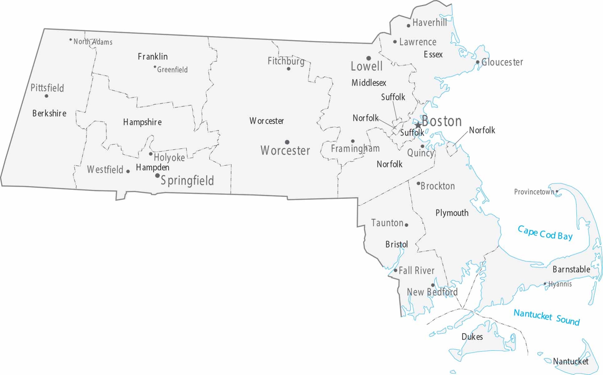
Our map shows Boston and its suburbs taking up most of the eastern part of the state. Worcester holds the center, Springfield anchors the west, and Cape Cod hooks out into the Atlantic. The counties are small and packed with cities since the whole state is pretty densely populated.
Map Information
On the Map
|
Name |
Population 2024 |
Total Area (sq mi) |
FIPS Code |
|
Barnstable County |
232,570 |
1,305.50 |
25-001 |
|
Berkshire County |
128,726 |
946.5 |
25-003 |
|
Bristol County |
588,593 |
691.1 |
25-005 |
|
Dukes County |
21,061 |
491 |
25-007 |
|
Essex County |
823,938 |
828.5 |
25-009 |
|
Franklin County |
70,871 |
724.5 |
25-011 |
|
Hampden County |
464,151 |
634.1 |
25-013 |
|
Hampshire County |
165,399 |
545.3 |
25-015 |
|
Middlesex County |
1,668,956 |
846.9 |
25-017 |
|
Nantucket County |
14,670 |
303.7 |
25-019 |
|
Norfolk County |
740,754 |
444.3 |
25-021 |
|
Plymouth County |
542,090 |
1,093.30 |
25-023 |
|
Suffolk County |
793,144 |
120.2 |
25-025 |
|
Worcester County |
881,248 |
1,579.20 |
25-027 |
Counties and Cities Maps
Select any state map below to view its counties and cities map.


Massachusetts State Maps
Here’s our state maps of Massachusetts


