Downtown Anchorage Map
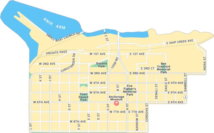
Anchorage is in southern Alaska along the Cook Inlet. Our map of Downtown Anchorage gives a close look at the streets near the waterfront.
Anchorage is in southern Alaska along the Cook Inlet. Our map of Downtown Anchorage gives a close look at the streets near the waterfront.
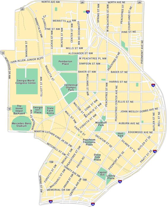
Here’s our map of Downtown Atlanta showing the State Capitol and Centennial Park. You’ll find interstates, streets, and green spaces.
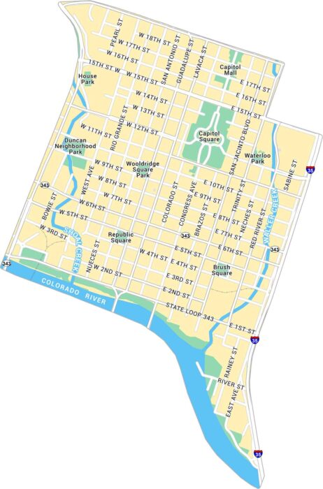
Austin lies in central Texas. Our map of Downtown Austin brings the Capitol, riverfront, and Sixth Street area into view.
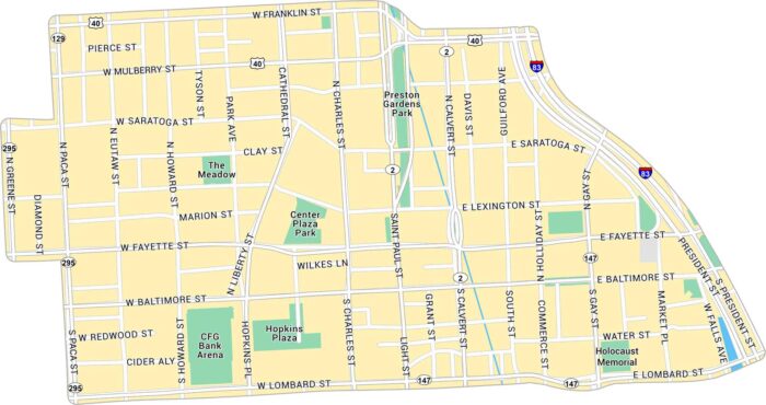
Baltimore sits on the Chesapeake Bay, a major hub in Maryland’s coastal region. This map includes interstates, parks, and local roads.
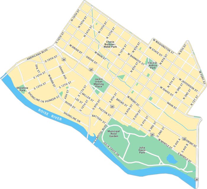
Our map of Downtown Boise highlights from Boise River to the Capitol and city center. You’ll find the main roads, local parks and highways.
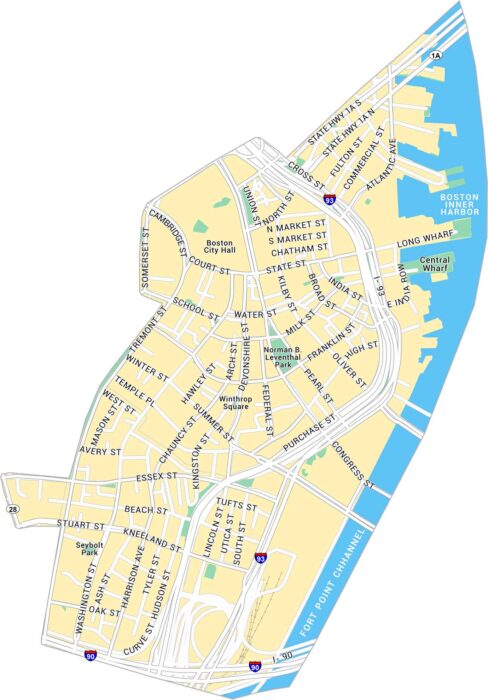
See how Downtown Boston fits together with this detailed map. It covers historic streets, waterfront areas, and local parks.
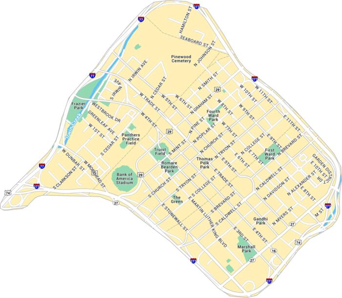
Our map of Downtown Charlotte outlines the blocks around Trade and Tryon Street. It includes main roads, green spaces, and highways.
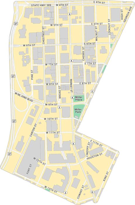
Here’s our map of Downtown Chattanooga located near the Tennessee River. It highlights key roads, local parks, and state highways.
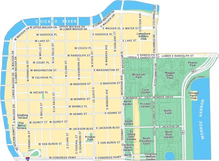
Our map of Downtown Chicago shows the streets that run from the Loop to the lakefront. You’ll see the parks, highways, and major routes.
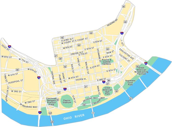
Here’s our map of Downtown Cincinnati, situated along the Ohio River. You’ll see stadiums, bridges, and streets running through the city.
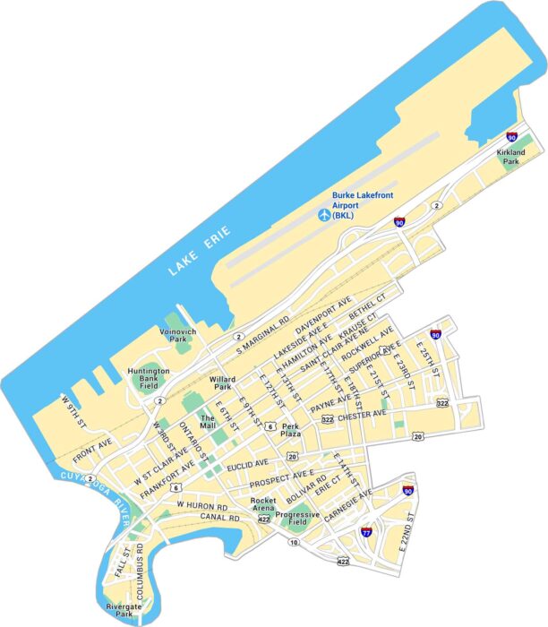
Our map of Downtown Cleveland lays out the lakefront, stadium, and busy downtown streets. It’s an easy way to get oriented in the city.
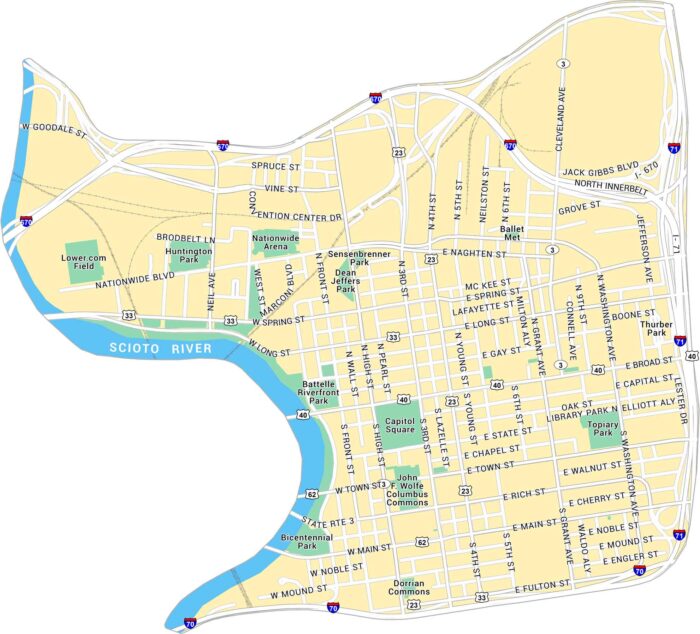
This map of Downtown Columbus shows the Scioto River and the streets around the Capitol. It gives a clear look at downtown’s layout.
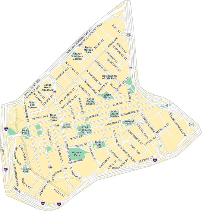
Our map of Downtown Dallas gives you a full look at the city’s core. You’ll find parks, railways and all the main routes through downtown.
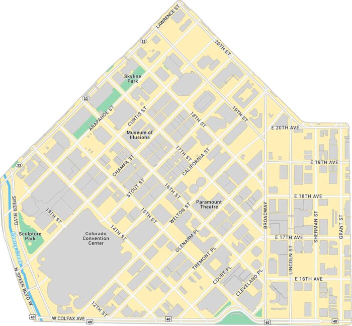
Here’s our map of Downtown Denver with a view of the city’s core. We’ve marked buildings, parks, major roads, and highways.
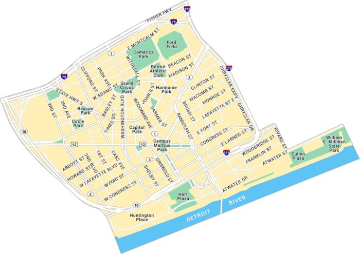
Our map of Downtown Detroit shows the streets along the river and around Campus Martius Park. The Detroit River forms the southern edge.