Kentucky Lakes and Rivers Map
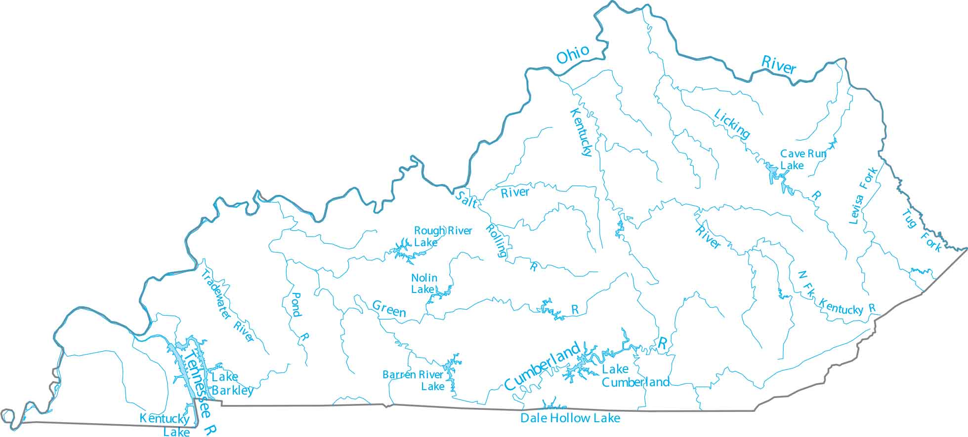
Step into a region defined by more miles of running water than almost any other state. Kentucky is in the Ohio Valley, shaped by rivers along nearly every edge. Our map of Kentucky shows the Ohio River boundary and interior waterways.
Map Information
On the Map
Lakes and Rivers State Maps
Select any state map below to view its lakes and rivers map.


Kentucky State Maps
Our Kentucky maps reveal the Bluegrass State


