Indiana Lakes and Rivers Map
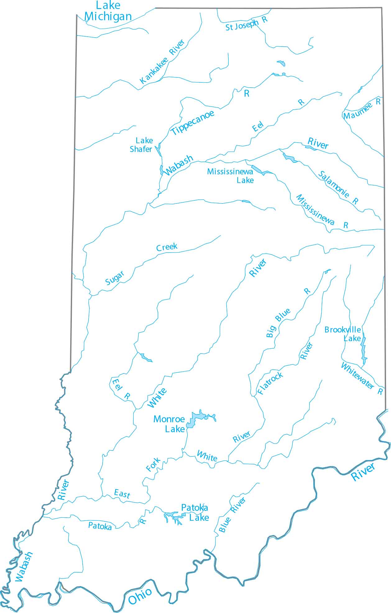
See how Indiana’s rivers connect the state together. Our map shows the Wabash River flowing southwest through the entire state. Indiana is positioned in the Great Lakes region with Lake Michigan providing shoreline in the northwest corner.
Map Information
On the Map
Lakes and Rivers State Maps
Select any state map below to view its lakes and rivers map.


Indiana State Maps
Study about Indiana with our map collection


