Illinois Lakes and Rivers Map
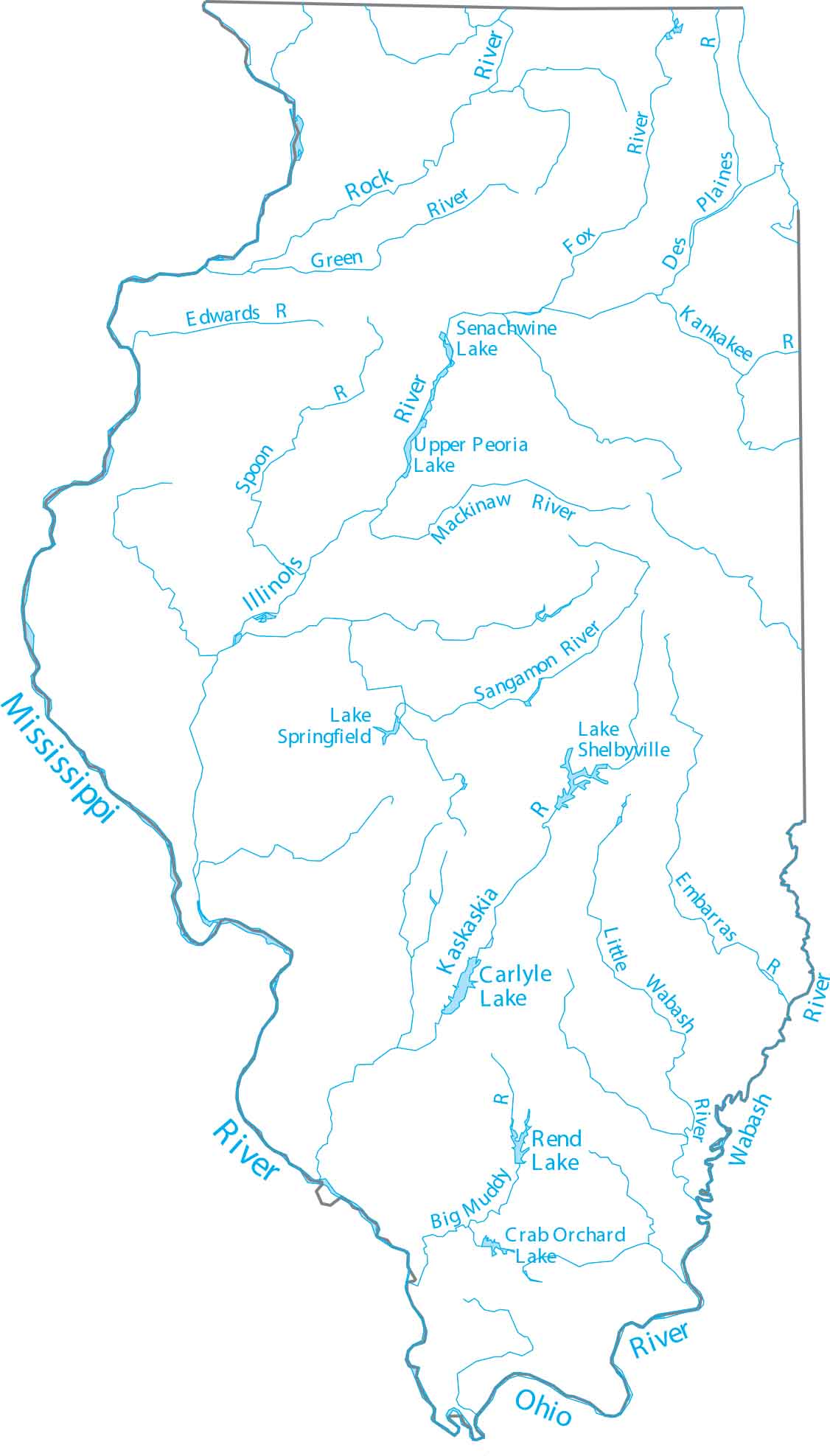
Check out Illinois with our map of major rivers and lakes. As a state in the Midwest, it’s bordered by some of the nation’s biggest rivers. It’s bordered by the Mississippi and Ohio rivers, while the Illinois River cuts right through the center of the state.
Map Information
On the Map
Lakes and Rivers State Maps
Select any state map below to view its lakes and rivers map.


Illinois State Maps
Get to know Illinois with our state maps


