Home » State Maps » Colorado Lakes and Rivers Map

Colorado Lakes and Rivers Map

Colorado Lakes and Rivers Map

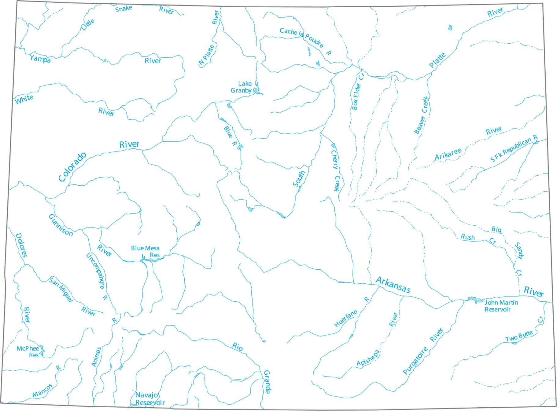
Start with this map of Colorado’s lakes and rivers. Colorado is the starting point for the Rio Grande and the Colorado River, both of which begin high in the Rockies. These headwaters supply most of the Western United States.

Map Information

  • Lakes and Rivers Map of Colorado
  • Original map provided by National Map. Map updated by our team.
  • Free for personal and commercial purpose. Attribution is required. How to attribute?

On the Map

Colorado Location Map
Lakes and Reservoirs: Blue Mesa Reservoir, John Martin Reservoir, Lake Granby, McPhee Reservoir, Navajo Reservoir Rivers and Creeks: Animas River, Apishapa River, Arikaree River, Arkansas River, Beaver Creek, Big Sandy Creek, Blue River, Box Elder Creek, Cache la Poudre River, Cherry Creek, Colorado River, Dolores River, Gunnison River, Huerfano River, Little Snake River, Mancos River, North Platte River, Purgatoire River, Rio Grande, Rush Creek, San Miguel River, South Fork Republican River, South Platte River, Two Butte Creek, Uncompahgre River, White River, Yampa River

Leave a Reply

Your email address will not be published. Required fields are marked *