Louisiana Parish Map
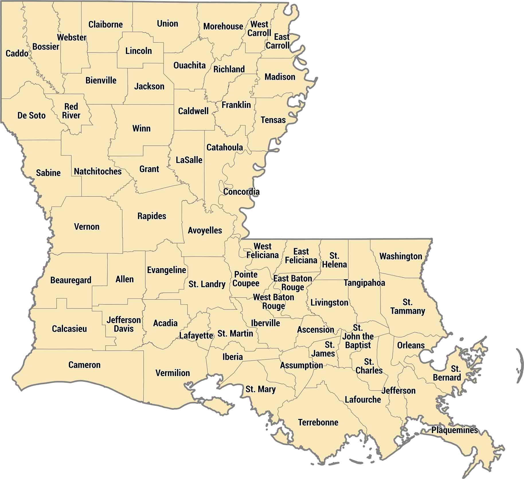
Louisiana calls them parishes instead of counties and there’s 64 of them total. Rivers, bayous, and the Gulf Coast shape most of the parishes in Louisiana. But northern parishes are hill country, completely different from the swampy coast.
Map Information
On the Map
Our table below provides you with population, area, and FIPS code for each parish.
|
Name |
Population 2024 |
Total Area (sq mi) |
FIPS Code |
|
Acadia Parish |
56,604 |
657.5 |
22-001 |
|
Allen Parish |
22,501 |
765.9 |
22-003 |
|
Ascension Parish |
133,534 |
302.8 |
22-005 |
|
Assumption Parish |
20,050 |
364.5 |
22-007 |
|
Avoyelles Parish |
38,373 |
865.7 |
22-009 |
|
Beauregard Parish |
36,695 |
1,165.80 |
22-011 |
|
Bienville Parish |
12,412 |
822.1 |
22-013 |
|
Bossier Parish |
131,102 |
867.4 |
22-015 |
|
Caddo Parish |
224,893 |
936.6 |
22-017 |
|
Calcasieu Parish |
206,861 |
1,094.30 |
22-019 |
|
Caldwell Parish |
9,393 |
540.7 |
22-021 |
|
Cameron Parish |
4,678 |
1,936.70 |
22-023 |
|
Catahoula Parish |
8,280 |
739.4 |
22-025 |
|
Claiborne Parish |
13,537 |
767.4 |
22-027 |
|
Concordia Parish |
17,797 |
747.3 |
22-029 |
|
De Soto Parish |
27,274 |
894.6 |
22-031 |
|
East Baton Rouge Parish |
453,022 |
470.2 |
22-033 |
|
East Carroll Parish |
6,892 |
442.4 |
22-035 |
|
East Feliciana Parish |
19,112 |
455.8 |
22-037 |
|
Evangeline Parish |
31,745 |
679.6 |
22-039 |
|
Franklin Parish |
19,107 |
635.4 |
22-041 |
|
Grant Parish |
22,109 |
664.6 |
22-043 |
|
Iberia Parish |
67,540 |
1,030.50 |
22-045 |
|
Iberville Parish |
29,766 |
652.9 |
22-047 |
|
Jackson Parish |
14,797 |
580.3 |
22-049 |
|
Jefferson Parish |
427,253 |
642 |
22-051 |
|
Jefferson Davis Parish |
31,436 |
658.6 |
22-053 |
|
Lafayette Parish |
254,241 |
269.2 |
22-055 |
|
Lafourche Parish |
95,342 |
1,468.90 |
22-057 |
|
LaSalle Parish |
14,702 |
662.4 |
22-059 |
|
Lincoln Parish |
48,243 |
472.5 |
22-061 |
|
Livingston Parish |
152,886 |
691.5 |
22-063 |
|
Madison Parish |
9,093 |
650.9 |
22-065 |
|
Morehouse Parish |
23,787 |
806.1 |
22-067 |
|
Natchitoches Parish |
35,982 |
1,299.00 |
22-069 |
|
Orleans Parish |
362,701 |
349.8 |
22-071 |
|
Ouachita Parish |
157,874 |
631.7 |
22-073 |
|
Plaquemines Parish |
22,289 |
2,567.20 |
22-075 |
|
Pointe Coupee Parish |
19,845 |
590.7 |
22-077 |
|
Rapides Parish |
125,899 |
1,361.60 |
22-079 |
|
Red River Parish |
7,238 |
402.3 |
22-081 |
|
Richland Parish |
19,643 |
564.5 |
22-083 |
|
Sabine Parish |
21,746 |
1,011.60 |
22-085 |
|
St. Bernard Parish |
44,783 |
2,155.20 |
22-087 |
|
St. Charles Parish |
50,400 |
396.9 |
22-089 |
|
St. Helena Parish |
10,857 |
409.5 |
22-091 |
|
St. James Parish |
19,110 |
257.8 |
22-093 |
|
St. John the Baptist Parish |
39,694 |
409.9 |
22-095 |
|
St. Landry Parish |
80,869 |
939 |
22-097 |
|
St. Martin Parish |
51,218 |
816.5 |
22-099 |
|
St. Mary Parish |
46,799 |
1,119.40 |
22-101 |
|
St. Tammany Parish |
277,615 |
1,095.60 |
22-103 |
|
Tangipahoa Parish |
139,823 |
844.1 |
22-105 |
|
Tensas Parish |
3,844 |
641.2 |
22-107 |
|
Terrebonne Parish |
103,864 |
2,082.00 |
22-109 |
|
Union Parish |
20,617 |
905.4 |
22-111 |
|
Vermilion Parish |
57,641 |
1,542.10 |
22-113 |
|
Vernon Parish |
45,819 |
1,341.50 |
22-115 |
|
Washington Parish |
45,090 |
675.9 |
22-117 |
|
Webster Parish |
35,184 |
614.8 |
22-119 |
|
West Baton Rouge Parish |
28,425 |
203.8 |
22-121 |
|
West Carroll Parish |
9,254 |
360.6 |
22-123 |
|
West Feliciana Parish |
15,155 |
426 |
22-125 |
|
Winn Parish |
13,405 |
956.8 |
22-127 |
Louisiana State Maps
Here are maps showcasing the state of Louisiana


State County Maps
Click on a map below to check out county maps of each state.


