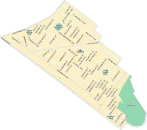
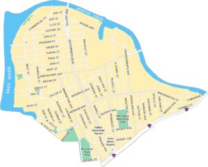
Dyker Heights Map, New York
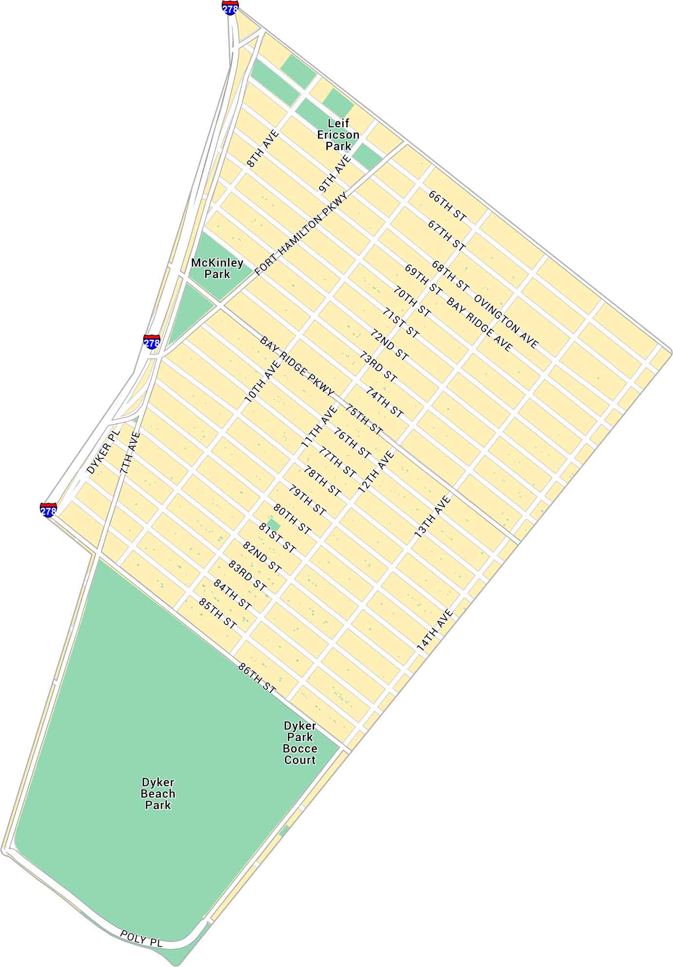
Our map of Dyker Heights shows the Brooklyn neighborhood along the southwestern edge of the borough. Get to know this quiet, suburban-feeling corner of the city.
Map Information
Brooklyn Neighborhood Maps
See our neighborhood maps for a closer look of the city.
On the Map
Interstates/Highways: I-278 Major Roads: Fort Hamilton Pkwy, Bay Ridge Pkwy, 86th St, 13th Ave, 11th Ave, 10th Ave, 7th Ave, 8th Ave, 9th Ave, 12th Ave, 14th Ave, 66th St, 75th St, 82nd St, Poly Pl, Ovington Ave, Dyker Pl Parks: Dyker Beach Park, McKinley Park, Leif Ericson Park, Dyker Park Bocce CourtCity Maps of New York
Here are the city maps that define New York


