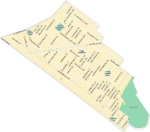
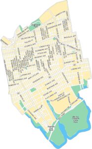
Greenpoint Map, New York
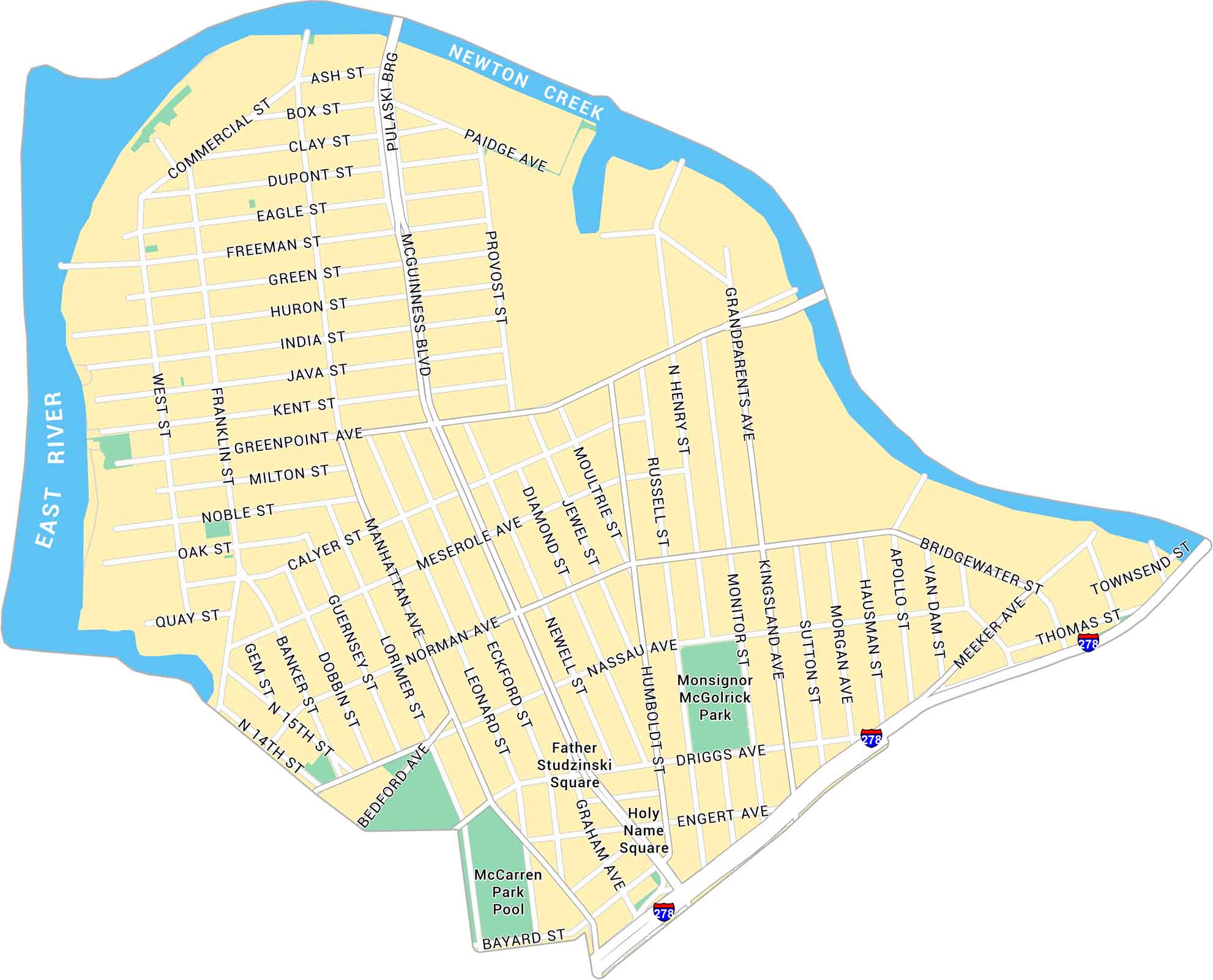
Greenpoint sits at the northern tip of Brooklyn, along the East River. This map shows its waterfront, main streets, and residential blocks.
Map Information
Brooklyn Neighborhood Maps
See our neighborhood maps for a closer look of the city.
On the Map
Interstates/Highways: I-278 Major Roads: McGuinness Blvd, Greenpoint Ave, Manhattan Ave, Bedford Ave, Driggs Ave, Nassau Ave, Norman Ave, Meserole Ave, Kingsland Ave, Meeker Ave, Pulaski Brg, Provost St, Franklin St, West St, Humboldt St, Graham Ave, Bridgewater St, Apollo St, Morgan Ave, Sutton St Creeks/Rivers: East River, Newton Creek Parks: Monsignor McGolrick Park, Father Studzinski Square, Holy Name Square Landmarks: McCarren Park PoolCity Maps of New York
Here are the city maps that define New York


