Wisconsin Lakes and Rivers Map
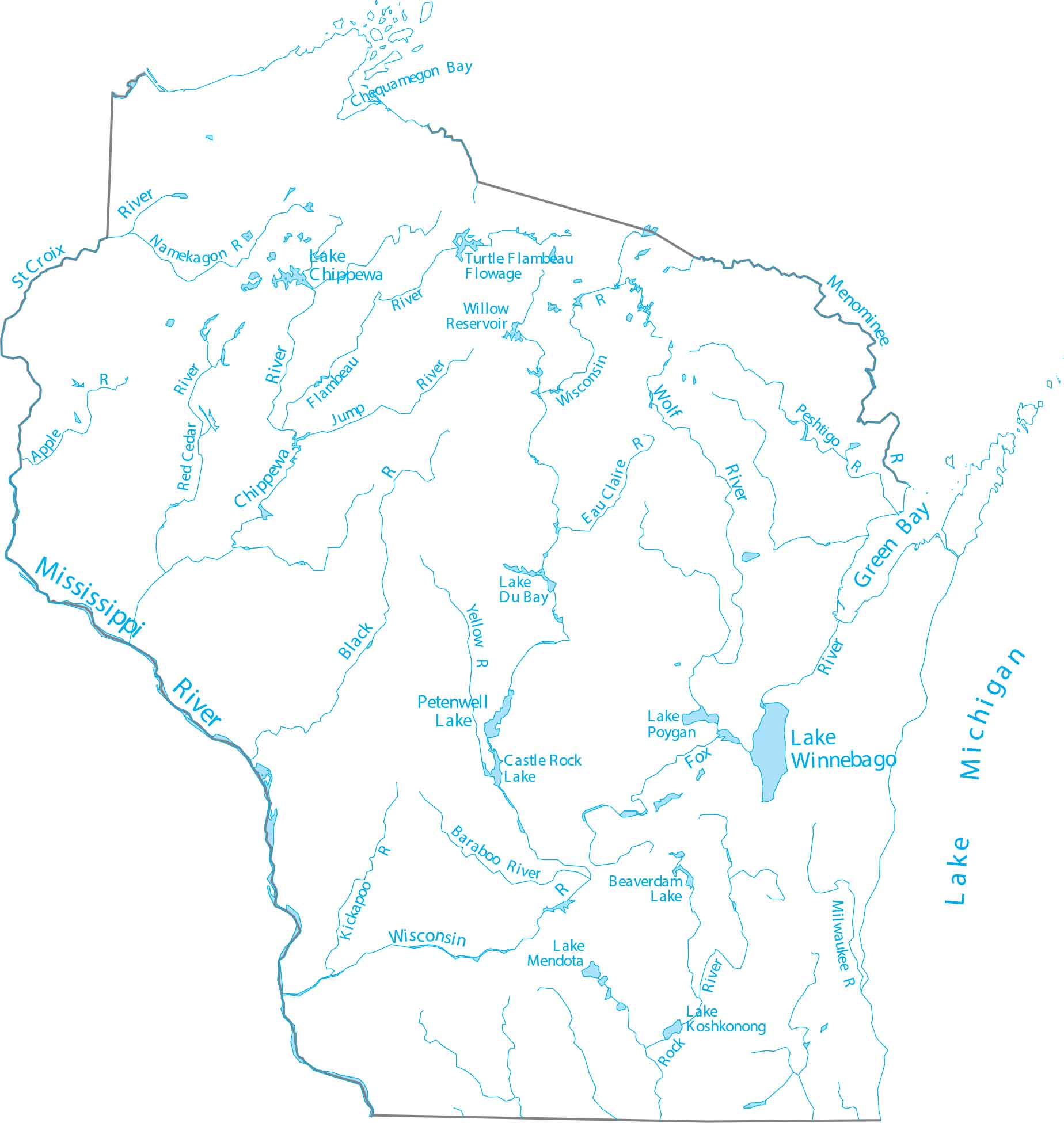
Wisconsin is in the Upper Midwest, shaped by glacial lakes and major rivers. Our map shows the Wisconsin River, which flows through the center. Lake Superior and Lake Michigan form the northern and eastern edges.
Map Information
On the Map
Lakes and Rivers State Maps
Select any state map below to view its lakes and rivers map.


Wisconsin State Maps
Discover maps of the Badger State.


