Washington Precipitation Map
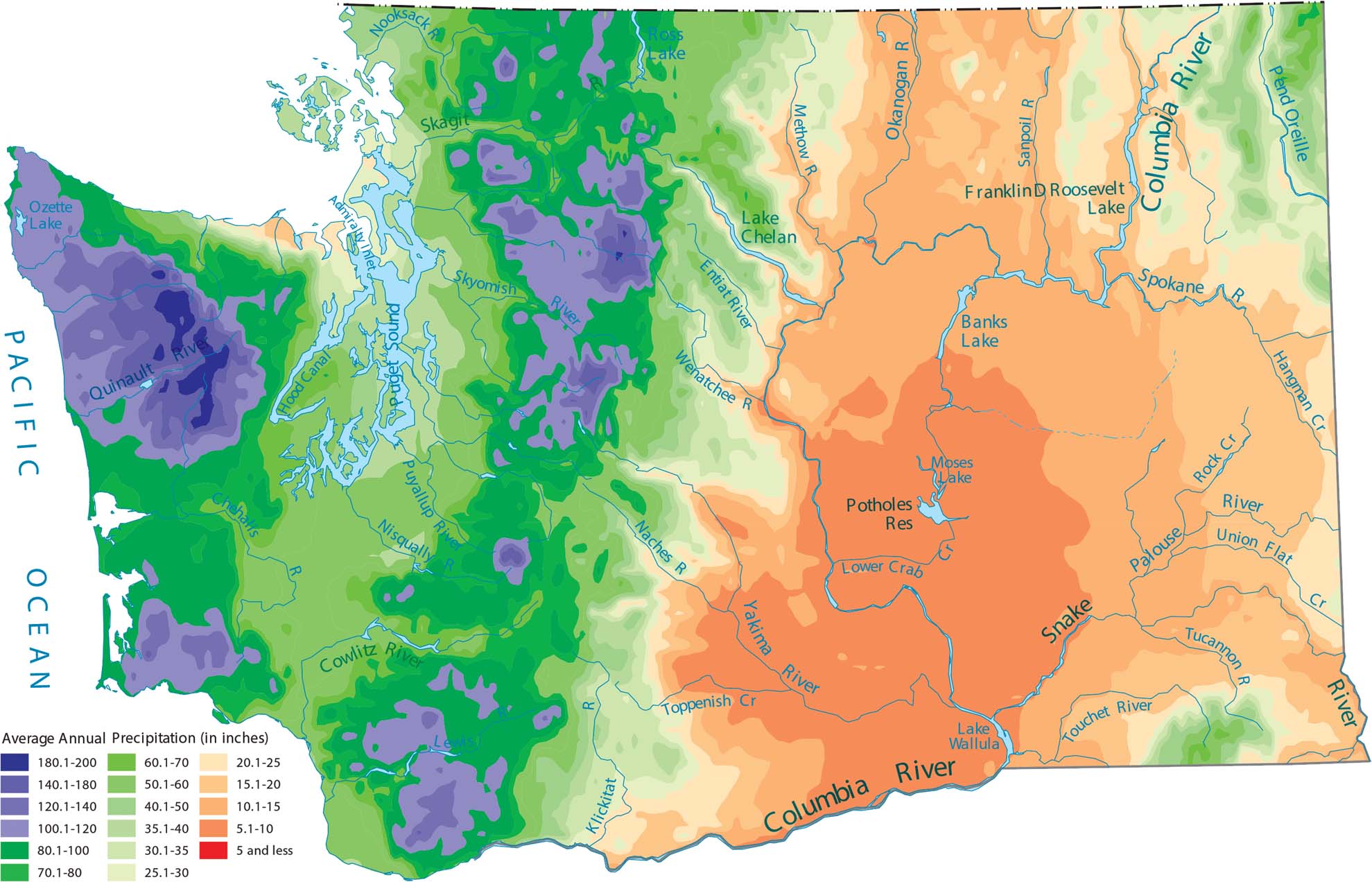
Washington is known for its rain. But that is only true for the western half of the state. Our precipitation map of Washington shows that the Olympic Mountains and the Cascades get the most water. Notice how the eastern side of the state is a dry desert because the mountains block all the ocean mist.
Map Information
State Precipitation Maps
Select any state map below to view its precipitation map.


Washington State Maps
Move through the Evergreen State with our map collection.


