US Election 1789 Map
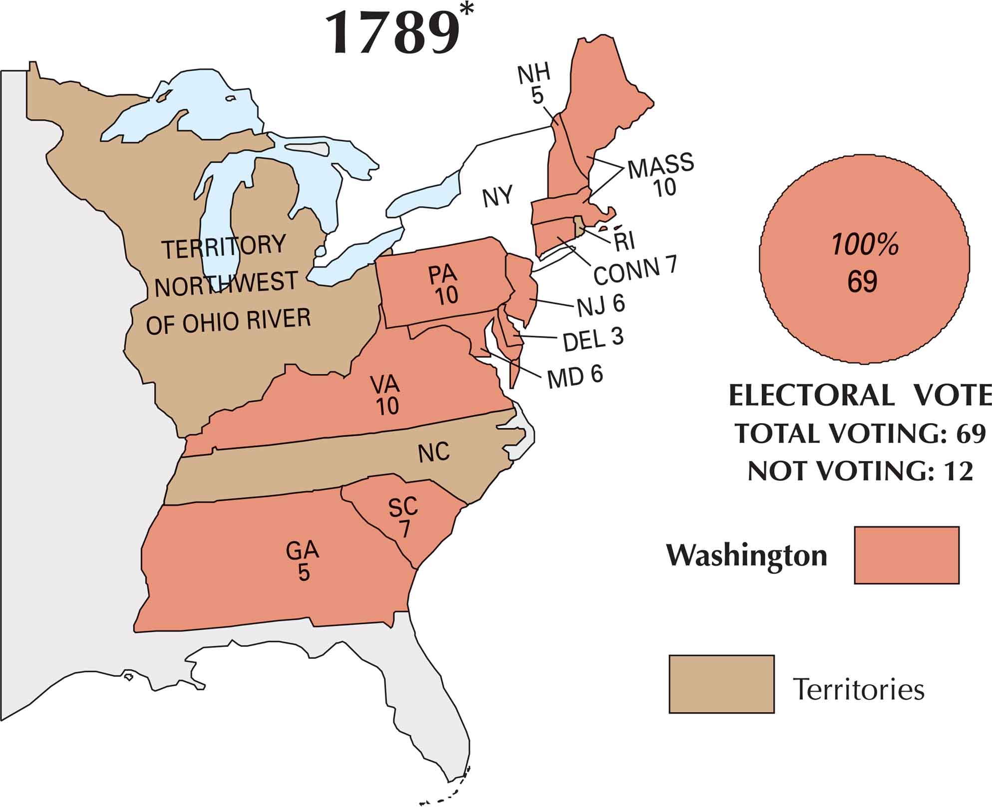
Back in 1789, the first U.S. presidential election looked nothing like what we think of today. There were no political parties. But George Washington was the clear and unanimous choice. States held elections in different ways. This map shows how the country was just getting started. Only ten states actually voted.
Map Information


Country Maps
Explore the geography that defines this nation.


