Maryland Physical Map
Our physical map of Maryland shows a state squeezed between mountains and coast with the Appalachians and the Chesapeake Bay.
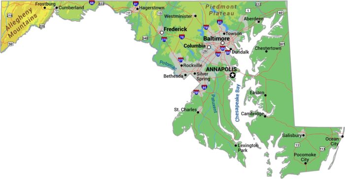
Our physical map of Maryland shows a state squeezed between mountains and coast with the Appalachians and the Chesapeake Bay.
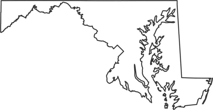
Our Maryland outline map shows Maryland as one of the most irregular shapes. It’s because the Chesapeake Bay cuts right through the middle.
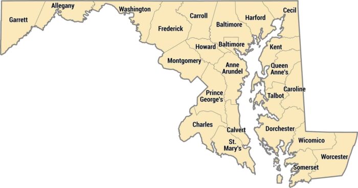
Maryland has 23 counties plus Baltimore as an independent city. The Eastern Shore counties sit across the Chesapeake Bay, rural and flat.
Baltimore sits on the Chesapeake Bay, a major hub in Maryland’s coastal region. This map includes interstates, parks, and local roads.
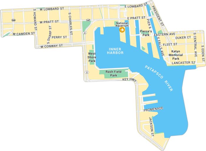
Inner Harbor is located along Baltimore’s waterfront, just south of downtown. Our map outlines the harbor, streets, and nearby attractions.
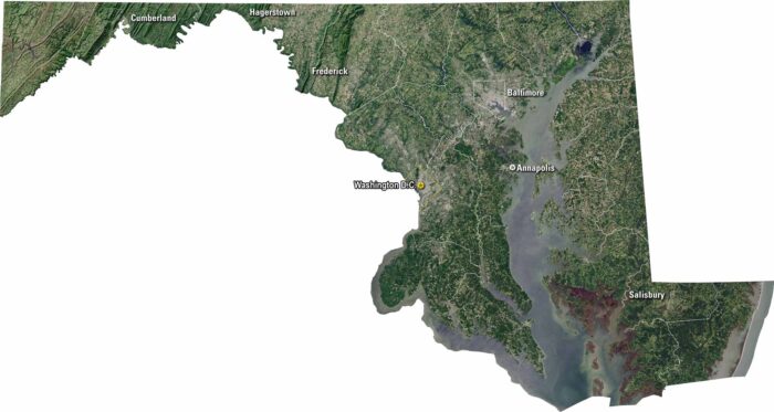
Maryland spreads across bays, rivers, and rolling hills. Our satellite map shows all the way from Washington, D.C. to Chesapeake Bay.
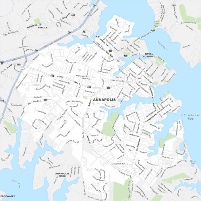
Here’s our map of Annapolis, located along Chesapeake Bay. Annapolis is the capital of Maryland and home to the U.S. Naval Academy.
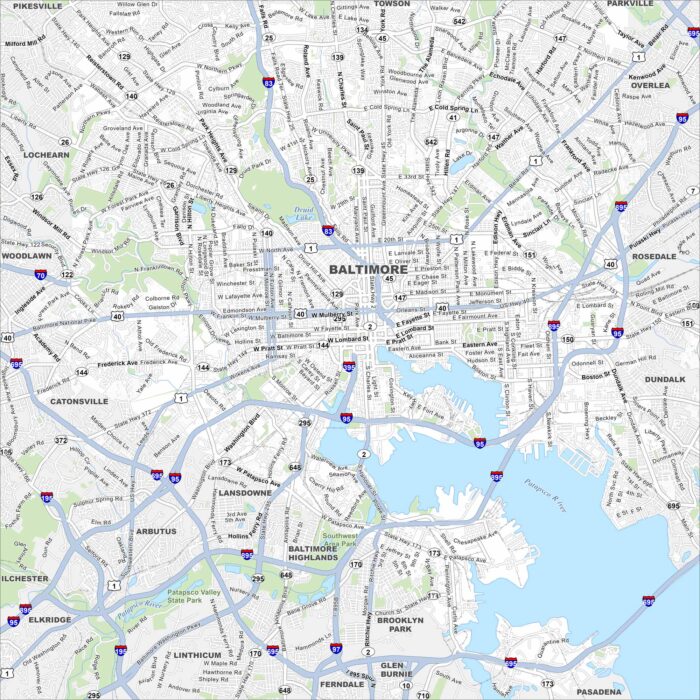
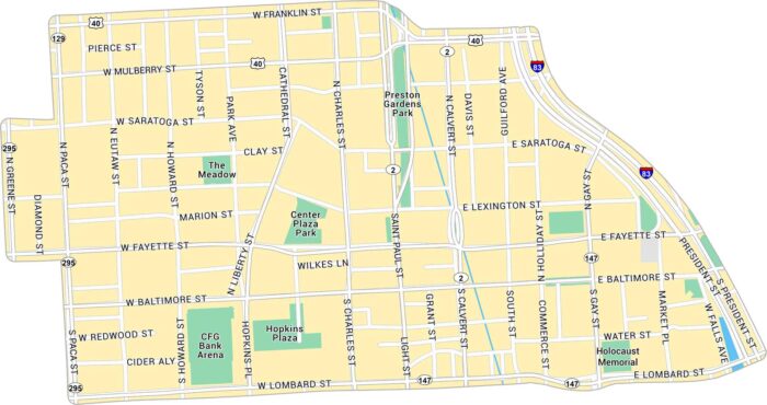
Our map of Baltimore highlights the highways, streets, and waterfront routes. Roads bend around the Inner Harbor area.
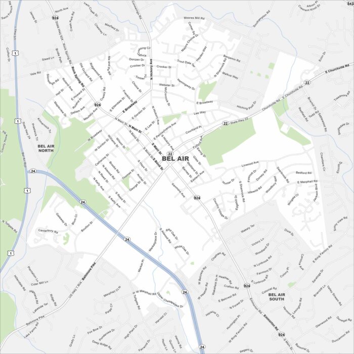
We’ve mapped out every major road in Bel Air. See the heart of Harford County with its historic downtown and nearby parks.
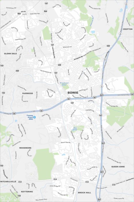
Explore Bowie, Maryland on our map between Washington and Baltimore. Parks, lakes, and suburban streets fill the area.
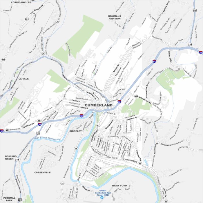
Cumberland is shown on our map with its roads and highways. Located in western Maryland, the city sits along the Potomac River.
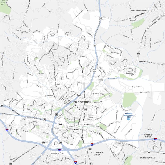
Frederick is set in a valley with the Monocacy River flowing by. Catoctin Mountain rises just to the west. I-70 and I-270 intersect here.
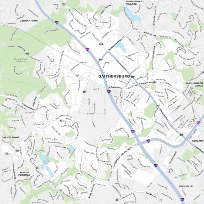
See our map of Gaithersburg northwest of Washington, D.C. Lakes and creeks bring in a mix of open space. Roads and highways crisscross here.
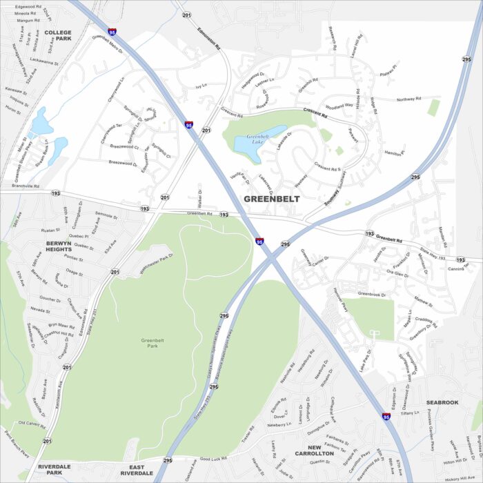
Greenbelt is just northeast of Washington, D.C. This map shows parkland and green space surrounding the community.
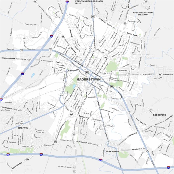
Our map of Hagerstown shows the city in western Maryland’s Cumberland Valley. Interstates 70 and 81 meet close here.