Map of Bowie, Maryland
Explore Bowie, Maryland on our map between Washington and Baltimore. Parks, lakes, and suburban streets fill the area.
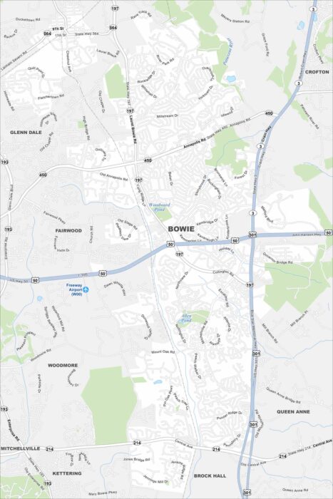
Explore Bowie, Maryland on our map between Washington and Baltimore. Parks, lakes, and suburban streets fill the area.
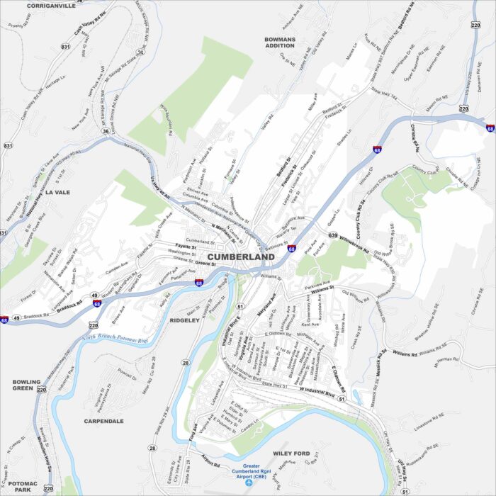
Cumberland is shown on our map with its roads and highways. Located in western Maryland, the city sits along the Potomac River.
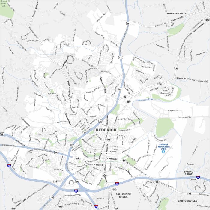
Frederick is set in a valley with the Monocacy River flowing by. Catoctin Mountain rises just to the west. I-70 and I-270 intersect here.
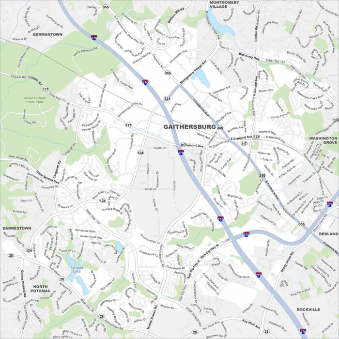
See our map of Gaithersburg northwest of Washington, D.C. Lakes and creeks bring in a mix of open space. Roads and highways crisscross here.
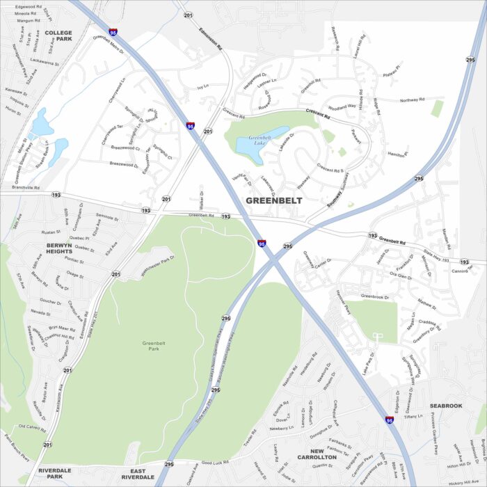
Greenbelt is just northeast of Washington, D.C. This map shows parkland and green space surrounding the community.
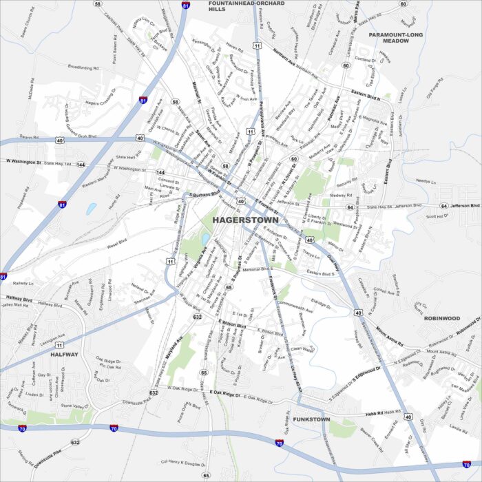
Our map of Hagerstown shows the city in western Maryland’s Cumberland Valley. Interstates 70 and 81 meet close here.
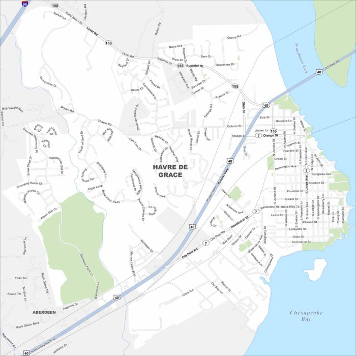
Havre de Grace sits at the head of the Chesapeake Bay where the Susquehanna River meets the bay. Our map shows plenty of water nearby.
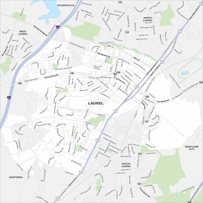
Laurel lies between Washington, D.C. and Baltimore. Our map highlights the Patuxent River running along its edge.
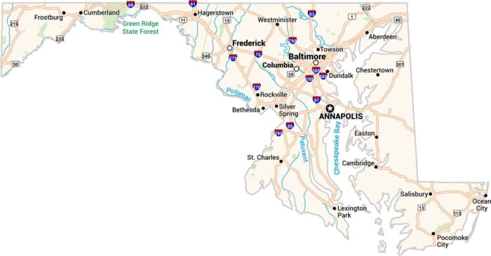
Our Maryland map includes it all. From busy Baltimore to the quiet shores of the Chesapeake Bay, it has cities, rivers, and highways.
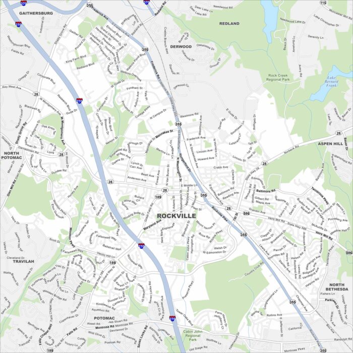
Our map of Rockville shows the downtown area, neighborhoods, and major roads. It also reveals how the city ties into the D.C. metro area.
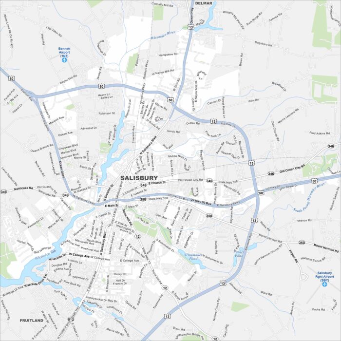
Here’s our map of Salisbury. It shows the downtown streets and the riverside setting. Use it to get around this Eastern Shore city.