Map of Desert Hot Springs, California
Our map of Desert Hot Springs shows this desert town north of Palm Springs. The area is famous for its natural hot mineral springs.
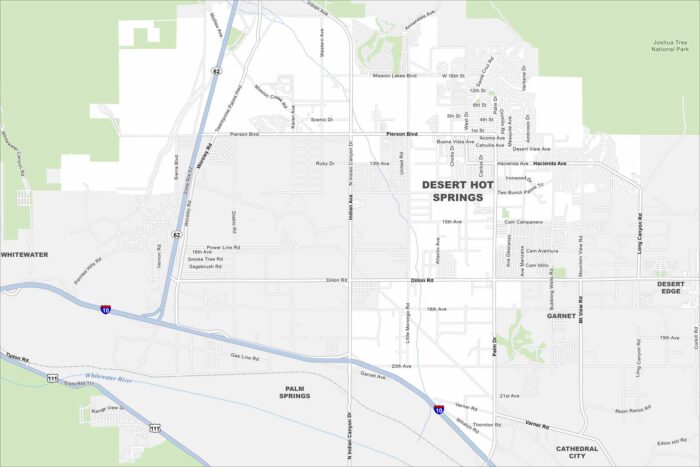
Our map of Desert Hot Springs shows this desert town north of Palm Springs. The area is famous for its natural hot mineral springs.
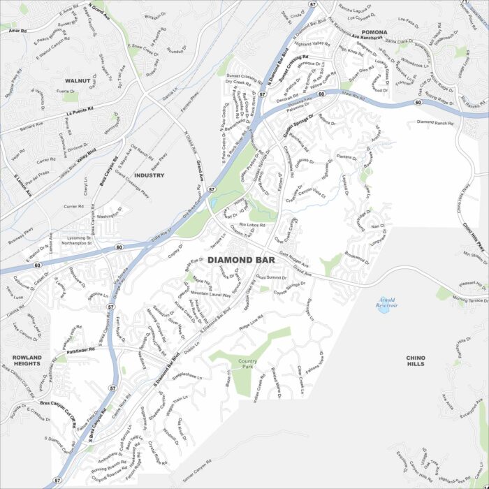
Explore our map of Diamond Bar in eastern Los Angeles County. Freeways intersect here, surrounded by rolling hills and neighborhoods.
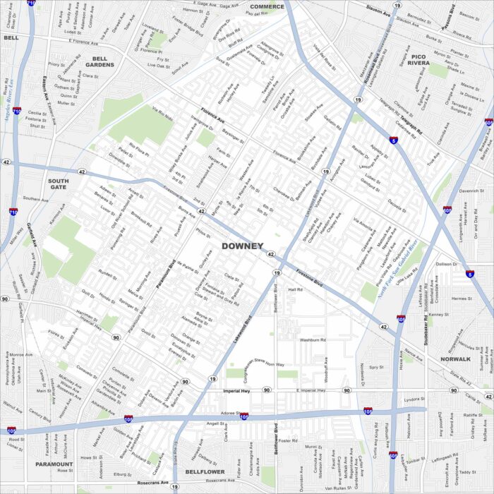
Check out our map of Downey in Los Angeles County. Streets extend between freeways, and you’ll notice the Los Angeles River nearby.
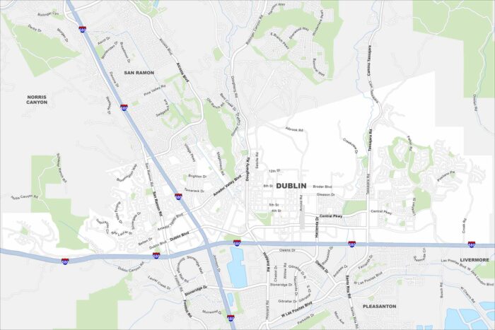
Explore Dublin on our map, situated in the East Bay region. Major highways meet here, surrounded by hills and new neighborhoods.
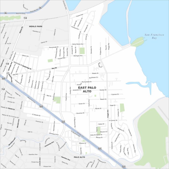
East Palo Alto is on the edge of the San Francisco Bay. This map highlights wetlands and open shoreline areas nearby.
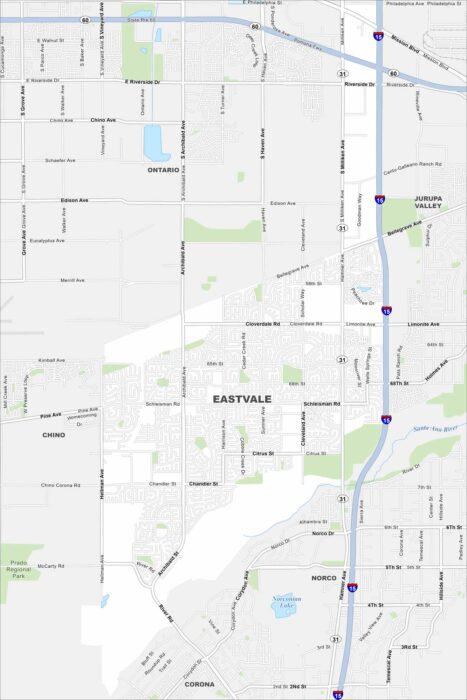
Check out Eastvale in the Inland Empire. Our map shows its neighborhoods spread out between the Santa Ana River and nearby freeways.
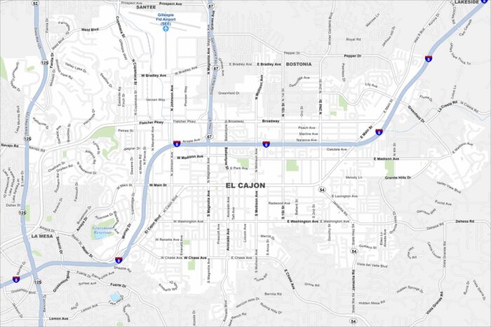
Explore El Cajon in a valley east of San Diego. This map highlights this city surrounded by mountains on nearly all sides.
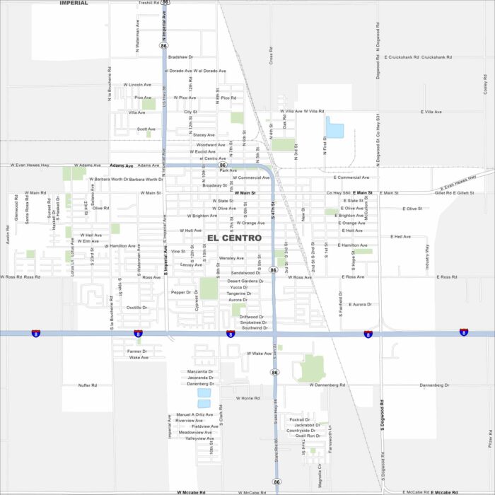
Our map of El Centro shows a city in the heart of the Imperial Valley. Canals and farmland cover the landscape around it.
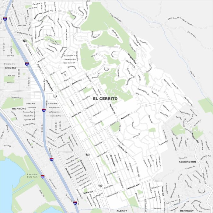
Our map of El Cerrito shows this hillside community overlooking San Francisco Bay. Streets climb toward the Berkeley Hills.
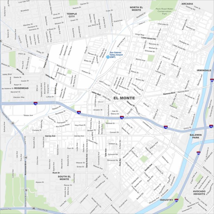
Explore El Monte, California in the San Gabriel Valley. The San Gabriel River runs along the edge of the city.
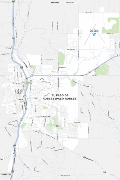
Paso Robles spreads across a rolling valley surrounded by vineyards. The Salinas River winds quietly through the region.
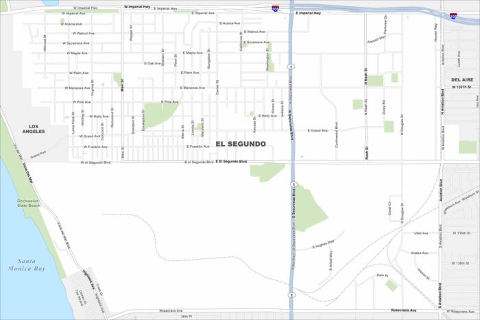
El Segundo hugs the coast just south of LAX. On the map, you’ll spot its wide beaches and industrial areas inland.
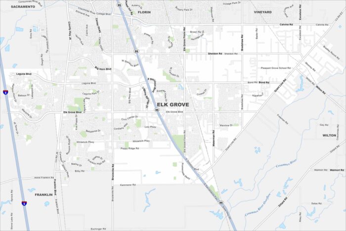
Elk Grove lies just south of Sacramento. It’s now one of California’s fastest-growing cities, thanks to its location near the capital.
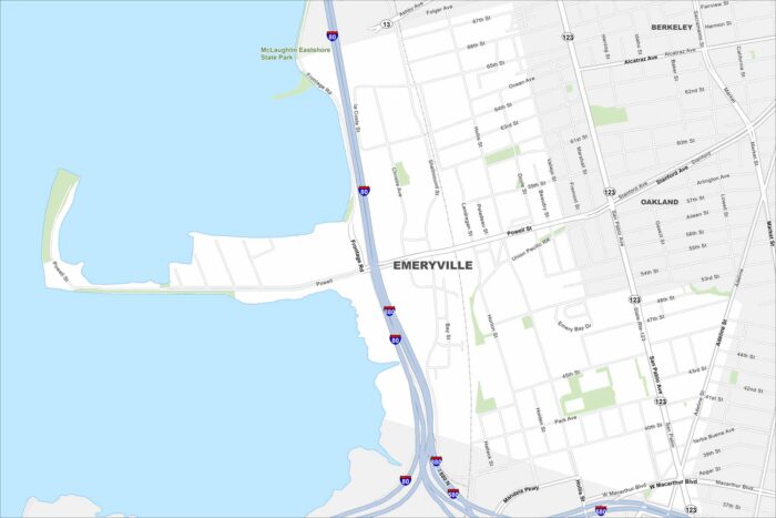
Emeryville is located between Oakland and Berkeley along I-80. The city borders the San Francisco Bay with views of the Bay Bridge.
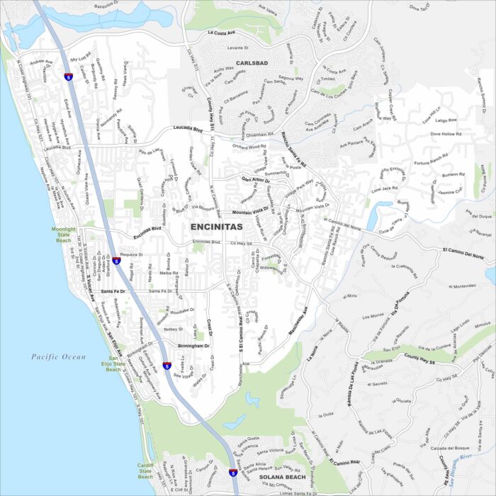
Our map of Encinitas puts it on the Pacific shoreline north of San Diego. Beaches line the coastline, while parks fill the rest.