Map of El Segundo, California
El Segundo hugs the coast just south of LAX. On the map, you’ll spot its wide beaches and industrial areas inland.
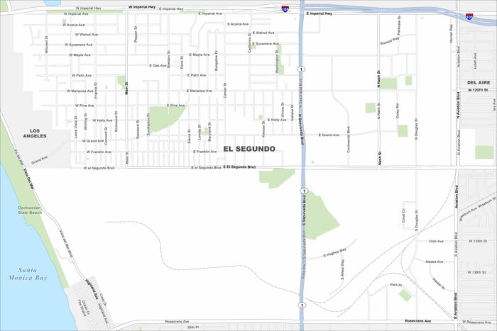
El Segundo hugs the coast just south of LAX. On the map, you’ll spot its wide beaches and industrial areas inland.
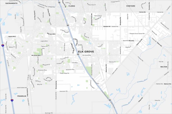
Elk Grove lies just south of Sacramento. It’s now one of California’s fastest-growing cities, thanks to its location near the capital.
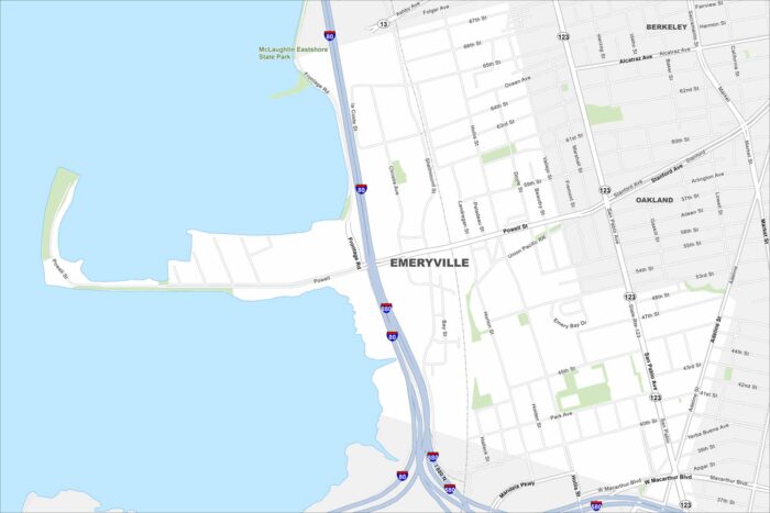
Emeryville is located between Oakland and Berkeley along I-80. The city borders the San Francisco Bay with views of the Bay Bridge.
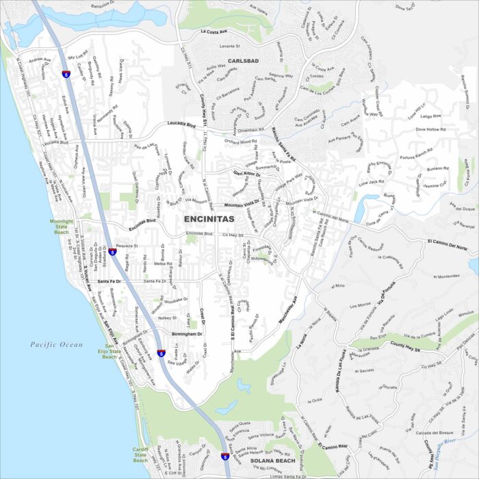
Our map of Encinitas puts it on the Pacific shoreline north of San Diego. Beaches line the coastline, while parks fill the rest.
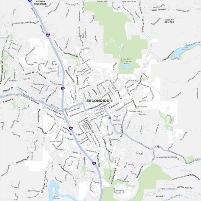
Escondido sits in a valley northeast of San Diego. This map shows its highways, roads and lakes. Lake Hodges stands out to the southwest.
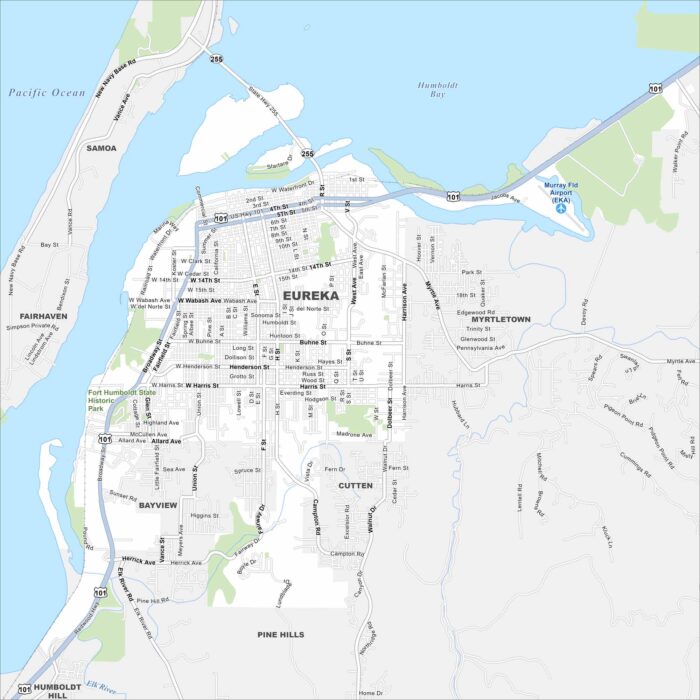
Eureka sits on Humboldt Bay along the northern California coast. It borders both redwood forests and Pacific waters with a bayfront location.
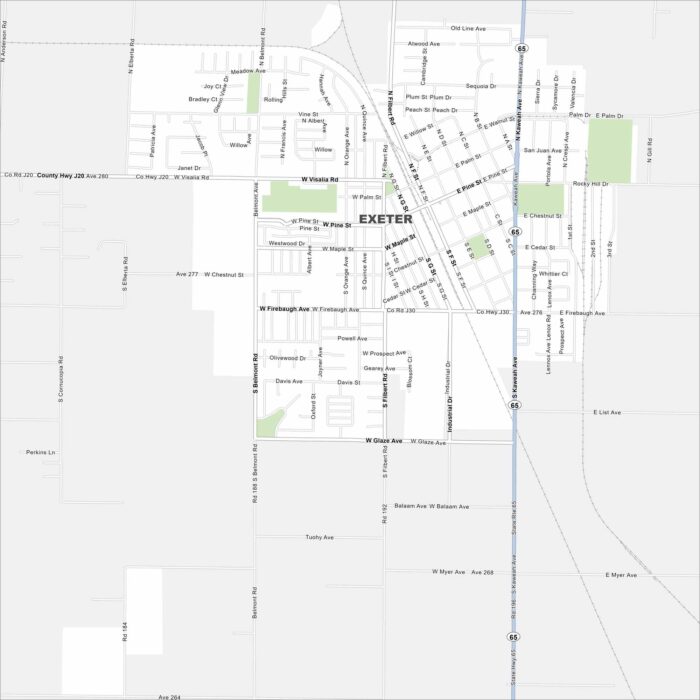
Exeter is in California’s Central Valley. The Sierra Nevada foothills rise not far away. Our map has its main routes, railways and parks.
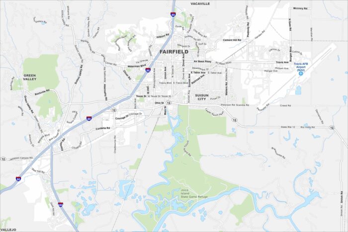
Fairfield lies between San Francisco and Sacramento in Solano County. This map shows highways, green spaces, and Travis Air Force Base.
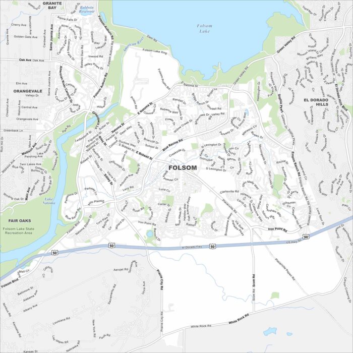
Folsom lies east of Sacramento along the American River. Folsom Lake and its dam dominate the northern edge.
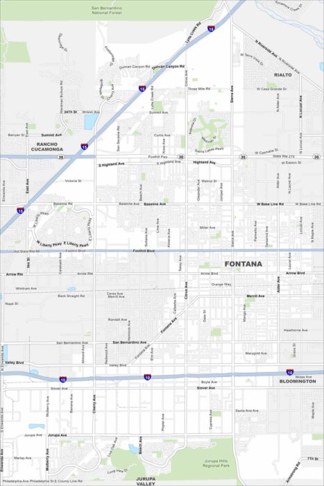
Our map of Fontana shows it in the Inland Empire at the foot of the San Bernardino Mountains. Wide neighborhoods stretch out.
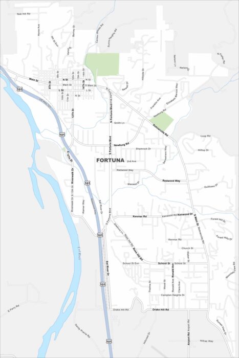
Fortuna lies along the Eel River in northern California. The map highlights Highway 101 running through with forested hills all around.
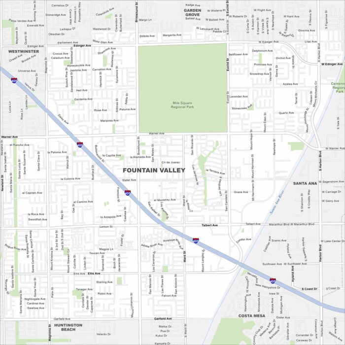
Explore our map of Fountain Valley, where you’ll spot the Santa Ana River on the east. Streets connect neatly to the nearby I-405 corridor.
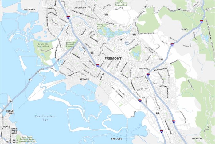
Fremont sits at the edge of the San Francisco Bay. Our map shows both I-880 and I-680, which both run through the city.
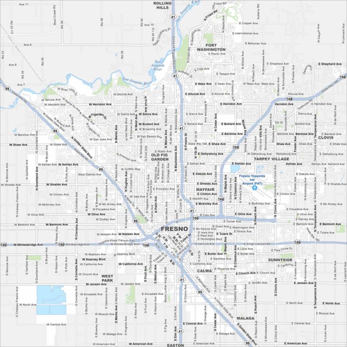
Fresno is in California’s Central Valley with the Sierra Nevada to the east. Our map shows highways, roads, lakes and parks.
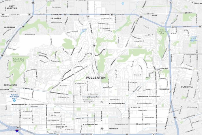
Fullerton is in northern Orange County, near Anaheim. Our map highlights freeways, rail lines, and city parks.