Map of Dana Point, California
Our map of Dana Point shows its streets, highways, and shoreline. The city is perched on the Pacific Ocean.
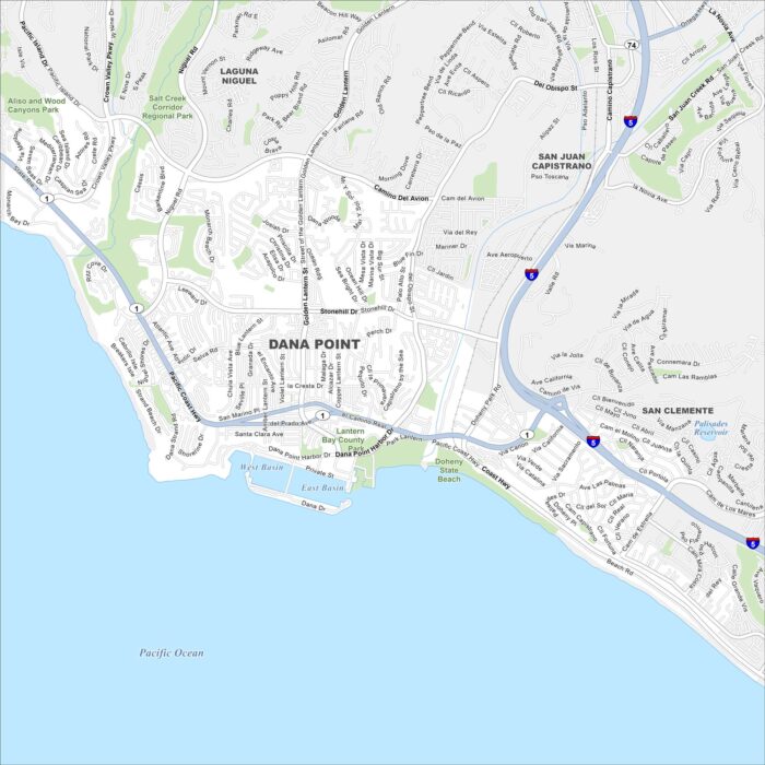
Our map of Dana Point shows its streets, highways, and shoreline. The city is perched on the Pacific Ocean.
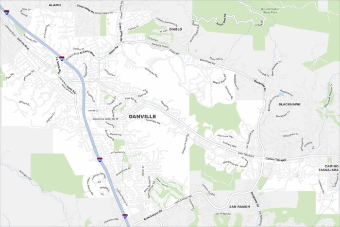
See Danville’s roads, highways, and open green spaces on our map. Tucked in the San Ramon Valley, it’s close to Mount Diablo.
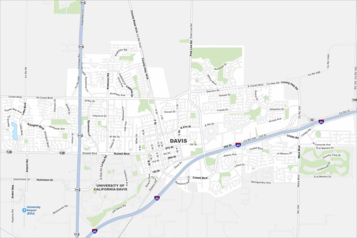
Davis appears here with its streets and highway. Located west of Sacramento, the city is known for its UC Davis campus.
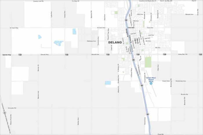
Look over Delano with its roads, highways, and farmland stretching in every direction. Fresno sits a short drive north.
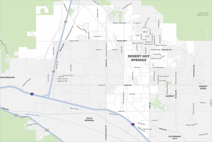
Our map of Desert Hot Springs shows this desert town north of Palm Springs. The area is famous for its natural hot mineral springs.
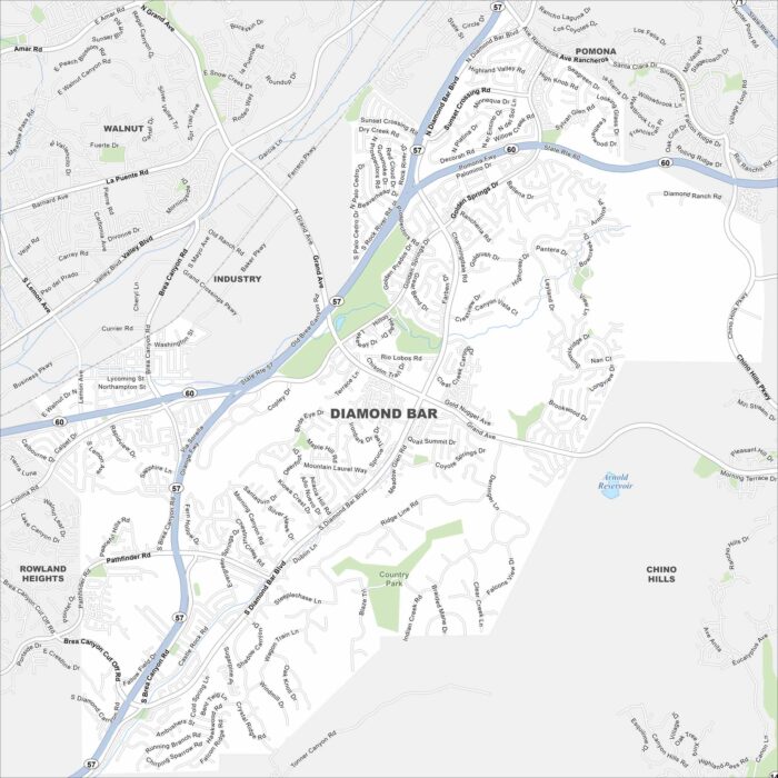
Explore our map of Diamond Bar in eastern Los Angeles County. Freeways intersect here, surrounded by rolling hills and neighborhoods.
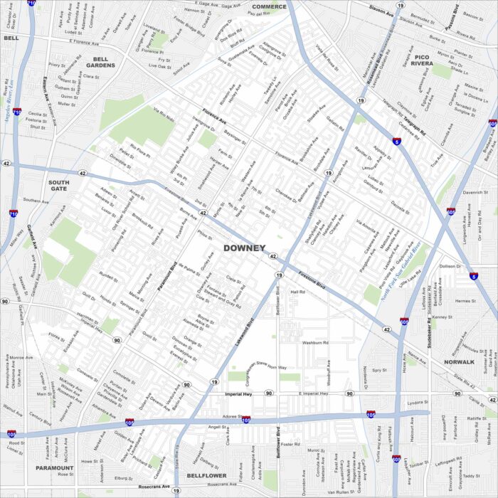
Check out our map of Downey in Los Angeles County. Streets extend between freeways, and you’ll notice the Los Angeles River nearby.
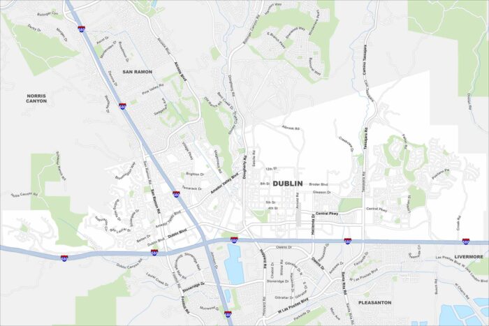
Explore Dublin on our map, situated in the East Bay region. Major highways meet here, surrounded by hills and new neighborhoods.
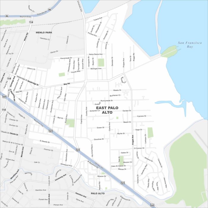
East Palo Alto is on the edge of the San Francisco Bay. This map highlights wetlands and open shoreline areas nearby.
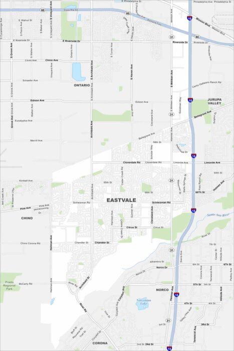
Check out Eastvale in the Inland Empire. Our map shows its neighborhoods spread out between the Santa Ana River and nearby freeways.
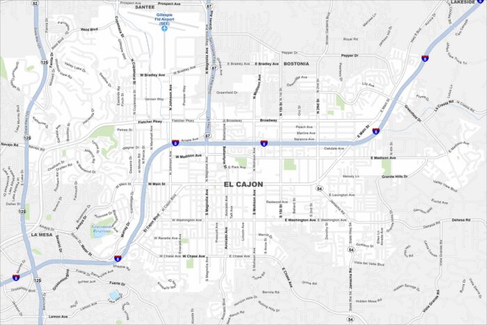
Explore El Cajon in a valley east of San Diego. This map highlights this city surrounded by mountains on nearly all sides.
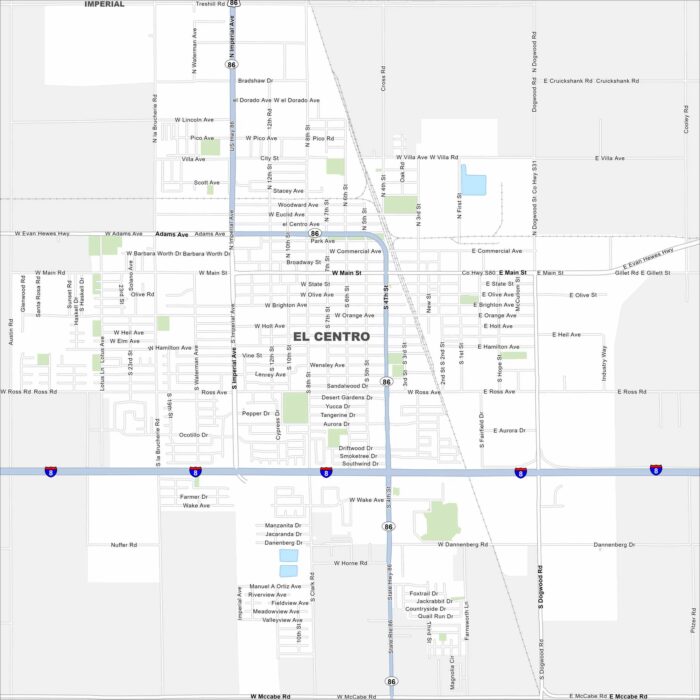
Our map of El Centro shows a city in the heart of the Imperial Valley. Canals and farmland cover the landscape around it.
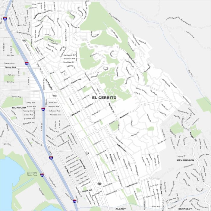
Our map of El Cerrito shows this hillside community overlooking San Francisco Bay. Streets climb toward the Berkeley Hills.
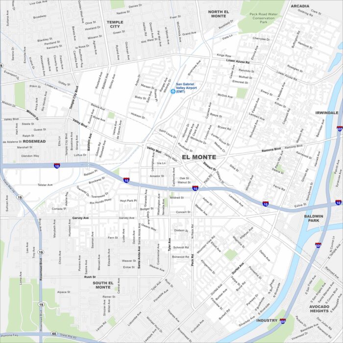
Explore El Monte, California in the San Gabriel Valley. The San Gabriel River runs along the edge of the city.
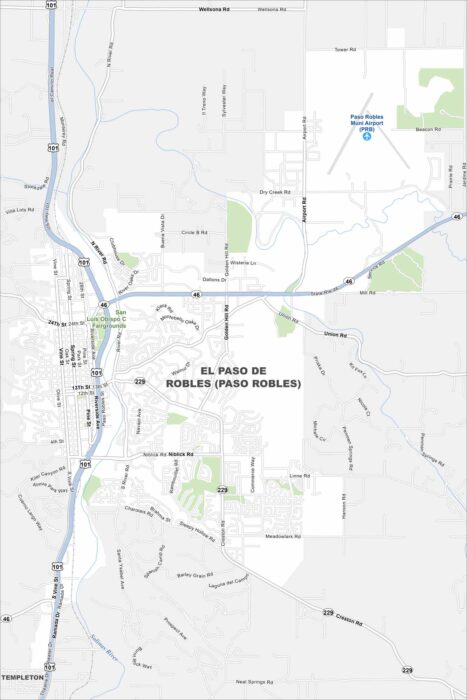
Paso Robles spreads across a rolling valley surrounded by vineyards. The Salinas River winds quietly through the region.