Map of Glendora, California
Check out our map of Glendora, California. This city spreads toward the San Gabriel Mountains. It’s called the “Pride of the Foothills”.
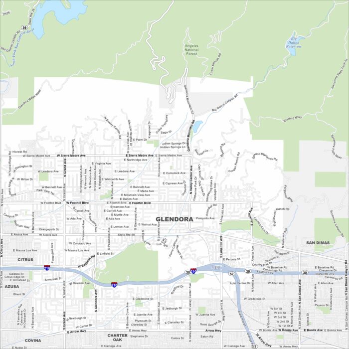
Check out our map of Glendora, California. This city spreads toward the San Gabriel Mountains. It’s called the “Pride of the Foothills”.
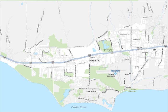
Goleta lies on the California coast just west of Santa Barbara. It’s quieter than its neighbor but still has beaches and farmland on the map.
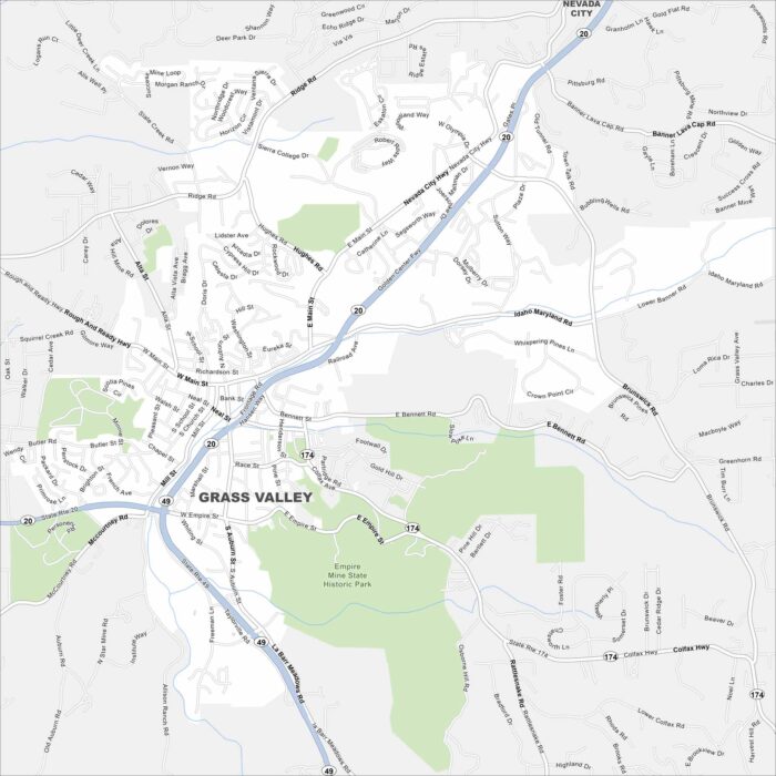
Grass Valley is in the Sierra Nevada foothills of northern California. Our map shows winding mountain roads, nearby creeks and parks.
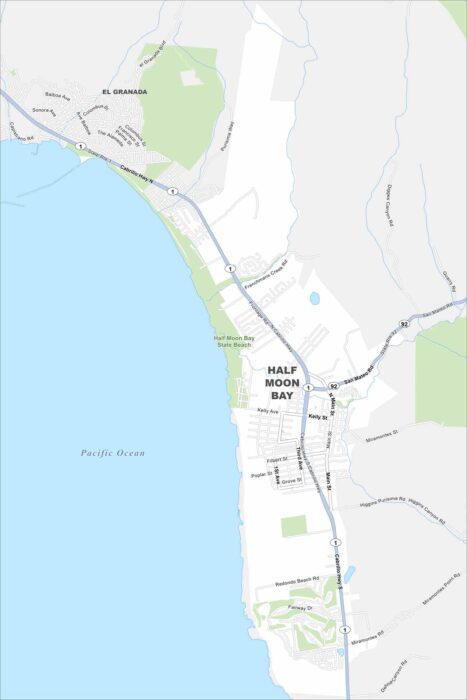
Half Moon Bay is a coastal city south of San Francisco. This map highlights its long stretch of beaches. Hills and farmland are in the east.
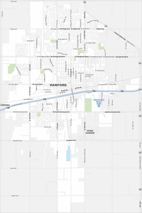
Hanford sits in California’s Central Valley between Fresno and Visalia. Our map shows the roads, railways and green spaces in the city.
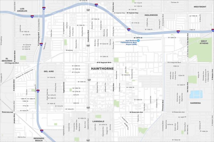
Hawthorne lies in Los Angeles County, just inland from the coast. On our map, you’ll see it boxed in by major freeways.
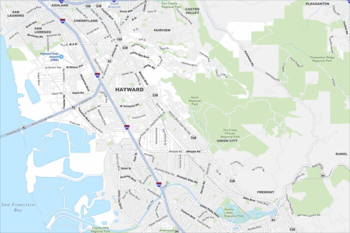
Hayward sits on the east side of the San Francisco Bay. You’ll notice wetlands along the shoreline on our map.
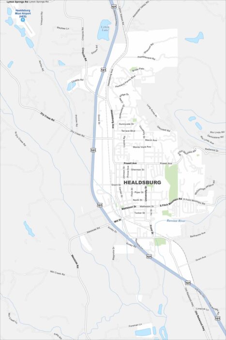
Healdsburg is in northern Sonoma County, surrounded by vineyards. Our map shows the Russian River winding through the area.
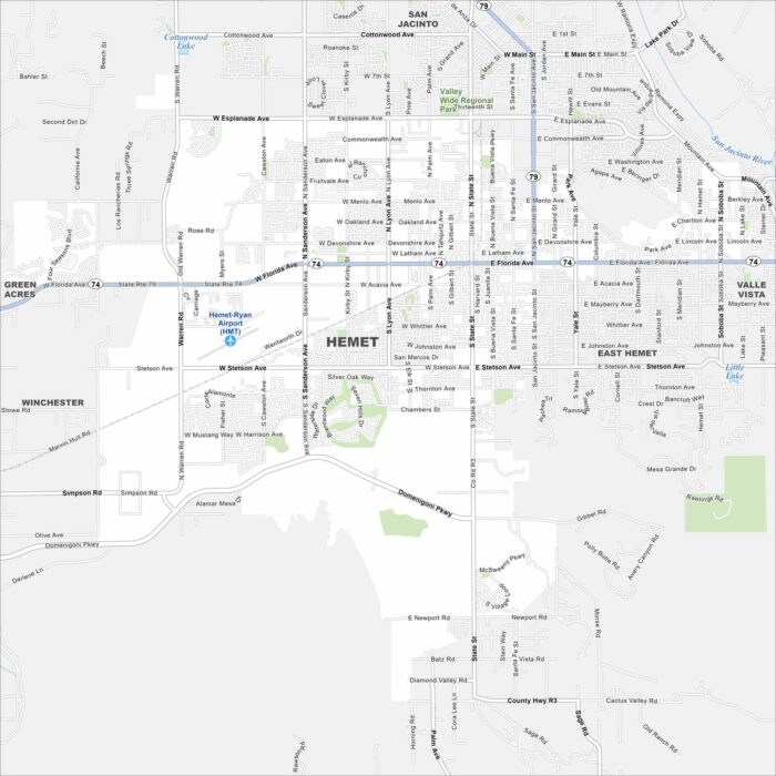
Hemet sits in Southern California’s Inland Empire. Our map shows the city surrounded by dry hills and valleys.
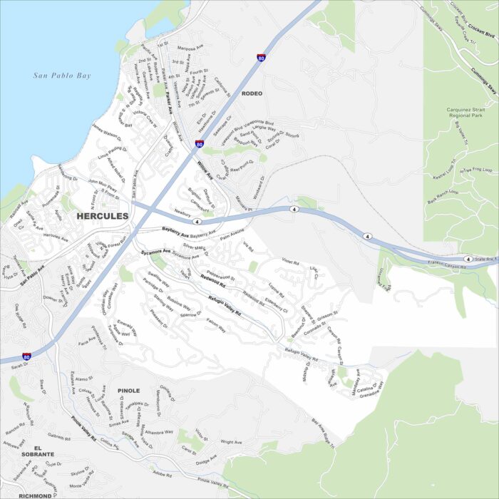
Hercules is on the northeastern edge of the San Francisco Bay Area. Our map shows this city pressed between the shoreline and nearby hills.
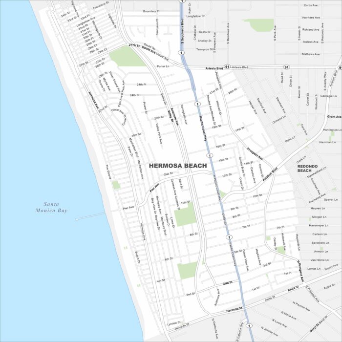
Hermosa Beach sits on the Southern California coast between Manhattan Beach and Redondo Beach. Our map shows its roads, green spaces and more.
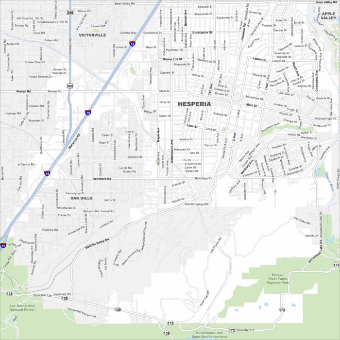
Hesperia lies in the Mojave Desert north of the San Bernardino Mountains. This map shows Interstate 15 running through the city.
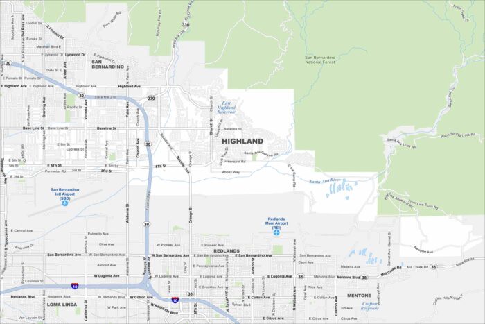
Explore our map of Highland in Southern California, which sits at the base of the San Bernardino Mountains.
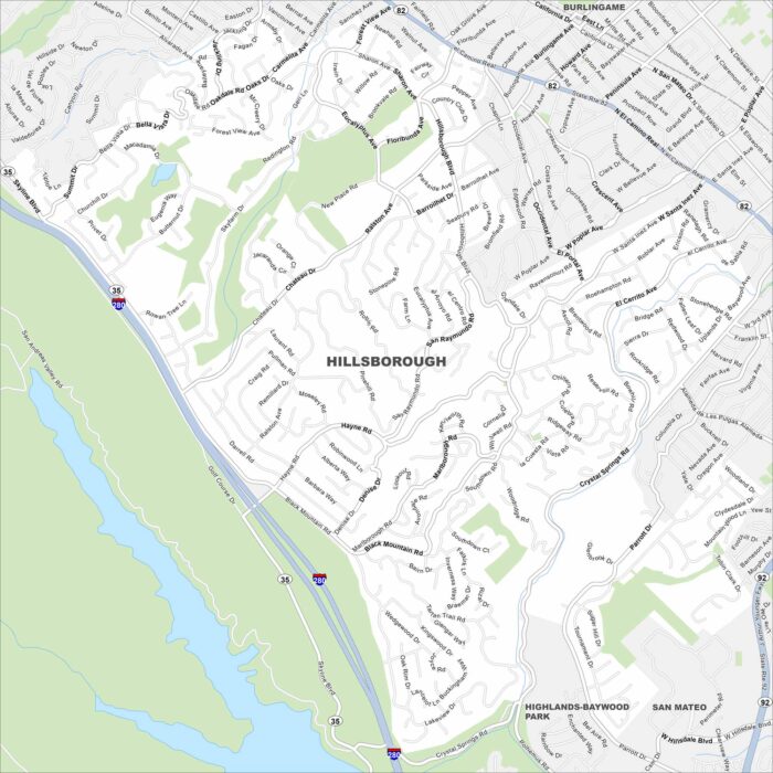
Our map of Hillsborough shows winding roads through wooded hills. It’s mostly residential, with large estates tucked between canyons.
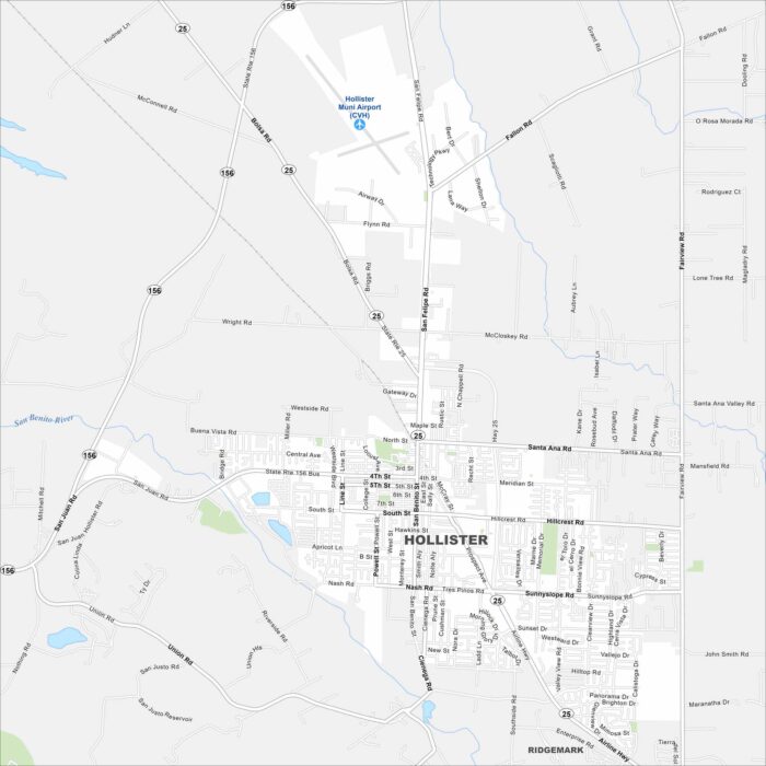
Our map of Hollister shows a grid of streets surrounded by farmland. The city sits in a valley ringed by low mountains.