Map of Hillsborough, California
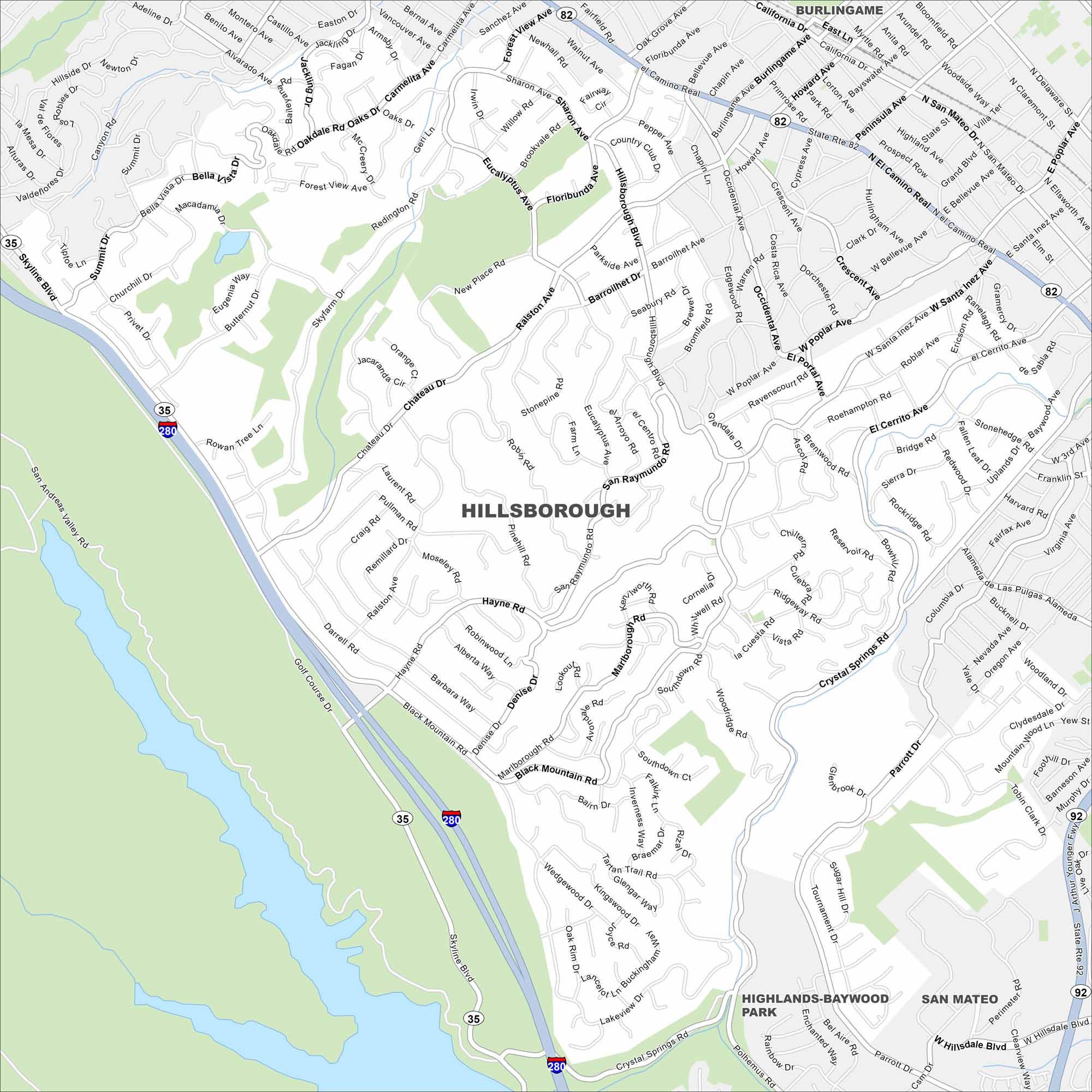
Our map of Hillsborough shows winding roads through wooded hills. It’s mostly residential, with large estates tucked between canyons. The town sits on the San Francisco Peninsula just south of San Francisco.
California State Maps
Explore California with our state maps


Map Information
On the Map
Interstates/Highways: I-280, State Rte 35, State Rte 82, State Rte 92 Major Roads: El Camino Real, Skyline Blvd, Chateau Dr, Black Mountain Rd, Hayne Rd, Crystal Springs Rd, Ralston Ave, Hillsborough Blvd, Polhemus Rd, Bunker Hill Dr, Tartan Trail Rd, Westbridge Rd, New Place Rd, Floribunda Ave, Eucalyptus Ave, San Raymundo Rd, Barroilhet Ave, El Cerrito Ave, Parrott Dr, Wedgewood Dr Parks and Preserves: Highlands-Baywood Park Nearby Communities: Burlingame, San MateoCalifornia City Maps
Here are detailed maps of California


