Map of Clovis, California
Our map of Clovis stretches from Highway 168 toward the Sierra Nevada foothills. The city is located northeast of Fresno.
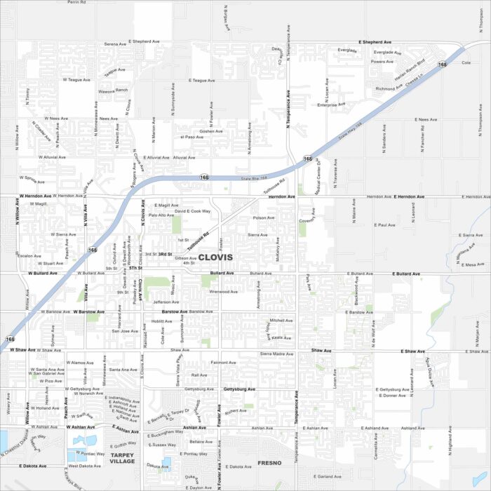
Our map of Clovis stretches from Highway 168 toward the Sierra Nevada foothills. The city is located northeast of Fresno.
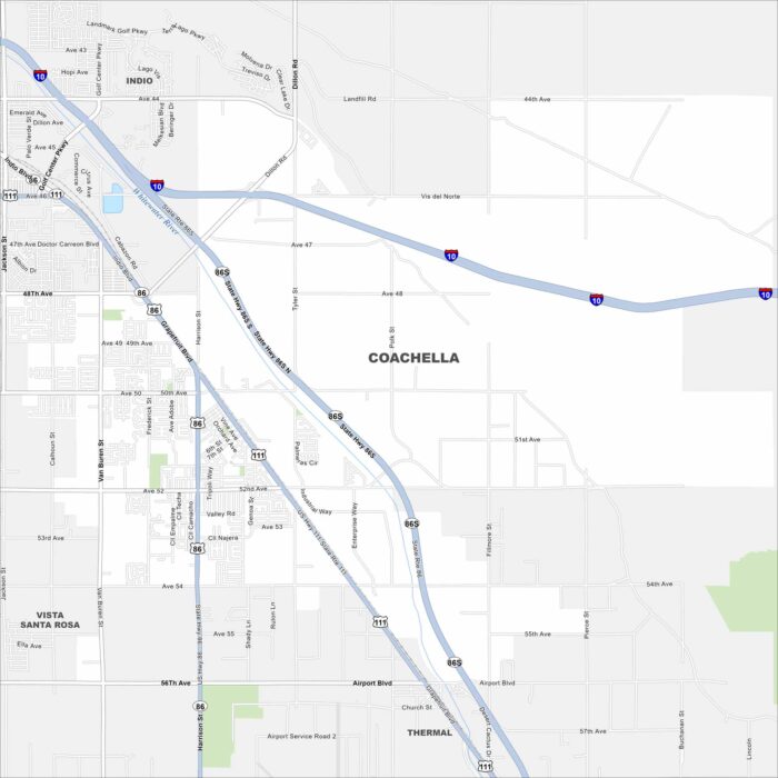
Coachella sits in the flat Coachella Valley with streets running straight across farmland. The city is famous for music festivals.
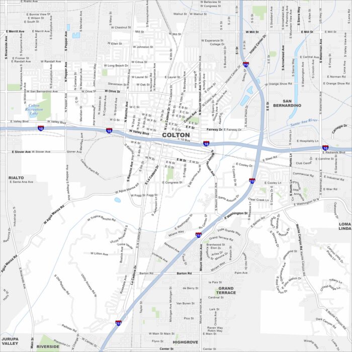
Here’s our map of Colton with its roads, waterways, and rail lines. This city is part of the Inland Empire and is a crossroads for trains.
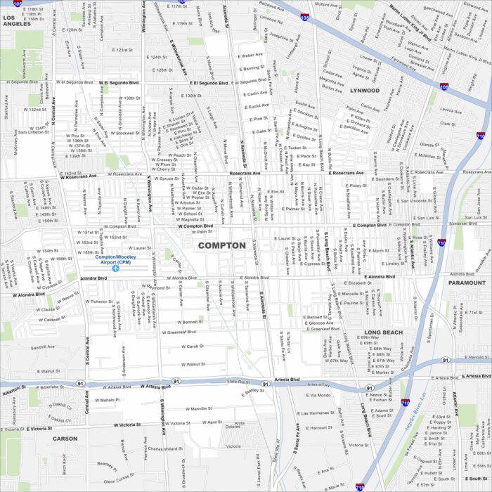
South of downtown Los Angeles, Compton is known for its cultural influence for hip hop music. Major freeways cross right through its center.
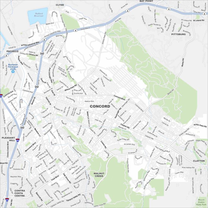
We’ve mapped out Concord with its mapped waterways, highways, and parks. The city sits in the East Bay region, near Mount Diablo.
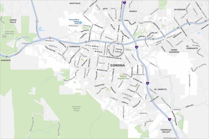
We’ve mapped Corona with its roads, highways, and foothill neighborhoods. The city sits at the base of the Santa Ana Mountains.
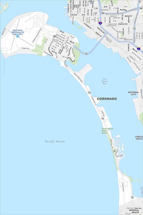
Our map of Coronado shows its streets, coastal access, and scenic bayfront. The city sits on a peninsula linked by the Coronado Bridge.
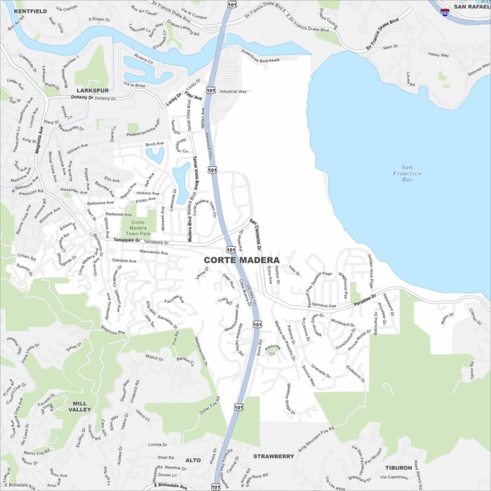
See Corte Madera with its streets, highways, and open marshlands. You can find it north of San Francisco. The bayfront lies just to the east.
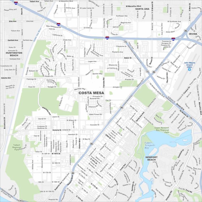
Here’s our map of Costa Mesa, located in the heart of Orange County. It’s a hub for arts and entertainment close to the Pacific Ocean.
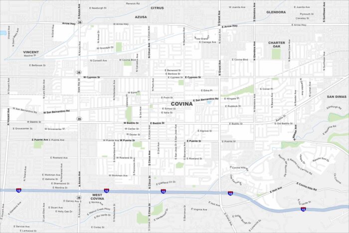
Our map of Covina shows its local roads, highways, and park areas. This city is situated east of Los Angeles, California.
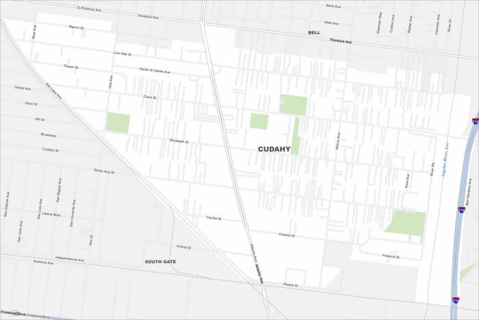
Our map of Cudahy outlines local roads, highways, and tight urban blocks. It’s part of southeast Los Angeles County.
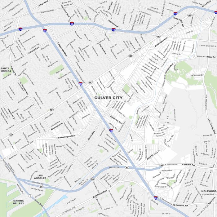
Look over Culver City with its mapped streets, highways, and parks. Known for its film studios, it lies in the heart of West Los Angeles.
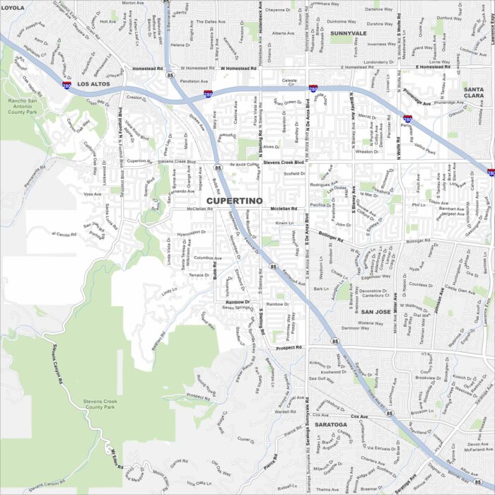
Our map of Cupertino shows its roadways, freeways, and nearby foothills. In the heart of Silicon Valley, the city is home to Apple.
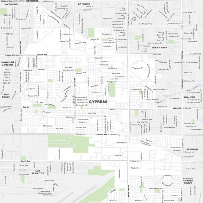
Cypress is shown on our map with its roads, highways, and park spaces. This Orange County suburb lies between Long Beach and Anaheim.
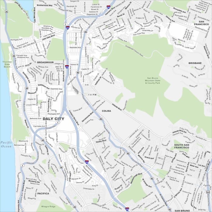
Look at our map of Daly City with its network of roads, highways, and coastal access. Fog from the ocean often blankets the area.