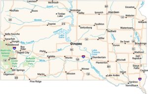
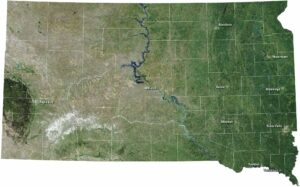
South Dakota Lakes and Rivers Map
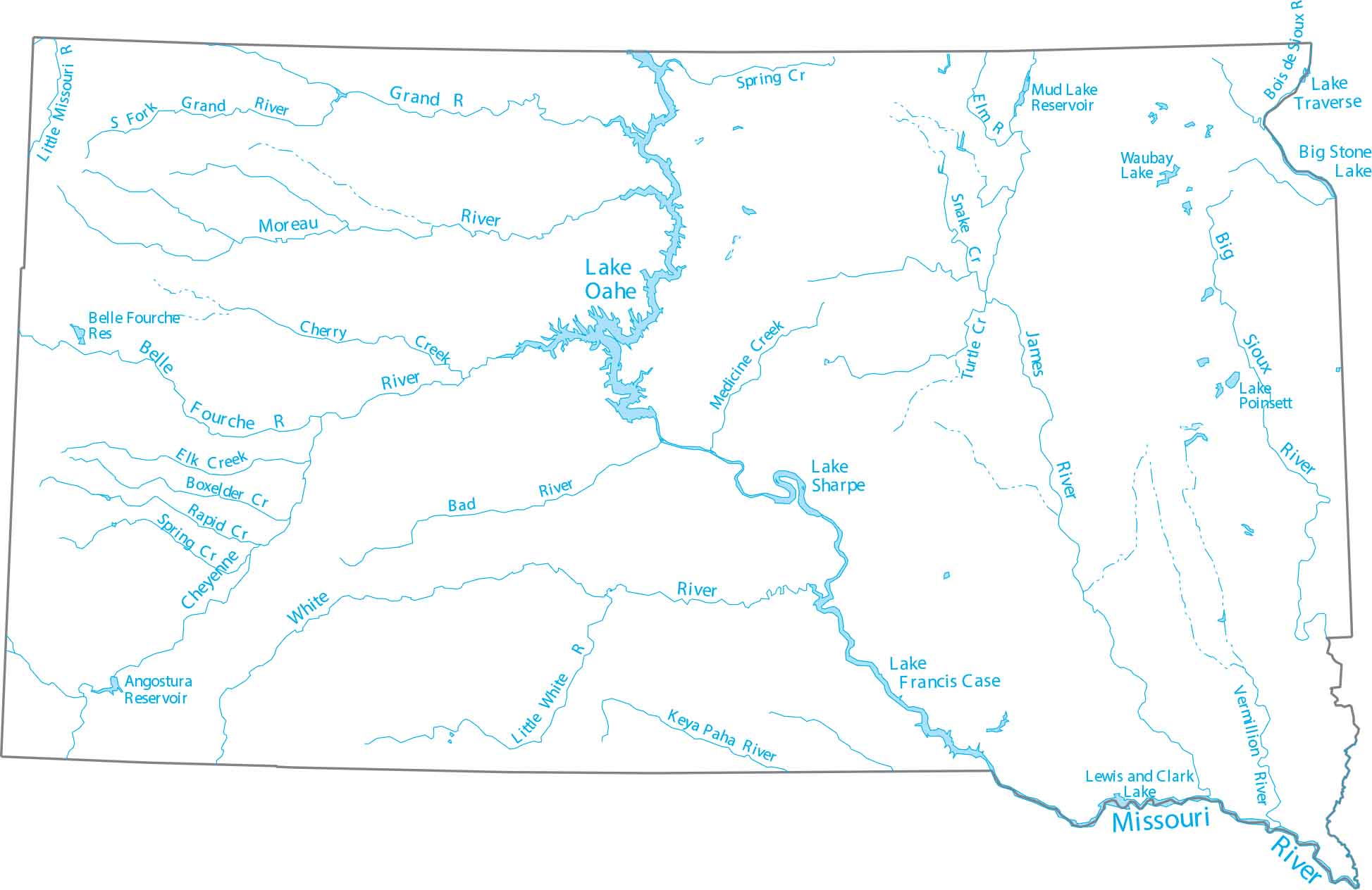
In South Dakota, the Missouri River splits the state into two regions. Our lakes and rivers map of South Dakota shows the Cheyenne River and the glacial lakes of the northeast.
Map Information
On the Map
Lakes and Rivers State Maps
Select any state map below to view its lakes and rivers map.


South Dakota State Maps
View maps from the prairies to the Black Hills.