Mississippi Lakes and Rivers Map
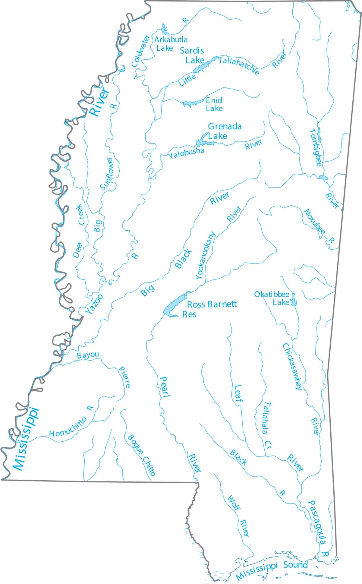
Mississippi is in the Deep South, anchored by the Mississippi River along its west. Our map of Mississippi highlights the Mississippi River and interior streams. We also show the linework of the Pearl and Yazoo rivers
Map Information
On the Map
Lakes and Rivers State Maps
Select any state map below to view its lakes and rivers map.


Mississippi State Maps
Explore maps of Mississippi’s towns, rivers, and roads.


