Minnesota Precipitation Map
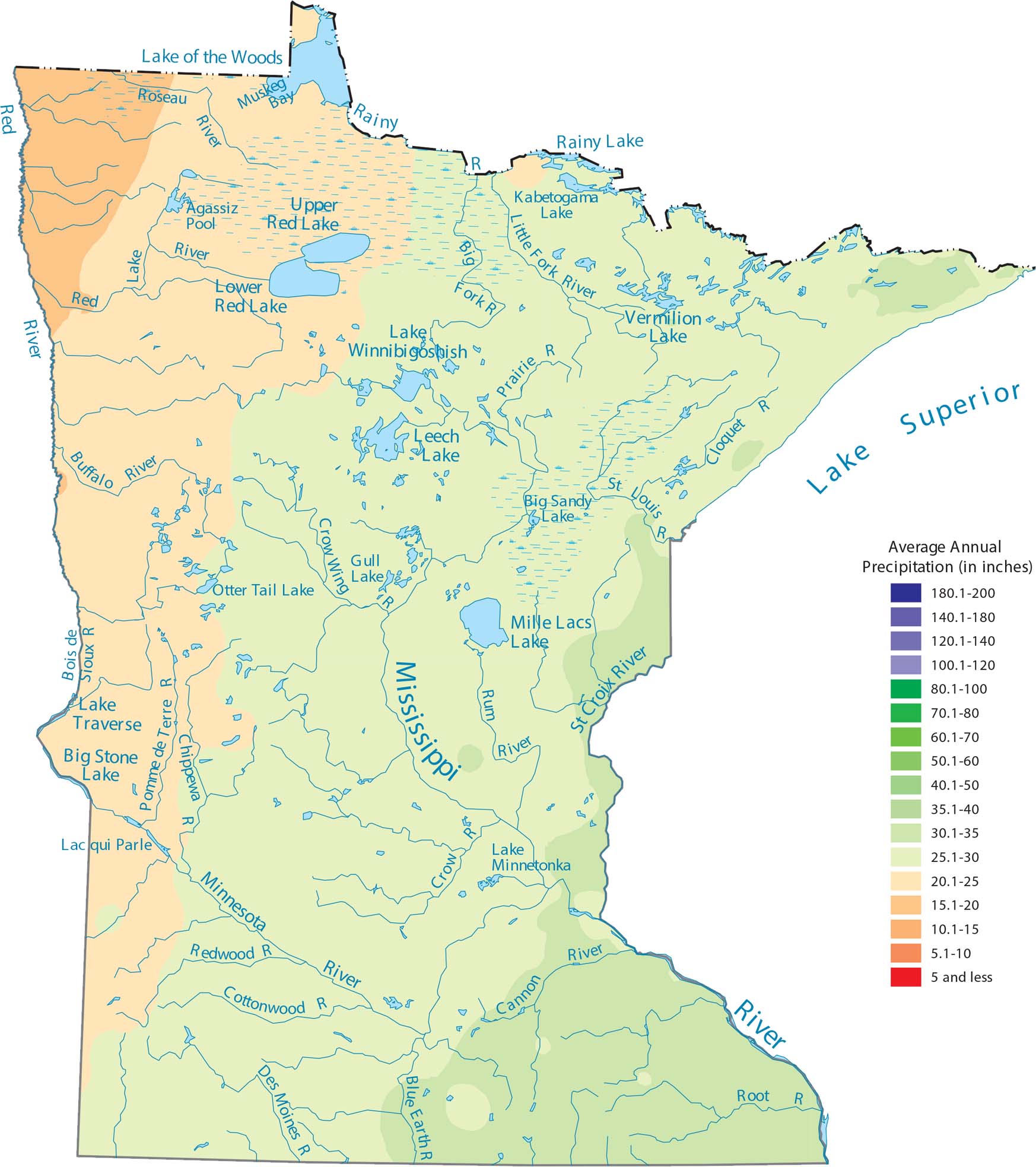
Our precipitation map of Minnesota shows rainfall increasing as you head southeast. The northern latitude and distance from major moisture sources keep things moderate. Although the northern parts get plenty of snow, the actual water amount is lower because the air is so cold.
Map Information
State Precipitation Maps
Select any state map below to view its precipitation map.


Minnesota State Maps
Explore every lake in our state maps of Minnesota


