Michigan Precipitation Map
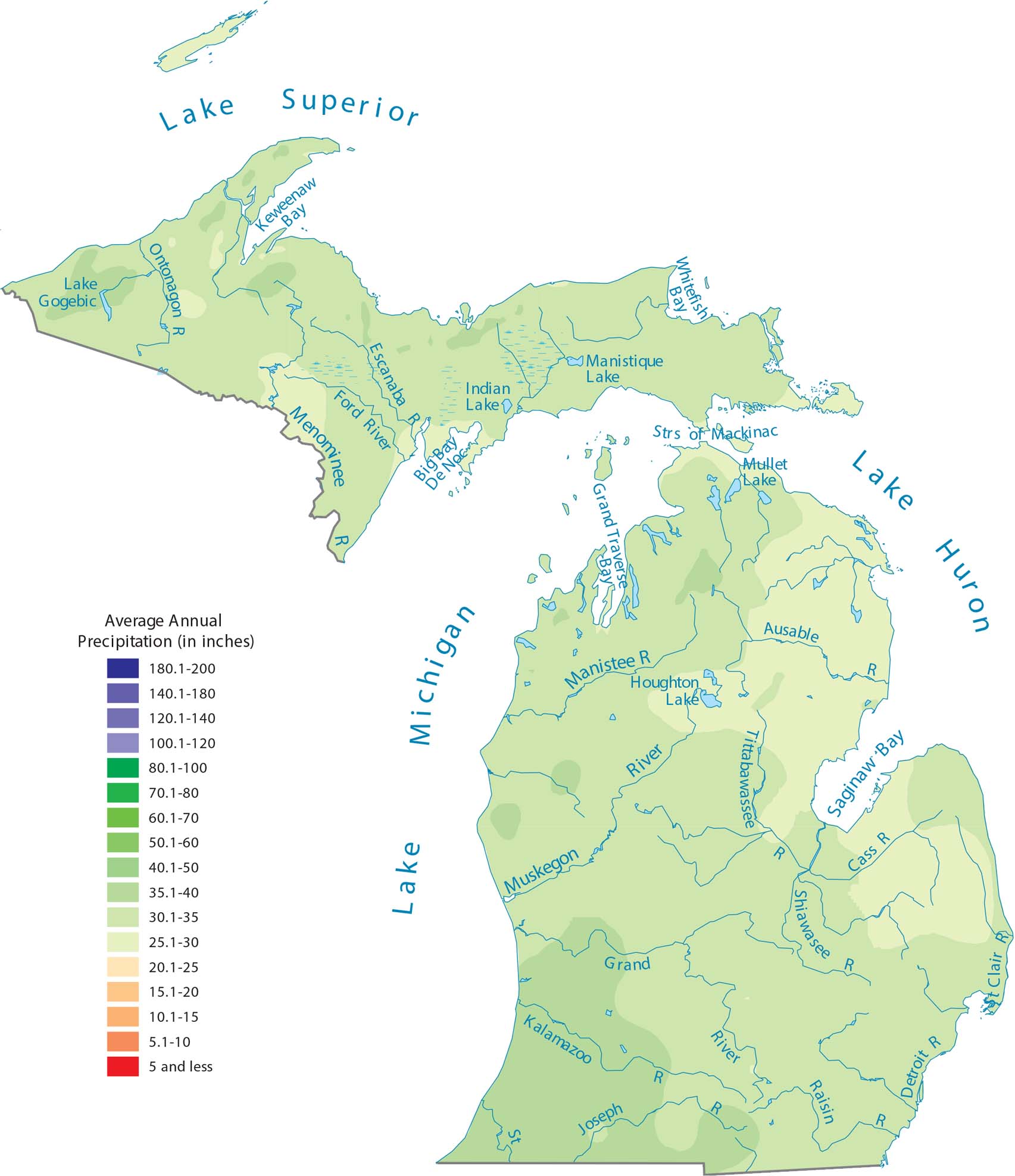
Large lakes influence nearby weather because they surround it on almost all sides. You’ll notice how areas near the Great Lakes appear wetter on the map. Our precipitation map of Michigan shows these water-driven patterns.
Map Information
State Precipitation Maps
Select any state map below to view its precipitation map.


Michigan State Maps
Get to know Michigan with our detailed maps


