Home » State Maps » Massachusetts Lakes and Rivers Map

Massachusetts Lakes and Rivers Map

Massachusetts Lakes and Rivers Map

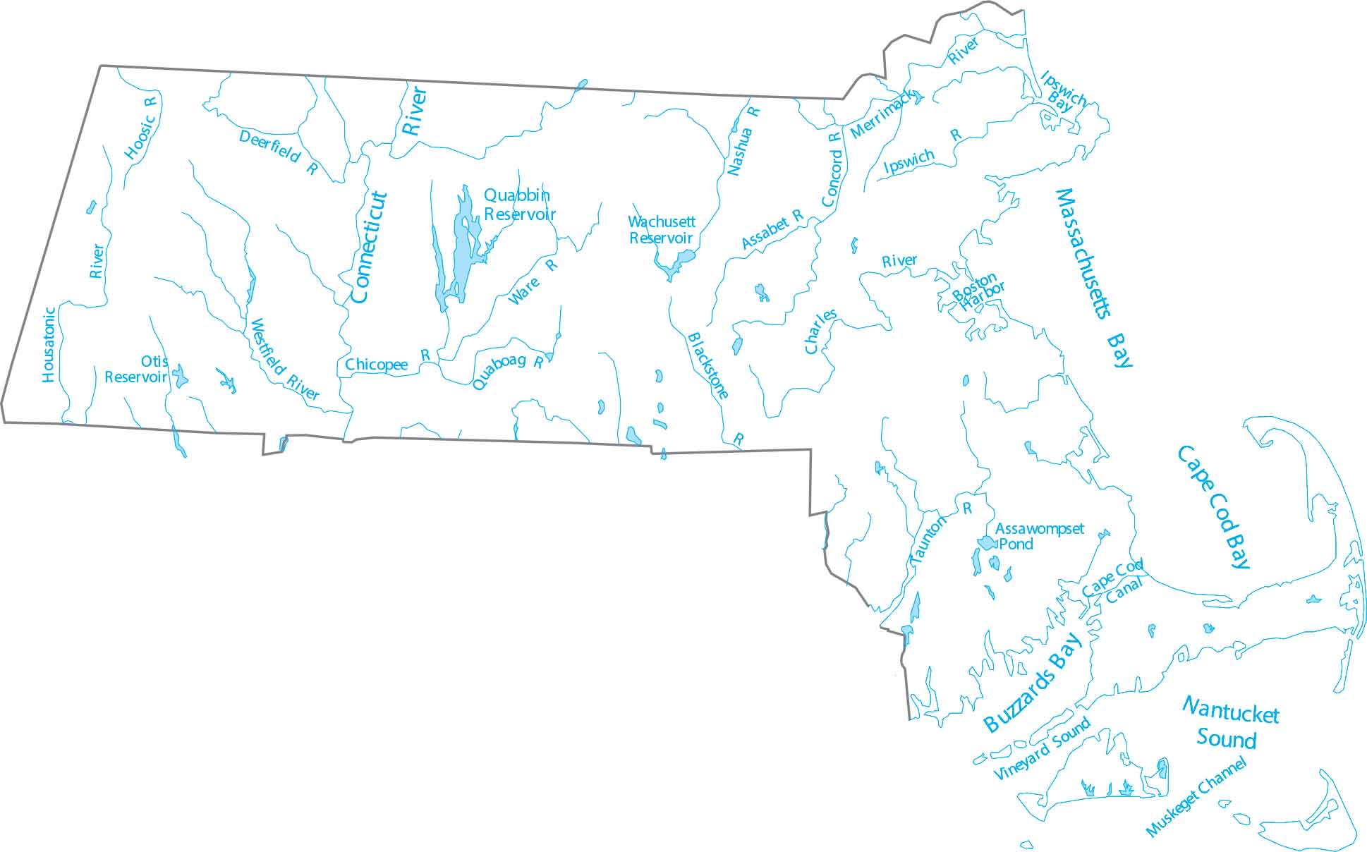
Massachusetts is in New England, where rivers run east and south to the Atlantic. Our map of Massachusetts highlights the Connecticut River and eastern lakes. Get to know Massachusetts through its rivers and reservoirs.

Map Information

  • Lakes and Rivers Map of Massachusetts
  • Original map provided by National Map. Map updated by our team.
  • Free for personal and commercial purpose. Attribution is required. How to attribute?

On the Map

Massachusetts Location Map
Major Rivers: Assabet River, Blackstone River, Charles River, Chicopee River, Concord River, Connecticut River, Deerfield River, Hoosic River, Housatonic River, Ipswich River, Merrimack River, Nashua River, Quaboag River, Taunton River, Ware River, Westfield River Bays, Sounds and Reservoirs: Buzzards Bay, Cape Cod Bay, Ipswich Bay, Long Island Sound, Massachusetts Bay, Nantucket Sound, Otis Reservoir, Quabbin Reservoir, Vineyard Sound, Wachusett Reservoir Hydrography: Assawompset Pond, Boston Harbor, Cape Cod Canal, Muskeget Channel

Leave a Reply

Your email address will not be published. Required fields are marked *