Northern Liberties Map, Philadelphia
Our map of Northern Liberties highlights the neighborhood just north of Old City. It shows main streets, parks, and the Delaware River.
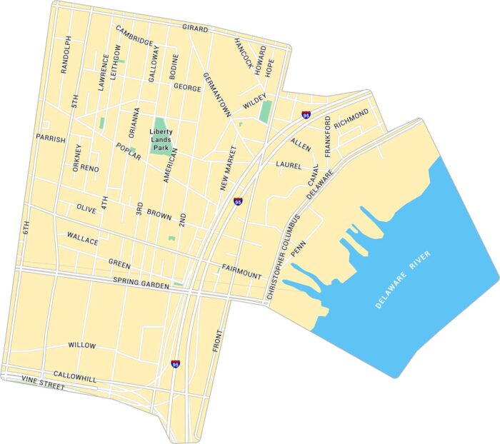
Our map of Northern Liberties highlights the neighborhood just north of Old City. It shows main streets, parks, and the Delaware River.
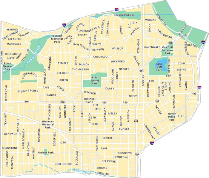
Our map of Oak Cliff shows the large, historic area just southwest of downtown Dallas. It highlights major roads, parks, and neighborhoods.
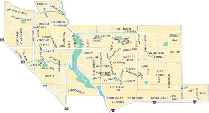
Oak Forest is located in northwest Houston. As you can see on our map of Oak Forest, it’s a residential area with the White Oak Bayou in it.
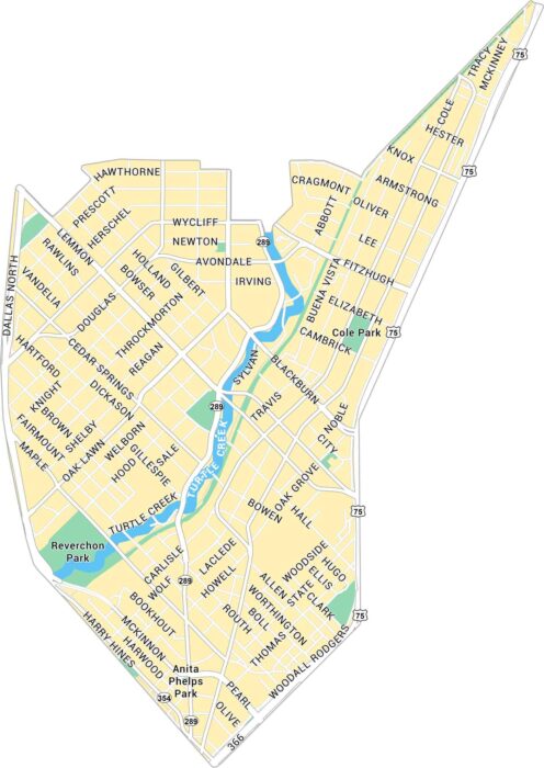
Oak Lawn sits just northwest of downtown Dallas. Our map of Oak Lawn shows its road network and Turtle Creek.
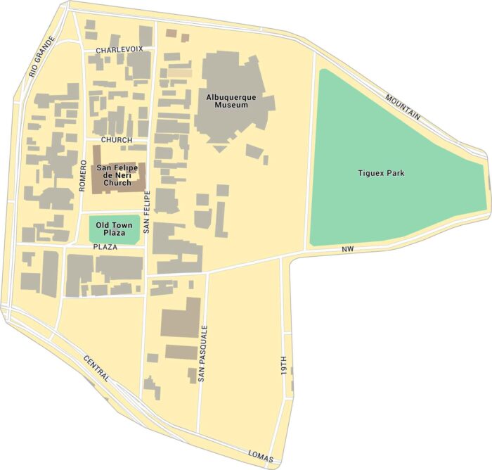
Old Town Albuquerque lies just west of downtown, near the Rio Grande. Our map shows its streets, landmarks, and surrounding parks.
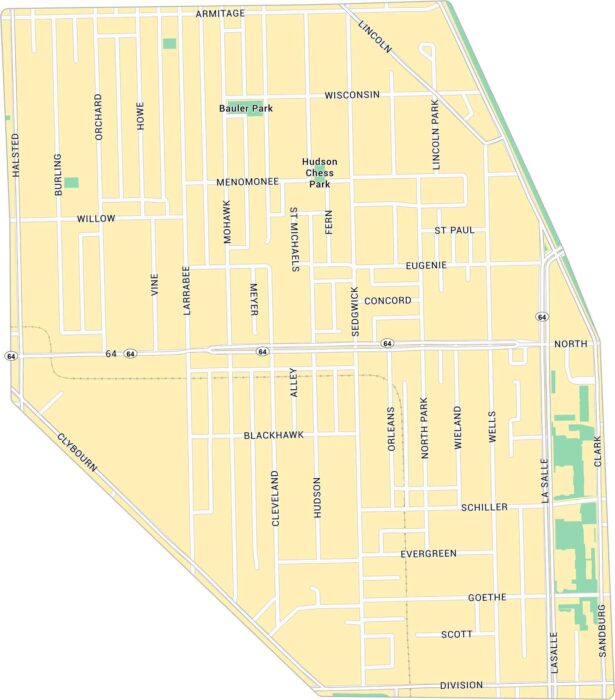
Old Town sits just north of downtown Chicago. Our map of Old Town Chicago shows its main roads, parks, and rail lines.
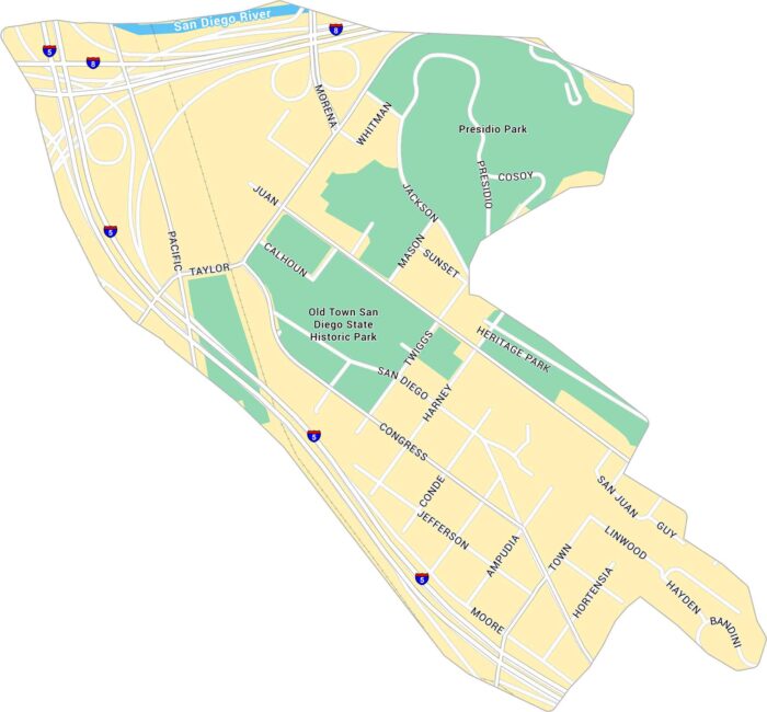
Old Town San Diego sits just north of downtown, near the junction of Interstates 5 and 8. Our map shows its streets, parks, and landmarks.
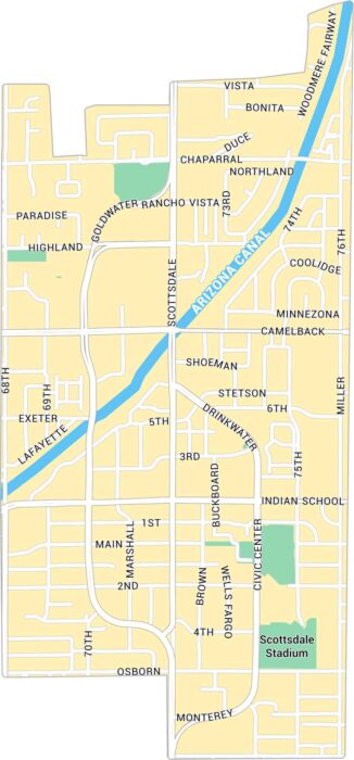
Old Town Scottsdale sits near the heart of the city. Our Old Town Scottsdale map shows its streets, landmarks, and green spaces.
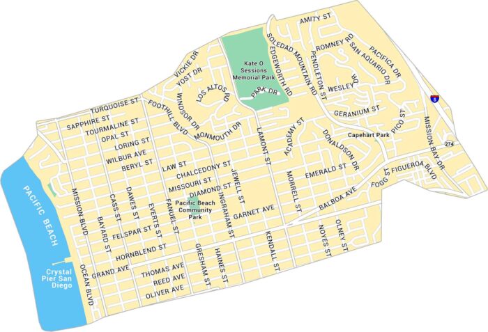
Our map of Pacific Beach shows the coastal neighborhood stretching along the San Diego shoreline. It includes streets, parks and Crystal Pier.
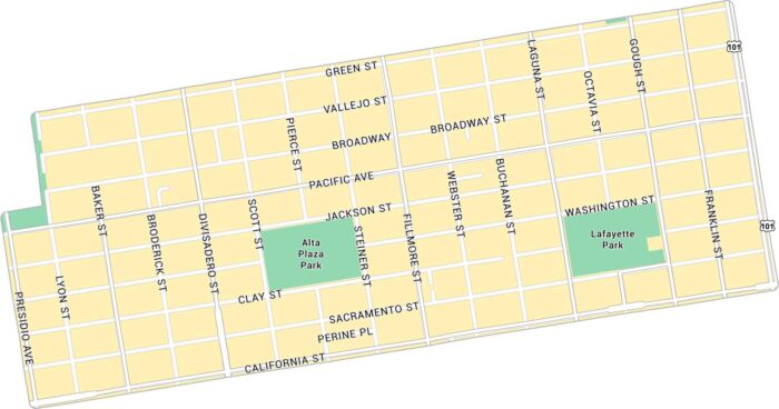
Our map of Pacific Heights shows the hilly neighborhood overlooking San Francisco Bay. It highlights main streets and parks.
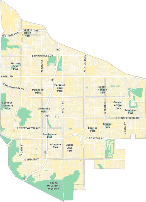
Our map of Paradise Valley shows this small, upscale neighborhood just north of Phoenix. It highlights major streets and local parks.
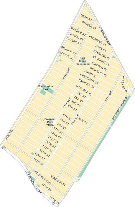
Our map of Park Slope shows this NYC neighborhood that stretches along Prospect Park. It includes main roads and green spaces.
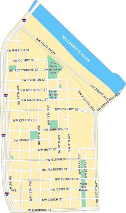
Our map of the Pearl District highlights one of Portland’s most walkable neighborhoods. It shows its streets, parks, and its rail lines.
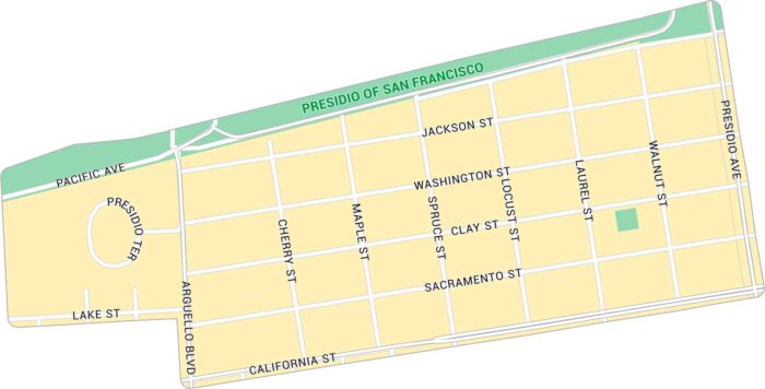
Our map of Presidio Heights shows a peaceful neighborhood bordering the Presidio. It includes major streets and nearby green spaces.
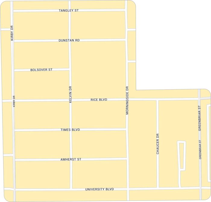
Rice Village sits west of Rice University. Our map highlights its network of roads. You can find it between Kirby Drive and University Blvd.