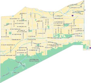
Paradise Valley Map, Phoenix
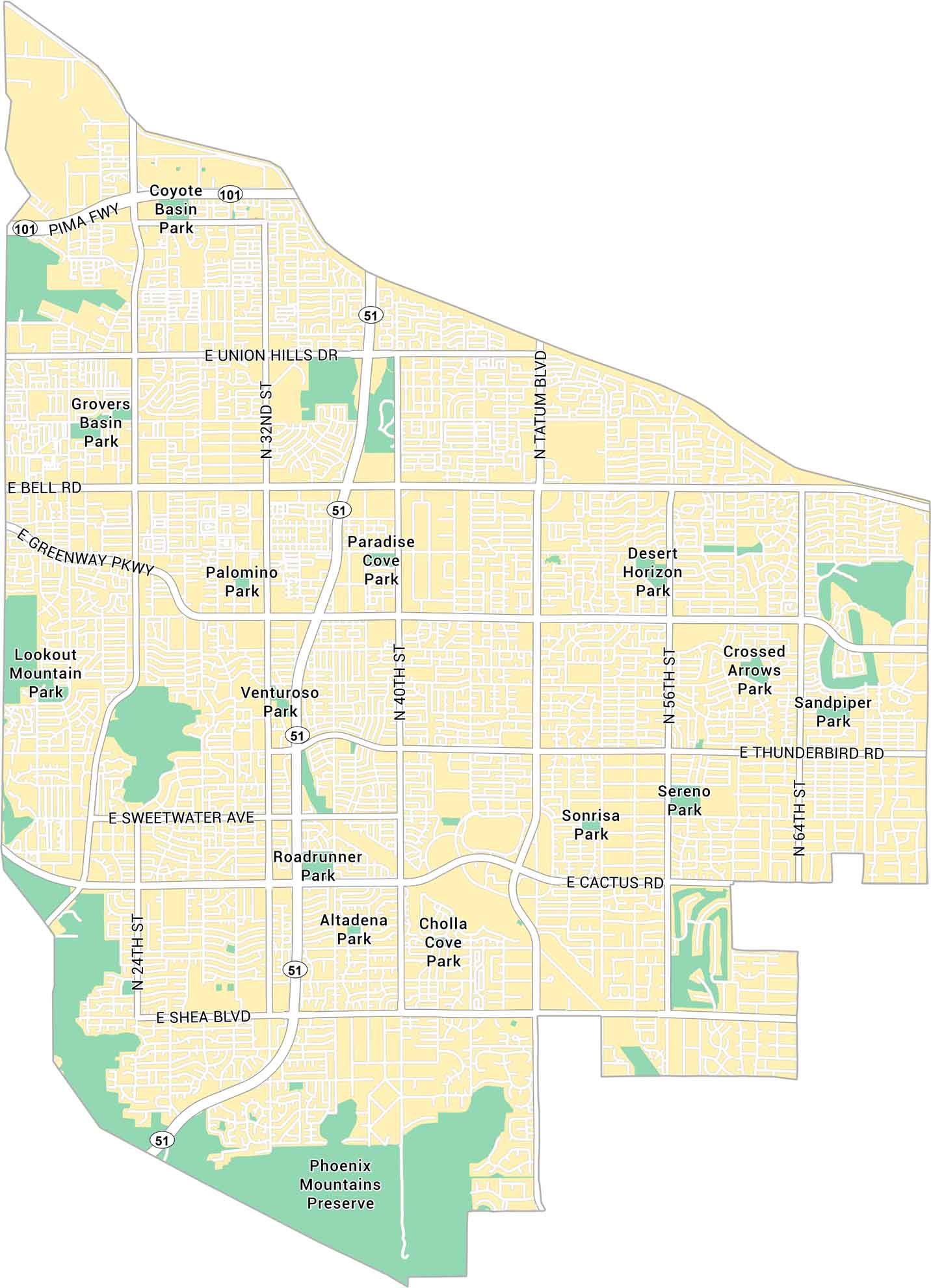
Our map of Paradise Valley shows this small, upscale neighborhood just north of Phoenix. It highlights major streets, local parks, and open desert spaces. This neighborhood is a quiet area, surrounded by mountains.
Map Information
On the Map
Interstates/Highways: State Rte 51, State Rte 101 Major Roads: Pima Fwy, Tatum Blvd, Bell Rd, Shea Blvd, Greenway Pkwy, Thunderbird Rd, Cactus Rd, Union Hills Dr, Sweetwater Ave, 40th St, 32nd St, 56th St, 64th St, 24th St Parks: Phoenix Mountains Preserve, Lookout Mountain Park, Roadrunner Park, Desert Horizon Park, Sereno Park, Sonrisa Park, Altadena Park, Cholla Cove Park, Paradise Cove Park, Palomino Park, Venturoso Park, Crossed Arrows Park, Sandpiper Park, Coyote Basin Park, Grovers Basin ParkPhoenix Neighborhood Maps
See our neighborhood maps of Phoenix, Arizona.
Arizona City Maps
Here’s our full batch of Arizona city maps


