US Election 1920 Map
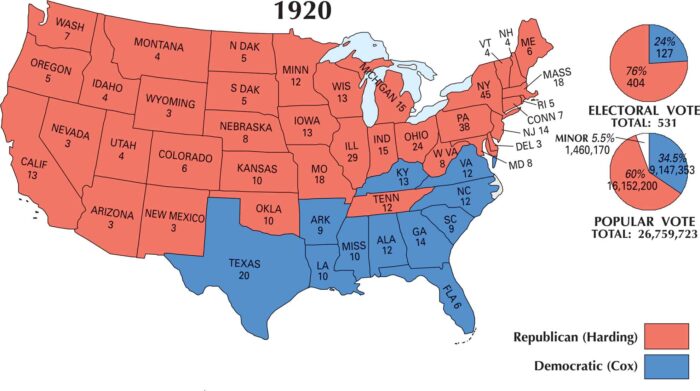
The US election map of 1920 is a sea of red. Warren G. Harding, the Republican, won in a lopsided landslide winning the northern sections.
The US election map of 1920 is a sea of red. Warren G. Harding, the Republican, won in a lopsided landslide winning the northern sections.
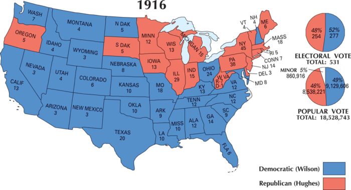
The 1916 map is mostly blue, showing Woodrow Wilson’s Democratic strength. He won re-election by winning more electoral and popular vote.
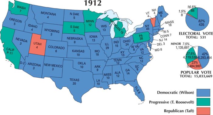
The 1912 US election map is almost entirely blue. The country leaned heavily Democratic as it handed the presidency to Woodrow Wilson.
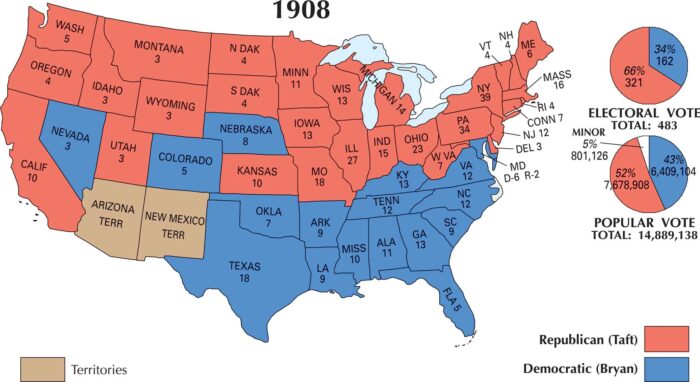
Our US election 1908 map shows the country was split between North and South. William Howard Taft won the industrial North and Midwest.
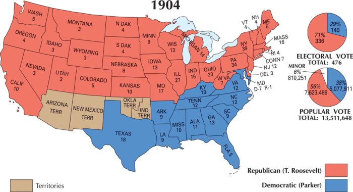
The 1904 election was a landslide for Theodore Roosevelt. Our US election 1904 map shows Roosevelt winning the northern half of states.
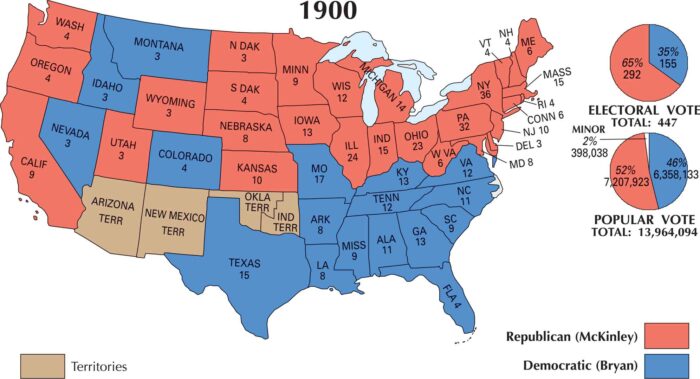
The 1900 election gave William McKinley a second term. Similar to the last election, support came from the Northeast, Midwest and West.
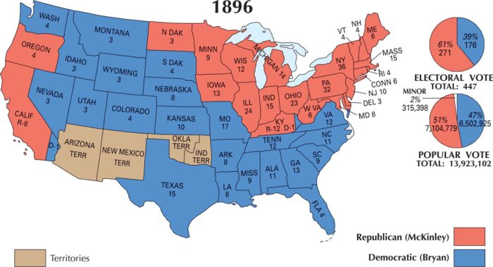
William McKinley won the 1896 election. This map shows McKinley strong in the Northeast, Midwest, and parts of the West.
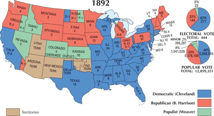
Our US election map of 1892 shows how Cleveland carried most of the South and parts of the Midwest. He defeated the Republicans and Populists.
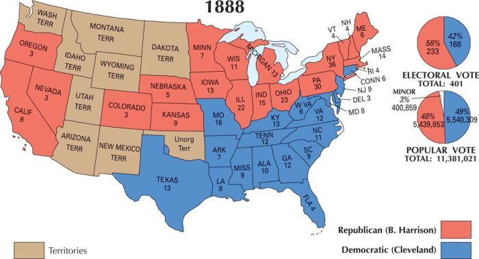
Our 1888 US election map shows Harrison carried most of the North and Midwest. Cleveland swept the South and parts of the border states.
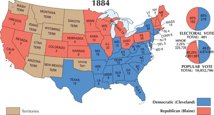
The 1884 US election was a close contest. Our map displays Democrat Grover Cleveland narrowly defeating Republican James G. Blaine.
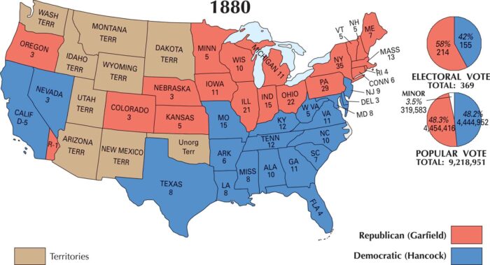
Our 1880 US election maps shows Republican James A. Garfield as the winner. It was one of the narrowest margins in US election history.
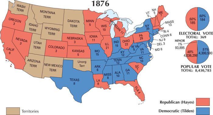
Our map shows the US 1876 election as razor-thin. Rutherford B. Hayes, the Republican, narrowly defeated Democrat Samuel J. Tilden.
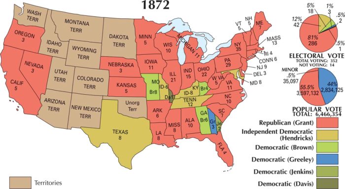
In 1872, Ulysses S. Grant easily won re-election, sweeping nearly the entire country. His Republican support stretched across the U.S.
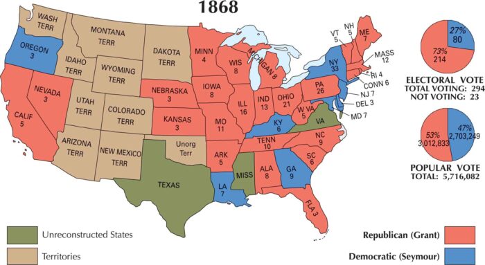
Our map of the 1868 US election shows Ulysses S. Grant’s victory. But the nation was still being stitched together after the Civil War.
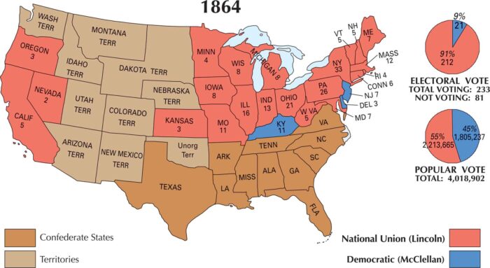
The US 1864 election was at war with itself without Confederate states. Abraham Lincoln’s re-election came as the Civil War neared its end.