Louisiana Parish Map
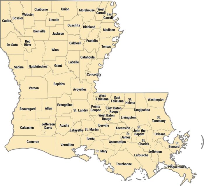
Louisiana calls them parishes instead of counties. Rivers, bayous, and the Gulf Coast shape most of the 64 parishes in Louisiana.
Louisiana calls them parishes instead of counties. Rivers, bayous, and the Gulf Coast shape most of the 64 parishes in Louisiana.
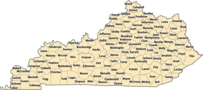
Kentucky has 120 counties, more than most states its size. Kentucky’s counties vary from Appalachian terrain to the rolling Bluegrass.
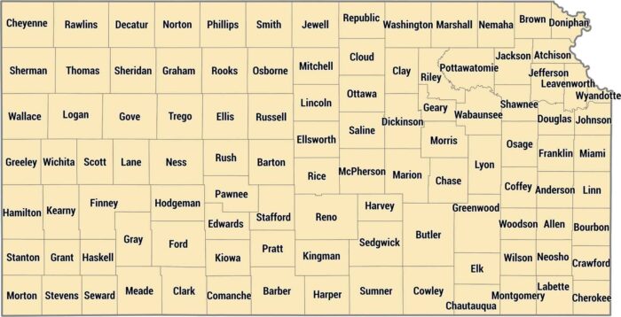
Kansas keeps it organized with 105 counties in tidy rectangles across the plains. This grid is from land surveying across the Great Plains.
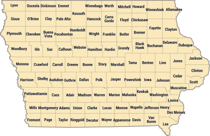
Neat and tidy. That’s one way to describe our county map of Iowa. Iowa’s 99 counties create an almost perfect checkerboard across the state.
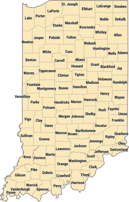
Our Indiana county map shows 92 counties laid out in a near-perfect grid. The map shows the shift from dense urban regions to rural spaces.
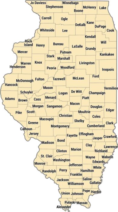
Explore Illinois’ 102 counties stretching from Chicago down to the confluence of the Mississippi and Ohio rivers.
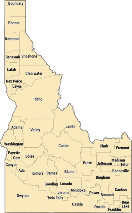
Idaho has 44 counties spread across mountains, plains, and canyons. They run from the Panhandle’s narrow shape to rugged mountains.
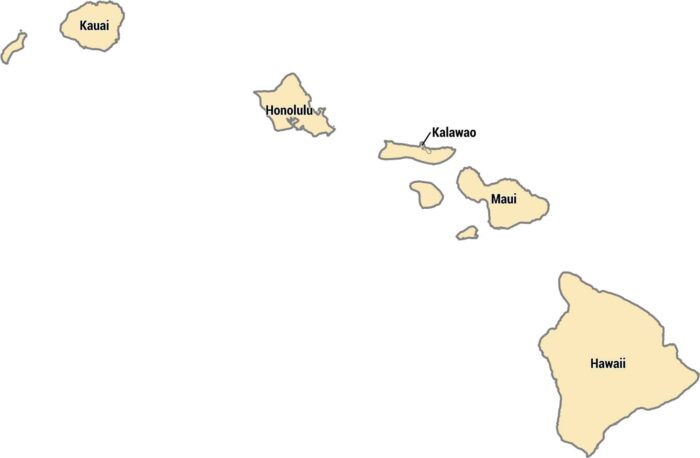
Hawaii’s 5 counties each cover different islands. Each county matches one of the islands, except for a small area on Molokai called Kalawao.
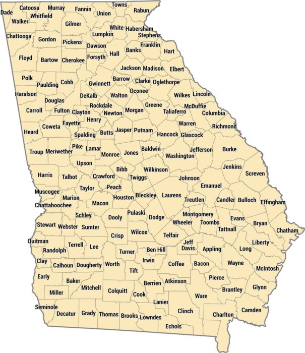
Georgia has 159 counties. That’s more than any state except Texas. Fulton County holds most of Atlanta and millions of people.
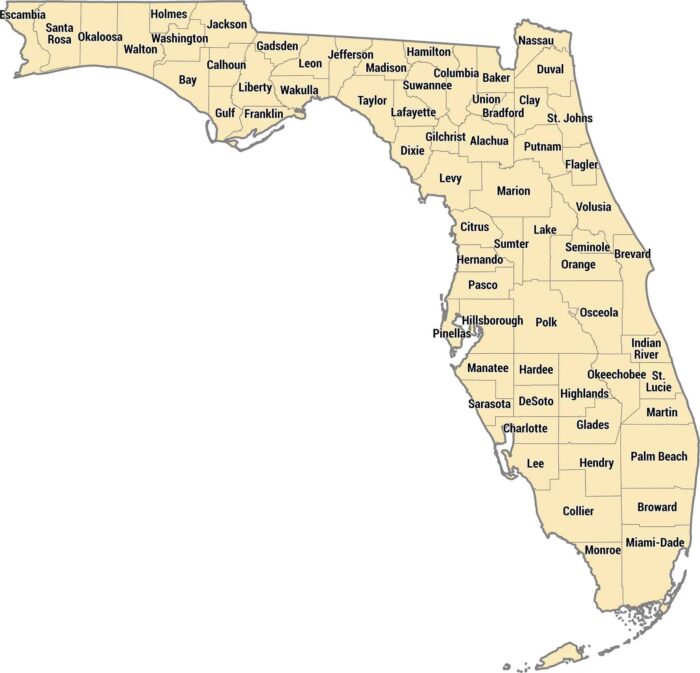
Our Florida county map shows 67 counties from the Panhandle to the Keys. The peninsula shape means you’ve got Gulf counties and more.

Delaware keeps it simple with just 3 counties. New Castle is in the north. Kent’s in the middle, and Sussex stretches down the coast
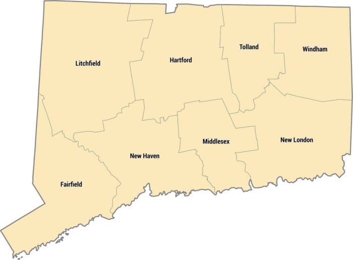
Connecticut only has 8 counties, some dating back to the 1600s. The whole state is tiny, so you can cross multiple counties in an hour.

The Rockies split Colorado’s 64 counties down the middle. Eastern counties are flat prairie, western counties are mountains and ski towns.
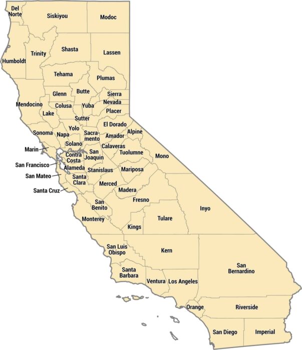
California has 58 counties ranging from tiny Alpine to massive San Bernardino. The coastal counties pack in millions of people.
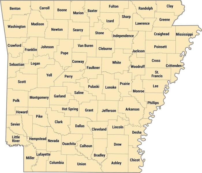
Our Arkansas county map shows all 75 counties across the state. Arkansas counties stretch from the rugged Ozarks to the flat, fertile Delta.