Home » State Maps » Louisiana Lakes and Rivers Map

Louisiana Lakes and Rivers Map

Louisiana Lakes and Rivers Map

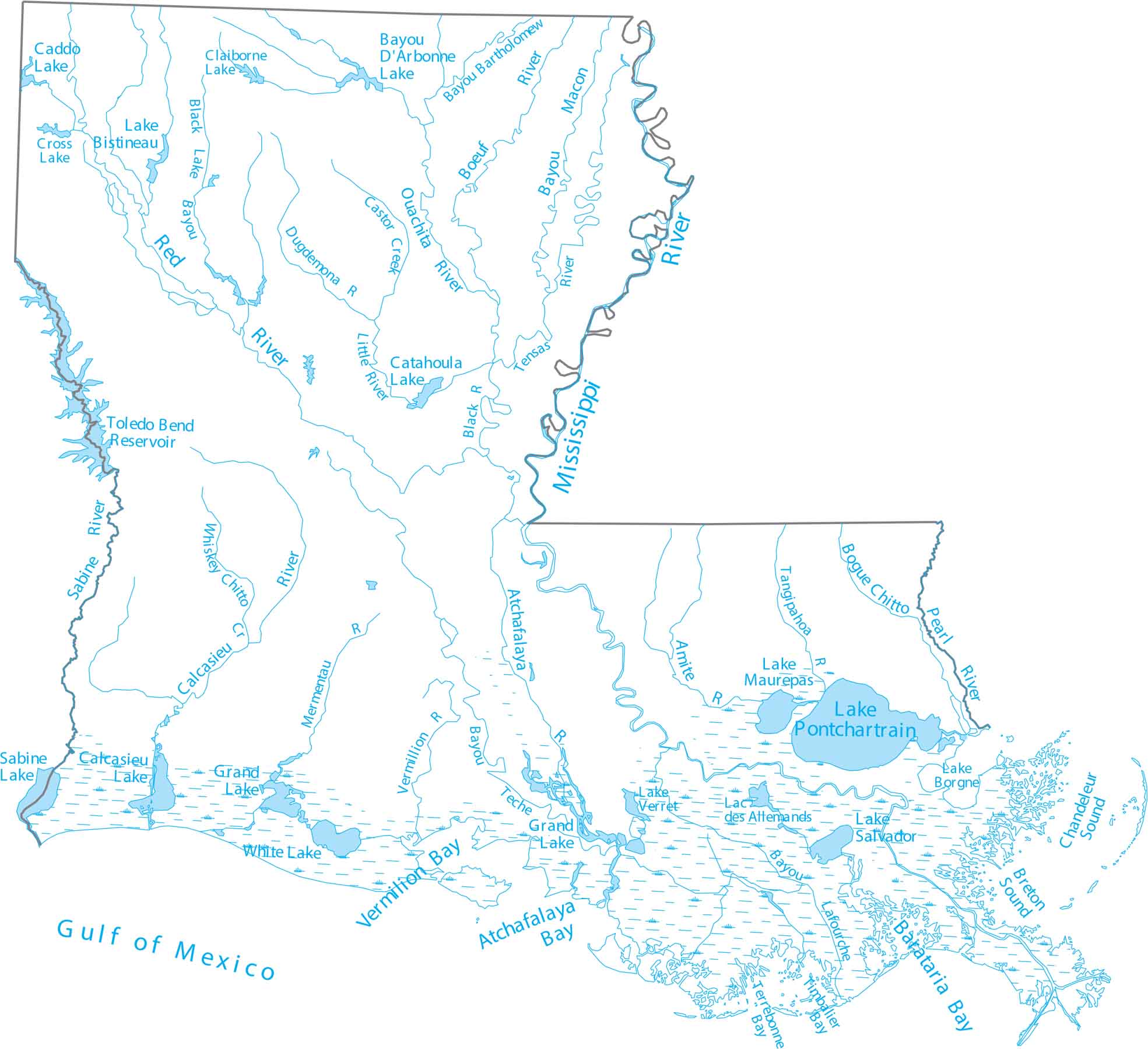
Louisiana is at the Gulf Coast, where the Mississippi River fans into a delta. Our map of Louisiana highlights the Mississippi River and coastal lakes. See how Louisiana’s waterways spread and branch.

Map Information

  • Lakes and Rivers Map of Louisiana
  • Original map provided by National Map. Map updated by our team.
  • Free for personal and commercial purpose. Attribution is required. How to attribute?

On the Map

Louisiana Location Map
Lakes and Reservoirs: Caddo Lake, Calcasieu Lake, Catahoula Lake, Claiborne Lake, Cross Lake, Grand Lake, Lac des Allemands, Lake Bistineau, Lake Borgne, Lake D’Arbonne, Lake Grand, Lake Maurepas, Lake Pontchartrain, Lake Salvador, Lake Verret, Sabine Lake, Toledo Bend Reservoir, White Lake Rivers and Streams: Amite River, Atchafalaya River, Black River, Boeuf River, Bogue Chitto River, Calcasieu River, Castor Creek, Dugdemona River, Little River, Mermentau River, Mississippi River, Ouachita River, Pearl River, Red River, Tangipahoa River, Tensas River, Vermillion River, Whiskey Chitto Creek Bays and Sounds: Atchafalaya Bay, Barataria Bay, Breton Sound, Chandeleur Sound, Terrebonne Bay, Timbalier Bay, Vermilion Bay Bayous: Bayou Bartholomew, Bayou Lafourche, Bayou Macon, Black Lake Bayou

Leave a Reply

Your email address will not be published. Required fields are marked *